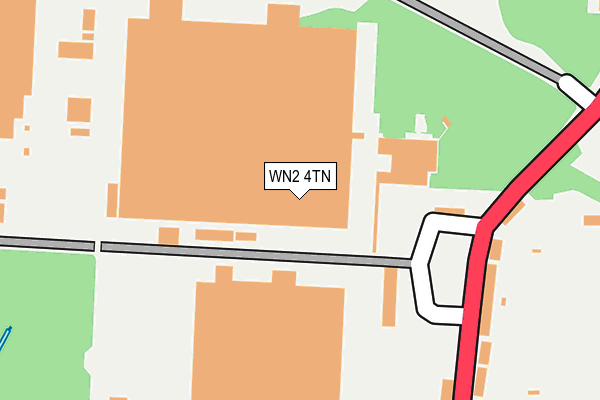
WN2 4TN is located in the Hindley Green electoral ward, within the metropolitan district of Wigan and the English Parliamentary constituency of Makerfield. The Sub Integrated Care Board (ICB) Location is NHS Greater Manchester ICB - 02H and the police force is Greater Manchester. This postcode has been in use since December 2001.


GetTheData
Source: OS OpenMap – Local (Ordnance Survey)
Source: OS VectorMap District (Ordnance Survey)
Licence: Open Government Licence (requires attribution)
| Easting | 363661 |
| Northing | 402468 |
| Latitude | 53.517621 |
| Longitude | -2.549514 |
GetTheData
Source: Open Postcode Geo
Licence: Open Government Licence
| Country | England |
| Postcode District | WN2 |
| ➜ WN2 open data dashboard ➜ See where WN2 is on a map ➜ Where is Leigh? | |
GetTheData
Source: Land Registry Price Paid Data
Licence: Open Government Licence
Elevation or altitude of WN2 4TN as distance above sea level:
| Metres | Feet | |
|---|---|---|
| Elevation | 50m | 164ft |
Elevation is measured from the approximate centre of the postcode, to the nearest point on an OS contour line from OS Terrain 50, which has contour spacing of ten vertical metres.
➜ How high above sea level am I? Find the elevation of your current position using your device's GPS.
GetTheData
Source: Open Postcode Elevation
Licence: Open Government Licence
| Ward | Hindley Green |
| Constituency | Makerfield |
GetTheData
Source: ONS Postcode Database
Licence: Open Government Licence
| Leigh Rd/Business Park (Leigh Rd) | Hindley Green | 216m |
| Leigh Rd/Business Park (Leigh Rd) | Hindley Green | 231m |
| Leigh Rd/Halesfield (Leigh Rd) | Hindley Green | 419m |
| Smiths Ln/Leigh Rd (Smiths Ln) | Tamer Lane End | 472m |
| Leigh Rd/Halesfield (Leigh Rd) | Hindley Green | 473m |
| Hindley Station | 3.2km |
| Daisy Hill Station | 3.3km |
| Hag Fold Station | 4.1km |
GetTheData
Source: NaPTAN
Licence: Open Government Licence
GetTheData
Source: ONS Postcode Database
Licence: Open Government Licence


➜ Get more ratings from the Food Standards Agency
GetTheData
Source: Food Standards Agency
Licence: FSA terms & conditions
| Last Collection | |||
|---|---|---|---|
| Location | Mon-Fri | Sat | Distance |
| Platt Bridge P O | 18:45 | 12:05 | 1,119m |
| Howe Bridge | 17:30 | 11:30 | 1,141m |
| Hindley Green P O | 18:30 | 11:55 | 2,357m |
GetTheData
Source: Dracos
Licence: Creative Commons Attribution-ShareAlike
| Facility | Distance |
|---|---|
| Brunswick Park (Hindley) Leigh Road, Hindley Green, Wigan Grass Pitches | 322m |
| Thomas Street Recreation Ground Thomas Street, Hindley Green, Wigan Grass Pitches | 563m |
| Hindley Green Primary School (Closed) Thomas Street, Hindley, Wigan Grass Pitches | 600m |
GetTheData
Source: Active Places
Licence: Open Government Licence
| School | Phase of Education | Distance |
|---|---|---|
| Hindley Green Community Primary School Thomas Street, Hindley Green, Wigan, WN2 4SS | Primary | 642m |
| St John's Church of England Primary School, Hindley Green Atherton Road, Hindley Green, Wigan, WN2 4SD | Primary | 746m |
| Bickershaw CofE Primary School Bickershaw Lane, Bickershaw, Wigan, WN2 4AE | Primary | 928m |
GetTheData
Source: Edubase
Licence: Open Government Licence
The below table lists the International Territorial Level (ITL) codes (formerly Nomenclature of Territorial Units for Statistics (NUTS) codes) and Local Administrative Units (LAU) codes for WN2 4TN:
| ITL 1 Code | Name |
|---|---|
| TLD | North West (England) |
| ITL 2 Code | Name |
| TLD3 | Greater Manchester |
| ITL 3 Code | Name |
| TLD36 | Greater Manchester North West |
| LAU 1 Code | Name |
| E08000010 | Wigan |
GetTheData
Source: ONS Postcode Directory
Licence: Open Government Licence
The below table lists the Census Output Area (OA), Lower Layer Super Output Area (LSOA), and Middle Layer Super Output Area (MSOA) for WN2 4TN:
| Code | Name | |
|---|---|---|
| OA | E00032056 | |
| LSOA | E01006322 | Wigan 026D |
| MSOA | E02001312 | Wigan 026 |
GetTheData
Source: ONS Postcode Directory
Licence: Open Government Licence
| WN2 4XG | Leigh Road | 221m |
| WN2 4XT | Slackey Fold | 342m |
| WN2 4XW | Leigh Road | 369m |
| WN2 4XX | Halesfield | 378m |
| WN2 4XF | Leigh Road | 427m |
| WN2 4XR | Smiths Lane | 491m |
| WN2 4UE | Heathlea Gardens | 505m |
| WN2 4XS | Smiths Lane | 512m |
| WN2 4SX | Sarah Street | 535m |
| WN2 4XL | Leigh Road | 550m |
GetTheData
Source: Open Postcode Geo; Land Registry Price Paid Data
Licence: Open Government Licence