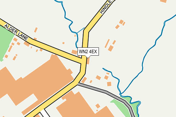
WN2 4EX lies on Hindley Road in Hindley Green, Wigan. WN2 4EX is located in the Westhoughton South electoral ward, within the metropolitan district of Bolton and the English Parliamentary constituency of Bolton West. The Sub Integrated Care Board (ICB) Location is NHS Greater Manchester ICB - 00T and the police force is Greater Manchester. This postcode has been in use since January 1980.


GetTheData
Source: OS OpenMap – Local (Ordnance Survey)
Source: OS VectorMap District (Ordnance Survey)
Licence: Open Government Licence (requires attribution)
| Easting | 364143 |
| Northing | 403929 |
| Latitude | 53.530786 |
| Longitude | -2.542413 |
GetTheData
Source: Open Postcode Geo
Licence: Open Government Licence
| Street | Hindley Road |
| Locality | Hindley Green |
| Town/City | Wigan |
| Country | England |
| Postcode District | WN2 |
➜ See where WN2 is on a map ➜ Where is Hindley? | |
GetTheData
Source: Land Registry Price Paid Data
Licence: Open Government Licence
Elevation or altitude of WN2 4EX as distance above sea level:
| Metres | Feet | |
|---|---|---|
| Elevation | 50m | 164ft |
Elevation is measured from the approximate centre of the postcode, to the nearest point on an OS contour line from OS Terrain 50, which has contour spacing of ten vertical metres.
➜ How high above sea level am I? Find the elevation of your current position using your device's GPS.
GetTheData
Source: Open Postcode Elevation
Licence: Open Government Licence
| Ward | Westhoughton South |
| Constituency | Bolton West |
GetTheData
Source: ONS Postcode Database
Licence: Open Government Licence
601, HINDLEY ROAD, HINDLEY GREEN, WIGAN, WN2 4EX 2002 26 JUL £310,000 |
GetTheData
Source: HM Land Registry Price Paid Data
Licence: Contains HM Land Registry data © Crown copyright and database right 2025. This data is licensed under the Open Government Licence v3.0.
| Hindley Road/Alexandra Hotel (Hindley Road) | Hindley Green | 9m |
| Hindley Rd/Alexandra Hotel (Hindley Rd) | Hindley Green | 43m |
| Swan Ln/Coupland Rd (Swan Ln) | Hindley Green | 215m |
| Swan Ln/Coupland Rd (Swan Ln) | Hindley Green | 276m |
| Hindley Rd/Wearish Ln (Hindley Rd) | Hosker's Nook | 412m |
| Daisy Hill Station | 2km |
| Hindley Station | 2.5km |
| Westhoughton Station | 3km |
GetTheData
Source: NaPTAN
Licence: Open Government Licence
| Percentage of properties with Next Generation Access | 100.0% |
| Percentage of properties with Superfast Broadband | 100.0% |
| Percentage of properties with Ultrafast Broadband | 0.0% |
| Percentage of properties with Full Fibre Broadband | 0.0% |
Superfast Broadband is between 30Mbps and 300Mbps
Ultrafast Broadband is > 300Mbps
| Percentage of properties unable to receive 2Mbps | 0.0% |
| Percentage of properties unable to receive 5Mbps | 0.0% |
| Percentage of properties unable to receive 10Mbps | 0.0% |
| Percentage of properties unable to receive 30Mbps | 0.0% |
GetTheData
Source: Ofcom
Licence: Ofcom Terms of Use (requires attribution)
GetTheData
Source: ONS Postcode Database
Licence: Open Government Licence


➜ Get more ratings from the Food Standards Agency
GetTheData
Source: Food Standards Agency
Licence: FSA terms & conditions
| Last Collection | |||
|---|---|---|---|
| Location | Mon-Fri | Sat | Distance |
| Platt Bridge P O | 18:45 | 12:05 | 532m |
| Sanderlings | 17:10 | 11:45 | 904m |
| 13 Wearish Lane | 17:10 | 11:40 | 1,227m |
GetTheData
Source: Dracos
Licence: Creative Commons Attribution-ShareAlike
| Risk of WN2 4EX flooding from rivers and sea | Medium |
| ➜ WN2 4EX flood map | |
GetTheData
Source: Open Flood Risk by Postcode
Licence: Open Government Licence
The below table lists the International Territorial Level (ITL) codes (formerly Nomenclature of Territorial Units for Statistics (NUTS) codes) and Local Administrative Units (LAU) codes for WN2 4EX:
| ITL 1 Code | Name |
|---|---|
| TLD | North West (England) |
| ITL 2 Code | Name |
| TLD3 | Greater Manchester |
| ITL 3 Code | Name |
| TLD36 | Greater Manchester North West |
| LAU 1 Code | Name |
| E08000001 | Bolton |
GetTheData
Source: ONS Postcode Directory
Licence: Open Government Licence
The below table lists the Census Output Area (OA), Lower Layer Super Output Area (LSOA), and Middle Layer Super Output Area (MSOA) for WN2 4EX:
| Code | Name | |
|---|---|---|
| OA | E00024979 | |
| LSOA | E01004934 | Bolton 035B |
| MSOA | E02001018 | Bolton 035 |
GetTheData
Source: ONS Postcode Directory
Licence: Open Government Licence
| WN2 4EY | Swan Lane | 81m |
| WN2 4GS | Coupland Road | 271m |
| WN2 4AY | Swan Lane | 299m |
| WN2 4ET | Alder Lane | 310m |
| WN2 4HN | Green Lane | 402m |
| WN2 4SF | Bethany Mews | 493m |
| WN2 4HW | Westlake Grove | 493m |
| WN2 4GL | Poolbank Close | 506m |
| WN2 4GJ | Sykefield Close | 521m |
| BL5 2AP | Fountain Park | 523m |
GetTheData
Source: Open Postcode Geo; Land Registry Price Paid Data
Licence: Open Government Licence