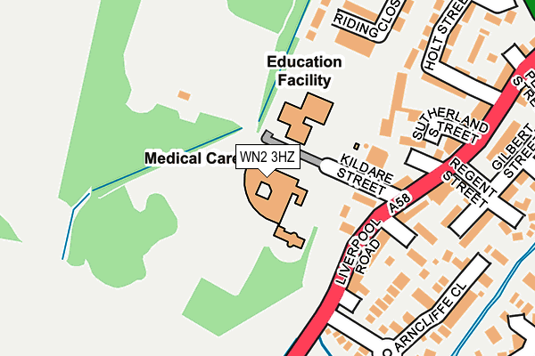
WN2 3HZ is located in the Hindley electoral ward, within the metropolitan district of Wigan and the English Parliamentary constituency of Makerfield. The Sub Integrated Care Board (ICB) Location is NHS Greater Manchester ICB - 02H and the police force is Greater Manchester. This postcode has been in use since June 1997.


GetTheData
Source: OS OpenMap – Local (Ordnance Survey)
Source: OS VectorMap District (Ordnance Survey)
Licence: Open Government Licence (requires attribution)
| Easting | 361246 |
| Northing | 404130 |
| Latitude | 53.532386 |
| Longitude | -2.586140 |
GetTheData
Source: Open Postcode Geo
Licence: Open Government Licence
| Country | England |
| Postcode District | WN2 |
| ➜ WN2 open data dashboard ➜ See where WN2 is on a map | |
GetTheData
Source: Land Registry Price Paid Data
Licence: Open Government Licence
Elevation or altitude of WN2 3HZ as distance above sea level:
| Metres | Feet | |
|---|---|---|
| Elevation | 40m | 131ft |
Elevation is measured from the approximate centre of the postcode, to the nearest point on an OS contour line from OS Terrain 50, which has contour spacing of ten vertical metres.
➜ How high above sea level am I? Find the elevation of your current position using your device's GPS.
GetTheData
Source: Open Postcode Elevation
Licence: Open Government Licence
| Ward | Hindley |
| Constituency | Makerfield |
GetTheData
Source: ONS Postcode Database
Licence: Open Government Licence
| February 2021 | Violence and sexual offences | On or near Parking Area | 398m |
| ➜ Get more crime data in our Crime section | |||
GetTheData
Source: data.police.uk
Licence: Open Government Licence
| Liverpool Rd/Blackberry Dr (Liverpool Rd) | Hindley | 164m |
| Liverpool Rd/Blackberry Dr (Liverpool Rd) | Hindley | 186m |
| Liverpool Rd/Hindley Health Ctr (Liverpool Rd) | Hindley | 274m |
| Liverpool Rd/Bird I'th'hand (Liverpool Rd) | Hindley | 300m |
| Wigan Rd/Bird I'th' Hand (Wigan Rd) | Hindley | 350m |
| Hindley Station | 1.3km |
| Ince (Manchester) Station | 1.8km |
| Wigan North Western Station | 3.4km |
GetTheData
Source: NaPTAN
Licence: Open Government Licence
GetTheData
Source: ONS Postcode Database
Licence: Open Government Licence


➜ Get more ratings from the Food Standards Agency
GetTheData
Source: Food Standards Agency
Licence: FSA terms & conditions
| Last Collection | |||
|---|---|---|---|
| Location | Mon-Fri | Sat | Distance |
| Hindley Green P O | 18:30 | 11:55 | 686m |
| Belle Green Lane | 17:50 | 11:05 | 1,182m |
| Woodville Road | 18:15 | 11:05 | 1,435m |
GetTheData
Source: Dracos
Licence: Creative Commons Attribution-ShareAlike
| Facility | Distance |
|---|---|
| St Peter's C Of E Primary School Kildare Street, Hindley, Wigan Grass Pitches | 80m |
| Hindley Town Fc Kildare Street, Hindley, Wigan Grass Pitches | 134m |
| Hindley St Peters Cricket Club Hurst Street, Hindley, Wigan Grass Pitches | 513m |
GetTheData
Source: Active Places
Licence: Open Government Licence
| School | Phase of Education | Distance |
|---|---|---|
| St Peter's Church of England Primary School, Hindley Kildare Street, Hindley, Wigan, WN2 3HY | Primary | 104m |
| St Benedict's Catholic Primary School Hindley Abbott Street, Hindley, Wigan, WN2 3DG | Primary | 519m |
| Hindley Junior and Infant School Argyle Street, Hindley, Wigan, WN2 3PN | Primary | 769m |
GetTheData
Source: Edubase
Licence: Open Government Licence
The below table lists the International Territorial Level (ITL) codes (formerly Nomenclature of Territorial Units for Statistics (NUTS) codes) and Local Administrative Units (LAU) codes for WN2 3HZ:
| ITL 1 Code | Name |
|---|---|
| TLD | North West (England) |
| ITL 2 Code | Name |
| TLD3 | Greater Manchester |
| ITL 3 Code | Name |
| TLD36 | Greater Manchester North West |
| LAU 1 Code | Name |
| E08000010 | Wigan |
GetTheData
Source: ONS Postcode Directory
Licence: Open Government Licence
The below table lists the Census Output Area (OA), Lower Layer Super Output Area (LSOA), and Middle Layer Super Output Area (MSOA) for WN2 3HZ:
| Code | Name | |
|---|---|---|
| OA | E00031806 | |
| LSOA | E01006269 | Wigan 013A |
| MSOA | E02001299 | Wigan 013 |
GetTheData
Source: ONS Postcode Directory
Licence: Open Government Licence
| WN2 3HX | The Lawns | 106m |
| WN2 3HY | Kildare Street | 123m |
| WN2 3HQ | Liverpool Road | 173m |
| WN2 3HJ | Princess Street | 189m |
| WN2 3JA | Sutherland Street | 224m |
| WN2 3JX | Hockery View | 229m |
| WN2 3LH | Arncliffe Close | 231m |
| WN2 3HU | Liverpool Road | 236m |
| WN2 3NY | Arncliffe Court | 260m |
| WN2 3HE | Gilbert Street | 269m |
GetTheData
Source: Open Postcode Geo; Land Registry Price Paid Data
Licence: Open Government Licence