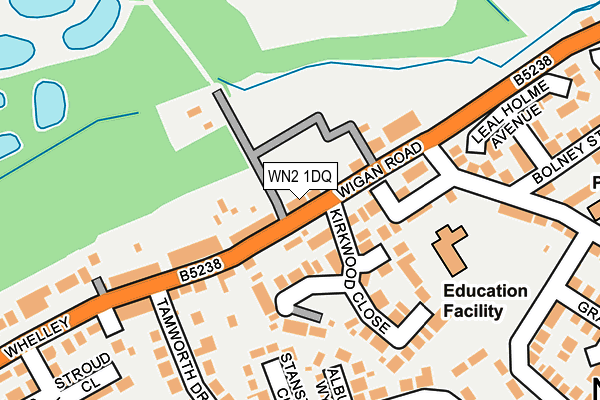
WN2 1DQ lies on Whelley in Wigan. WN2 1DQ is located in the Aspull, New Springs & Whelley electoral ward, within the metropolitan district of Wigan and the English Parliamentary constituency of Wigan. The Sub Integrated Care Board (ICB) Location is NHS Greater Manchester ICB - 02H and the police force is Greater Manchester. This postcode has been in use since January 1980.


GetTheData
Source: OS OpenMap – Local (Ordnance Survey)
Source: OS VectorMap District (Ordnance Survey)
Licence: Open Government Licence (requires attribution)
| Easting | 359877 |
| Northing | 406963 |
| Latitude | 53.557745 |
| Longitude | -2.607157 |
GetTheData
Source: Open Postcode Geo
Licence: Open Government Licence
| Street | Whelley |
| Town/City | Wigan |
| Country | England |
| Postcode District | WN2 |
| ➜ WN2 open data dashboard ➜ See where WN2 is on a map ➜ Where is Wigan? | |
GetTheData
Source: Land Registry Price Paid Data
Licence: Open Government Licence
Elevation or altitude of WN2 1DQ as distance above sea level:
| Metres | Feet | |
|---|---|---|
| Elevation | 70m | 230ft |
Elevation is measured from the approximate centre of the postcode, to the nearest point on an OS contour line from OS Terrain 50, which has contour spacing of ten vertical metres.
➜ How high above sea level am I? Find the elevation of your current position using your device's GPS.
GetTheData
Source: Open Postcode Elevation
Licence: Open Government Licence
| Ward | Aspull, New Springs & Whelley |
| Constituency | Wigan |
GetTheData
Source: ONS Postcode Database
Licence: Open Government Licence
| Whelley/Holly Field (Whelley) | New Springs | 21m |
| Wigan Rd/Vigo St (Wigan Rd) | New Springs | 48m |
| Tamworth Drive/Whelley (Sebnd) (Tamworth Drive) | New Springs | 176m |
| Whelley/Cheltenham St (Whelley) | New Springs | 208m |
| Wigan Rd/Cale Ln (Wigan Rd) | New Springs | 220m |
| Ince (Manchester) Station | 2.1km |
| Wigan Wallgate Station | 2.2km |
| Wigan North Western Station | 2.3km |
GetTheData
Source: NaPTAN
Licence: Open Government Licence
| Percentage of properties with Next Generation Access | 100.0% |
| Percentage of properties with Superfast Broadband | 100.0% |
| Percentage of properties with Ultrafast Broadband | 100.0% |
| Percentage of properties with Full Fibre Broadband | 0.0% |
Superfast Broadband is between 30Mbps and 300Mbps
Ultrafast Broadband is > 300Mbps
| Percentage of properties unable to receive 2Mbps | 0.0% |
| Percentage of properties unable to receive 5Mbps | 0.0% |
| Percentage of properties unable to receive 10Mbps | 0.0% |
| Percentage of properties unable to receive 30Mbps | 0.0% |
GetTheData
Source: Ofcom
Licence: Ofcom Terms of Use (requires attribution)
GetTheData
Source: ONS Postcode Database
Licence: Open Government Licence


➜ Get more ratings from the Food Standards Agency
GetTheData
Source: Food Standards Agency
Licence: FSA terms & conditions
| Last Collection | |||
|---|---|---|---|
| Location | Mon-Fri | Sat | Distance |
| Chauner Place | 18:20 | 11:05 | 1,694m |
| St Clements Road | 18:20 | 11:10 | 1,729m |
| Mesnes Road P O | 19:00 | 12:00 | 1,786m |
GetTheData
Source: Dracos
Licence: Creative Commons Attribution-ShareAlike
| Facility | Distance |
|---|---|
| Cale Lane Playing Fields Cale Lane, Aspull Grass Pitches | 409m |
| Canon Sharples School Whelley, Wigan Grass Pitches | 492m |
| St Catherines Playing Fields Platt Lane, Wigan Grass Pitches | 1.1km |
GetTheData
Source: Active Places
Licence: Open Government Licence
| School | Phase of Education | Distance |
|---|---|---|
| Holy Family Catholic Primary School, New Springs, Wigan Longfield Street, New Springs, Wigan, WN2 1EL | Primary | 152m |
| Canon Sharples Church of England Primary School and Nursery Whelley, Wigan, WN2 1BP | Primary | 490m |
| Dean Trust Rose Bridge Holt Street, Ince, Wigan, WN1 3HD | Secondary | 1.3km |
GetTheData
Source: Edubase
Licence: Open Government Licence
The below table lists the International Territorial Level (ITL) codes (formerly Nomenclature of Territorial Units for Statistics (NUTS) codes) and Local Administrative Units (LAU) codes for WN2 1DQ:
| ITL 1 Code | Name |
|---|---|
| TLD | North West (England) |
| ITL 2 Code | Name |
| TLD3 | Greater Manchester |
| ITL 3 Code | Name |
| TLD36 | Greater Manchester North West |
| LAU 1 Code | Name |
| E08000010 | Wigan |
GetTheData
Source: ONS Postcode Directory
Licence: Open Government Licence
The below table lists the Census Output Area (OA), Lower Layer Super Output Area (LSOA), and Middle Layer Super Output Area (MSOA) for WN2 1DQ:
| Code | Name | |
|---|---|---|
| OA | E00032402 | |
| LSOA | E01006391 | Wigan 007D |
| MSOA | E02001293 | Wigan 007 |
GetTheData
Source: ONS Postcode Directory
Licence: Open Government Licence
| WN2 1DH | Wigan Road | 97m |
| WN2 1DZ | Kirkwood Close | 103m |
| WN2 1EL | Longfield Street | 119m |
| WN2 1DA | Whelley | 143m |
| WN2 1BN | Albury Way | 190m |
| WN2 1AQ | Tamworth Drive | 192m |
| WN2 1AJ | Stanstead Close | 199m |
| WN2 1HL | Silvington Way | 236m |
| WN2 1EH | Lealholme Avenue | 250m |
| WN2 1AG | Burnham Grove | 267m |
GetTheData
Source: Open Postcode Geo; Land Registry Price Paid Data
Licence: Open Government Licence