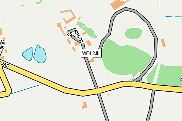
WF4 2JL is located in the Wakefield Rural electoral ward, within the metropolitan district of Wakefield and the English Parliamentary constituency of Wakefield. The Sub Integrated Care Board (ICB) Location is NHS West Yorkshire ICB - 03R and the police force is West Yorkshire. This postcode has been in use since January 1980.


GetTheData
Source: OS OpenMap – Local (Ordnance Survey)
Source: OS VectorMap District (Ordnance Survey)
Licence: Open Government Licence (requires attribution)
| Easting | 432618 |
| Northing | 412903 |
| Latitude | 53.611670 |
| Longitude | -1.508455 |
GetTheData
Source: Open Postcode Geo
Licence: Open Government Licence
| Country | England |
| Postcode District | WF4 |
| ➜ WF4 open data dashboard ➜ See where WF4 is on a map ➜ Where is Woolley? | |
GetTheData
Source: Land Registry Price Paid Data
Licence: Open Government Licence
Elevation or altitude of WF4 2JL as distance above sea level:
| Metres | Feet | |
|---|---|---|
| Elevation | 90m | 295ft |
Elevation is measured from the approximate centre of the postcode, to the nearest point on an OS contour line from OS Terrain 50, which has contour spacing of ten vertical metres.
➜ How high above sea level am I? Find the elevation of your current position using your device's GPS.
GetTheData
Source: Open Postcode Elevation
Licence: Open Government Licence
| Ward | Wakefield Rural |
| Constituency | Wakefield |
GetTheData
Source: ONS Postcode Database
Licence: Open Government Licence
| May 2022 | Burglary | On or near Old Mount Farm | 309m |
| May 2022 | Burglary | On or near The Paddock | 456m |
| January 2022 | Violence and sexual offences | On or near Old Mount Farm | 309m |
| ➜ Get more crime data in our Crime section | |||
GetTheData
Source: data.police.uk
Licence: Open Government Licence
| New Lane Woolley Hall College (New Road) | Woolley Village | 169m |
| New Lane Woolley Hall College (New Road) | Woolley Village | 173m |
| Woolley Green High St (The Green) | Woolley Village | 615m |
| The Green | Woolley Village | 616m |
| Woolley Cross Roads (New Road) | Woolley Village | 745m |
| Darton Station | 3km |
GetTheData
Source: NaPTAN
Licence: Open Government Licence
| Percentage of properties with Next Generation Access | 100.0% |
| Percentage of properties with Superfast Broadband | 100.0% |
| Percentage of properties with Ultrafast Broadband | 0.0% |
| Percentage of properties with Full Fibre Broadband | 0.0% |
Superfast Broadband is between 30Mbps and 300Mbps
Ultrafast Broadband is > 300Mbps
| Percentage of properties unable to receive 2Mbps | 0.0% |
| Percentage of properties unable to receive 5Mbps | 0.0% |
| Percentage of properties unable to receive 10Mbps | 0.0% |
| Percentage of properties unable to receive 30Mbps | 0.0% |
GetTheData
Source: Ofcom
Licence: Ofcom Terms of Use (requires attribution)
GetTheData
Source: ONS Postcode Database
Licence: Open Government Licence


➜ Get more ratings from the Food Standards Agency
GetTheData
Source: Food Standards Agency
Licence: FSA terms & conditions
| Last Collection | |||
|---|---|---|---|
| Location | Mon-Fri | Sat | Distance |
| Woolley | 17:15 | 11:15 | 614m |
| Seckar Lane/Barnsley Road | 17:00 | 11:00 | 1,302m |
| 13 Windhill Drive | 16:30 | 08:00 | 1,803m |
GetTheData
Source: Dracos
Licence: Creative Commons Attribution-ShareAlike
| Facility | Distance |
|---|---|
| Woolley Park Golf Club New Road, Woolley, Wakefield Golf | 312m |
| Barnsley Golf Course Wakefield Road, Staincross, Barnsley Golf | 2.1km |
| Woodlands Driving Range Wakefield Road, Staincross, Barnsley Golf | 2.5km |
GetTheData
Source: Active Places
Licence: Open Government Licence
| School | Phase of Education | Distance |
|---|---|---|
| Crigglestone Dane Royd Junior and Infant School Stoney Lane, Hall Green, Wakefield, WF4 3LZ | Primary | 2.2km |
| Camphill Wakefield (Pennine Camphill Community Ltd) Wood Lane, Chapelthorpe, Wakefield, WF4 3JL | Not applicable | 2.5km |
| Wellgate Primary School George Street, Mapplewell, Barnsley, S75 6HR | Primary | 2.6km |
GetTheData
Source: Edubase
Licence: Open Government Licence
The below table lists the International Territorial Level (ITL) codes (formerly Nomenclature of Territorial Units for Statistics (NUTS) codes) and Local Administrative Units (LAU) codes for WF4 2JL:
| ITL 1 Code | Name |
|---|---|
| TLE | Yorkshire and The Humber |
| ITL 2 Code | Name |
| TLE4 | West Yorkshire |
| ITL 3 Code | Name |
| TLE45 | Wakefield |
| LAU 1 Code | Name |
| E08000036 | Wakefield |
GetTheData
Source: ONS Postcode Directory
Licence: Open Government Licence
The below table lists the Census Output Area (OA), Lower Layer Super Output Area (LSOA), and Middle Layer Super Output Area (MSOA) for WF4 2JL:
| Code | Name | |
|---|---|---|
| OA | E00060204 | |
| LSOA | E01011935 | Wakefield 038A |
| MSOA | E02002475 | Wakefield 038 |
GetTheData
Source: ONS Postcode Directory
Licence: Open Government Licence
| WF4 2JS | Woolley Park | 150m |
| WF4 2LD | Old Mount Farm | 331m |
| WF4 2JW | The Walled Garden | 337m |
| WF4 2TA | Woolley Hall Gardens | 373m |
| WF4 2JJ | New Road | 389m |
| WF4 2JH | New Road | 444m |
| WF4 2LZ | The Paddock | 489m |
| WF4 2JT | Back Lane | 511m |
| WF4 2JG | The Green | 525m |
| WF4 2LY | The Courtyard | 530m |
GetTheData
Source: Open Postcode Geo; Land Registry Price Paid Data
Licence: Open Government Licence