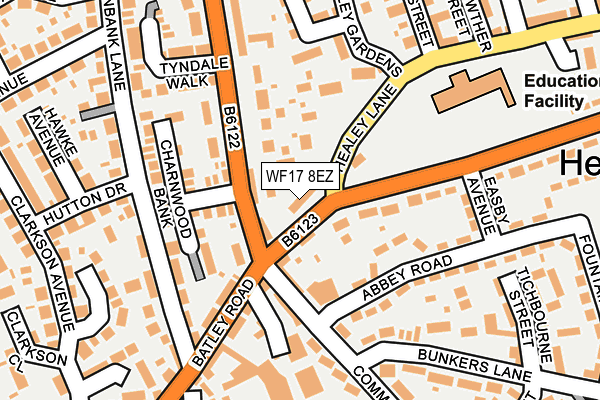
WF17 8EZ is located in the Heckmondwike electoral ward, within the metropolitan district of Kirklees and the English Parliamentary constituency of Batley and Spen. The Sub Integrated Care Board (ICB) Location is NHS West Yorkshire ICB - X2C4Y and the police force is West Yorkshire. This postcode has been in use since April 2004.


GetTheData
Source: OS OpenMap – Local (Ordnance Survey)
Source: OS VectorMap District (Ordnance Survey)
Licence: Open Government Licence (requires attribution)
| Easting | 422602 |
| Northing | 423921 |
| Latitude | 53.711225 |
| Longitude | -1.659045 |
GetTheData
Source: Open Postcode Geo
Licence: Open Government Licence
| Country | England |
| Postcode District | WF17 |
| ➜ WF17 open data dashboard ➜ See where WF17 is on a map ➜ Where is Batley? | |
GetTheData
Source: Land Registry Price Paid Data
Licence: Open Government Licence
Elevation or altitude of WF17 8EZ as distance above sea level:
| Metres | Feet | |
|---|---|---|
| Elevation | 130m | 427ft |
Elevation is measured from the approximate centre of the postcode, to the nearest point on an OS contour line from OS Terrain 50, which has contour spacing of ten vertical metres.
➜ How high above sea level am I? Find the elevation of your current position using your device's GPS.
GetTheData
Source: Open Postcode Elevation
Licence: Open Government Licence
| Ward | Heckmondwike |
| Constituency | Batley And Spen |
GetTheData
Source: ONS Postcode Database
Licence: Open Government Licence
| December 2023 | Violence and sexual offences | On or near Hutton Drive | 220m |
| December 2023 | Vehicle crime | On or near Hutton Drive | 220m |
| October 2023 | Criminal damage and arson | On or near Hutton Drive | 220m |
| ➜ Get more crime data in our Crime section | |||
GetTheData
Source: data.police.uk
Licence: Open Government Licence
| White Lee Rd Batley Road (White Lee Road) | Batley | 55m |
| West Park Rd Common Road (West Park Road) | Batley | 64m |
| Batley Road White Lee Rd (Batley Road) | Batley | 110m |
| Batley Rd Hollinbank Lane (Batley Road) | Heckmondwike | 191m |
| West Park Rd Easby Avenue (West Park Road) | Batley | 210m |
| Batley Station | 2.4km |
| Dewsbury Station | 2.7km |
| Ravensthorpe Station | 4km |
GetTheData
Source: NaPTAN
Licence: Open Government Licence
GetTheData
Source: ONS Postcode Database
Licence: Open Government Licence


➜ Get more ratings from the Food Standards Agency
GetTheData
Source: Food Standards Agency
Licence: FSA terms & conditions
| Last Collection | |||
|---|---|---|---|
| Location | Mon-Fri | Sat | Distance |
| Batley Road | 16:00 | 11:45 | 167m |
| Common Road | 17:30 | 11:30 | 179m |
| Healey Lane | 17:45 | 11:45 | 351m |
GetTheData
Source: Dracos
Licence: Creative Commons Attribution-ShareAlike
| Facility | Distance |
|---|---|
| Healey Junior Infant And Nursery School Healey Lane, Batley Grass Pitches | 200m |
| Healey Community Centre West Park Road, Batley Sports Hall | 341m |
| Heckmondwike Table Tennis Centre Cemetery Road, Heckmondwike Sports Hall | 617m |
GetTheData
Source: Active Places
Licence: Open Government Licence
| School | Phase of Education | Distance |
|---|---|---|
| Healey Junior Infant and Nursery School Healey Lane, Healey, Batley, WF17 8BN | Primary | 200m |
| Heckmondwike Primary School Cawley Lane, Heckmondwike, WF16 0AN | Primary | 486m |
| Heckmondwike Primary School Cawley Lane, Heckmondwike, WF16 0AN | Primary | 486m |
GetTheData
Source: Edubase
Licence: Open Government Licence
The below table lists the International Territorial Level (ITL) codes (formerly Nomenclature of Territorial Units for Statistics (NUTS) codes) and Local Administrative Units (LAU) codes for WF17 8EZ:
| ITL 1 Code | Name |
|---|---|
| TLE | Yorkshire and The Humber |
| ITL 2 Code | Name |
| TLE4 | West Yorkshire |
| ITL 3 Code | Name |
| TLE44 | Calderdale and Kirklees |
| LAU 1 Code | Name |
| E08000034 | Kirklees |
GetTheData
Source: ONS Postcode Directory
Licence: Open Government Licence
The below table lists the Census Output Area (OA), Lower Layer Super Output Area (LSOA), and Middle Layer Super Output Area (MSOA) for WF17 8EZ:
| Code | Name | |
|---|---|---|
| OA | E00055587 | |
| LSOA | E01011031 | Kirklees 006D |
| MSOA | E02002276 | Kirklees 006 |
GetTheData
Source: ONS Postcode Directory
Licence: Open Government Licence
| WF17 8DG | Healey Lane | 41m |
| WF17 8DE | Healey Lane | 83m |
| WF17 8PZ | Charnwood Close | 110m |
| WF17 7EN | West Park Road | 113m |
| WF17 7QL | Common Road | 114m |
| WF17 8PY | Charnwood Bank | 119m |
| WF16 9NE | Batley Road | 130m |
| WF17 7EP | Abbey Road | 141m |
| WF16 9NB | Batley Road | 153m |
| WF17 7EW | Easby Avenue | 168m |
GetTheData
Source: Open Postcode Geo; Land Registry Price Paid Data
Licence: Open Government Licence