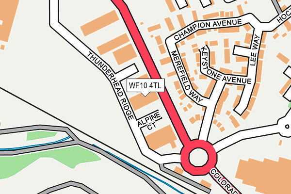
WF10 4TL is located in the Castleford Central and Glasshoughton electoral ward, within the metropolitan district of Wakefield and the English Parliamentary constituency of Normanton, Pontefract and Castleford. The Sub Integrated Care Board (ICB) Location is NHS West Yorkshire ICB - 03R and the police force is West Yorkshire. This postcode has been in use since September 2002.


GetTheData
Source: OS OpenMap – Local (Ordnance Survey)
Source: OS VectorMap District (Ordnance Survey)
Licence: Open Government Licence (requires attribution)
| Easting | 443205 |
| Northing | 424144 |
| Latitude | 53.711953 |
| Longitude | -1.346887 |
GetTheData
Source: Open Postcode Geo
Licence: Open Government Licence
| Country | England |
| Postcode District | WF10 |
| ➜ WF10 open data dashboard ➜ See where WF10 is on a map ➜ Where is Castleford? | |
GetTheData
Source: Land Registry Price Paid Data
Licence: Open Government Licence
Elevation or altitude of WF10 4TL as distance above sea level:
| Metres | Feet | |
|---|---|---|
| Elevation | 30m | 98ft |
Elevation is measured from the approximate centre of the postcode, to the nearest point on an OS contour line from OS Terrain 50, which has contour spacing of ten vertical metres.
➜ How high above sea level am I? Find the elevation of your current position using your device's GPS.
GetTheData
Source: Open Postcode Elevation
Licence: Open Government Licence
| Ward | Castleford Central And Glasshoughton |
| Constituency | Normanton, Pontefract And Castleford |
GetTheData
Source: ONS Postcode Database
Licence: Open Government Licence
| June 2022 | Vehicle crime | On or near Thunderhead Ridge | 100m |
| June 2022 | Criminal damage and arson | On or near South View | 250m |
| June 2022 | Violence and sexual offences | On or near South View | 250m |
| ➜ Get more crime data in our Crime section | |||
GetTheData
Source: data.police.uk
Licence: Open Government Licence
| Colorado Way Carr Ln (Colorado Way) | Glasshoughton | 35m |
| Colorado Way Carr Ln (Colorado Way) | Glasshoughton | 59m |
| Tomahawk Trail Keystone Avenue (Tomahawks Trail) | Glasshoughton | 215m |
| Asda Leeds Road (Leeds Road) | Glasshoughton | 386m |
| Leeds Rd Joffre Avenue (Leeds Road) | Glasshoughton | 393m |
| Glasshoughton Station | 0.5km |
| Castleford Station | 1.4km |
| Pontefract Tanshelf Station | 2.7km |
GetTheData
Source: NaPTAN
Licence: Open Government Licence
| Percentage of properties with Next Generation Access | 100.0% |
| Percentage of properties with Superfast Broadband | 100.0% |
| Percentage of properties with Ultrafast Broadband | 0.0% |
| Percentage of properties with Full Fibre Broadband | 0.0% |
Superfast Broadband is between 30Mbps and 300Mbps
Ultrafast Broadband is > 300Mbps
| Percentage of properties unable to receive 2Mbps | 0.0% |
| Percentage of properties unable to receive 5Mbps | 0.0% |
| Percentage of properties unable to receive 10Mbps | 0.0% |
| Percentage of properties unable to receive 30Mbps | 0.0% |
GetTheData
Source: Ofcom
Licence: Ofcom Terms of Use (requires attribution)
GetTheData
Source: ONS Postcode Database
Licence: Open Government Licence


➜ Get more ratings from the Food Standards Agency
GetTheData
Source: Food Standards Agency
Licence: FSA terms & conditions
| Last Collection | |||
|---|---|---|---|
| Location | Mon-Fri | Sat | Distance |
| Cannon Street / Leeds Road | 17:30 | 11:30 | 402m |
| Glasshoughton P.o. | 17:30 | 11:30 | 755m |
| St Pauls | 17:30 | 11:45 | 766m |
GetTheData
Source: Dracos
Licence: Creative Commons Attribution-ShareAlike
| Facility | Distance |
|---|---|
| Jd Gyms (Castleford) Colorado Way, Castleford Health and Fitness Gym, Studio | 370m |
| Snozone Castleford Colorado Way, Castleford Ski Slopes | 444m |
| Glasshoughton Centre Leeds Road, Glasshoughton, Castleford Grass Pitches, Artificial Grass Pitch | 530m |
GetTheData
Source: Active Places
Licence: Open Government Licence
| School | Phase of Education | Distance |
|---|---|---|
| Smawthorne Henry Moore Primary School, Castleford Ashton Road, Castleford, WF10 5AX | Primary | 652m |
| Glasshoughton Infant Academy Newfield Avenue, Castleford, WF10 4BH | Primary | 1.2km |
| Half Acres Primary Academy Temple Street, Castleford, WF10 5RE | Primary | 1.3km |
GetTheData
Source: Edubase
Licence: Open Government Licence
The below table lists the International Territorial Level (ITL) codes (formerly Nomenclature of Territorial Units for Statistics (NUTS) codes) and Local Administrative Units (LAU) codes for WF10 4TL:
| ITL 1 Code | Name |
|---|---|
| TLE | Yorkshire and The Humber |
| ITL 2 Code | Name |
| TLE4 | West Yorkshire |
| ITL 3 Code | Name |
| TLE45 | Wakefield |
| LAU 1 Code | Name |
| E08000036 | Wakefield |
GetTheData
Source: ONS Postcode Directory
Licence: Open Government Licence
The below table lists the Census Output Area (OA), Lower Layer Super Output Area (LSOA), and Middle Layer Super Output Area (MSOA) for WF10 4TL:
| Code | Name | |
|---|---|---|
| OA | E00168731 | |
| LSOA | E01011749 | Wakefield 005B |
| MSOA | E02002442 | Wakefield 005 |
GetTheData
Source: ONS Postcode Directory
Licence: Open Government Licence
| WF10 4TD | Merefield Way | 94m |
| WF10 4TH | Keystone Avenue | 139m |
| WF10 4TE | Champion Avenue | 183m |
| WF10 4TG | Parison Court | 189m |
| WF10 4TQ | Lee Way | 213m |
| WF10 4NA | Cannon Street | 244m |
| WF10 4NX | Grafton Street | 276m |
| WF10 4PW | Carr Lane Avenue | 295m |
| WF10 4NY | King Street | 313m |
| WF10 4PN | Carr Lane | 326m |
GetTheData
Source: Open Postcode Geo; Land Registry Price Paid Data
Licence: Open Government Licence