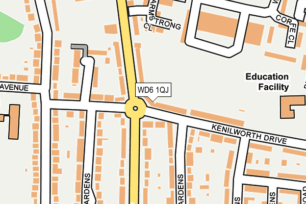
WD6 1QJ is located in the Borehamwood Kenilworth electoral ward, within the local authority district of Hertsmere and the English Parliamentary constituency of Hertsmere. The Sub Integrated Care Board (ICB) Location is NHS Hertfordshire and West Essex ICB - 06N and the police force is Hertfordshire. This postcode has been in use since January 1980.


GetTheData
Source: OS OpenMap – Local (Ordnance Survey)
Source: OS VectorMap District (Ordnance Survey)
Licence: Open Government Licence (requires attribution)
| Easting | 520445 |
| Northing | 196577 |
| Latitude | 51.655087 |
| Longitude | -0.260272 |
GetTheData
Source: Open Postcode Geo
Licence: Open Government Licence
| Country | England |
| Postcode District | WD6 |
| ➜ WD6 open data dashboard ➜ See where WD6 is on a map ➜ Where is Borehamwood? | |
GetTheData
Source: Land Registry Price Paid Data
Licence: Open Government Licence
Elevation or altitude of WD6 1QJ as distance above sea level:
| Metres | Feet | |
|---|---|---|
| Elevation | 110m | 361ft |
Elevation is measured from the approximate centre of the postcode, to the nearest point on an OS contour line from OS Terrain 50, which has contour spacing of ten vertical metres.
➜ How high above sea level am I? Find the elevation of your current position using your device's GPS.
GetTheData
Source: Open Postcode Elevation
Licence: Open Government Licence
| Ward | Borehamwood Kenilworth |
| Constituency | Hertsmere |
GetTheData
Source: ONS Postcode Database
Licence: Open Government Licence
| January 2024 | Violence and sexual offences | On or near Manor Way | 49m |
| January 2024 | Burglary | On or near Arundel Drive | 443m |
| January 2024 | Other theft | On or near Arundel Drive | 443m |
| ➜ Get more crime data in our Crime section | |||
GetTheData
Source: data.police.uk
Licence: Open Government Licence
| Kenilworth House (Manor Way) | Borehamwood | 70m |
| Kenilworth House (Manor Way) | Borehamwood | 100m |
| Durham Road (Manor Way) | Borehamwood | 192m |
| Durham Road (Manor Way) | Borehamwood | 275m |
| Warwick House (Warwick Road) | Borehamwood | 396m |
| Elstree & Borehamwood Station | 1.4km |
| Mill Hill Broadway Station | 4.7km |
| Radlett Station | 5.2km |
GetTheData
Source: NaPTAN
Licence: Open Government Licence
GetTheData
Source: ONS Postcode Database
Licence: Open Government Licence


➜ Get more ratings from the Food Standards Agency
GetTheData
Source: Food Standards Agency
Licence: FSA terms & conditions
| Last Collection | |||
|---|---|---|---|
| Location | Mon-Fri | Sat | Distance |
| Eldon Avenue | 18:30 | 11:30 | 533m |
| Furzehill Road | 17:30 | 11:30 | 807m |
| Shenley Road | 17:30 | 11:30 | 987m |
GetTheData
Source: Dracos
Licence: Creative Commons Attribution-ShareAlike
| Facility | Distance |
|---|---|
| Kenilworth Park Kenilworth Drive, Borehamwood Grass Pitches | 186m |
| Kenilworth Primary School Kenilworth Drive, Borehamwood Grass Pitches | 263m |
| Monksmead School Hillside Avenue, Borehamwood Grass Pitches | 305m |
GetTheData
Source: Active Places
Licence: Open Government Licence
| School | Phase of Education | Distance |
|---|---|---|
| Kenilworth Primary School Kenilworth Drive, Borehamwood, WD6 1QL | Primary | 262m |
| Monksmead School Hillside Avenue, Monksmead School, Borehamwood, WD6 1HL | Primary | 306m |
| Yavneh Primary School Hillside Avenue, Borehamwood, WD6 1HL | Primary | 419m |
GetTheData
Source: Edubase
Licence: Open Government Licence
The below table lists the International Territorial Level (ITL) codes (formerly Nomenclature of Territorial Units for Statistics (NUTS) codes) and Local Administrative Units (LAU) codes for WD6 1QJ:
| ITL 1 Code | Name |
|---|---|
| TLH | East |
| ITL 2 Code | Name |
| TLH2 | Bedfordshire and Hertfordshire |
| ITL 3 Code | Name |
| TLH23 | Hertfordshire CC |
| LAU 1 Code | Name |
| E07000098 | Hertsmere |
GetTheData
Source: ONS Postcode Directory
Licence: Open Government Licence
The below table lists the Census Output Area (OA), Lower Layer Super Output Area (LSOA), and Middle Layer Super Output Area (MSOA) for WD6 1QJ:
| Code | Name | |
|---|---|---|
| OA | E00119592 | |
| LSOA | E01023546 | Hertsmere 009C |
| MSOA | E02004904 | Hertsmere 009 |
GetTheData
Source: ONS Postcode Directory
Licence: Open Government Licence
| WD6 1QP | Kenilworth Drive | 43m |
| WD6 1QH | Manor Way | 63m |
| WD6 1QG | Kenilworth Drive | 67m |
| WD6 1QL | Kenilworth Drive | 106m |
| WD6 1QD | Kenilworth Drive | 125m |
| WD6 1QF | Kenilworth Close | 129m |
| WD6 1QW | Kenilworth Drive | 140m |
| WD6 1RR | Armstrong Close | 141m |
| WD6 1RS | Langdale Terrace | 158m |
| WD6 1QE | Kenilworth Drive | 162m |
GetTheData
Source: Open Postcode Geo; Land Registry Price Paid Data
Licence: Open Government Licence