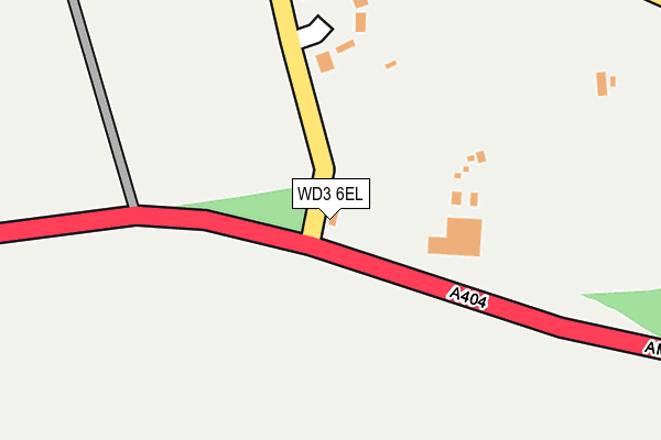
WD3 6EL is in Chenies, Rickmansworth. WD3 6EL is located in the Chess Valley electoral ward, within the unitary authority of Buckinghamshire and the English Parliamentary constituency of Chesham and Amersham. The Sub Integrated Care Board (ICB) Location is NHS Buckinghamshire, Oxfordshire and Berkshire West ICB - 14Y and the police force is Thames Valley. This postcode has been in use since January 1980.


GetTheData
Source: OS OpenMap – Local (Ordnance Survey)
Source: OS VectorMap District (Ordnance Survey)
Licence: Open Government Licence (requires attribution)
| Easting | 501712 |
| Northing | 197953 |
| Latitude | 51.671153 |
| Longitude | -0.530567 |
GetTheData
Source: Open Postcode Geo
Licence: Open Government Licence
| Locality | Chenies |
| Town/City | Rickmansworth |
| Country | England |
| Postcode District | WD3 |
| ➜ WD3 open data dashboard ➜ See where WD3 is on a map | |
GetTheData
Source: Land Registry Price Paid Data
Licence: Open Government Licence
Elevation or altitude of WD3 6EL as distance above sea level:
| Metres | Feet | |
|---|---|---|
| Elevation | 120m | 394ft |
Elevation is measured from the approximate centre of the postcode, to the nearest point on an OS contour line from OS Terrain 50, which has contour spacing of ten vertical metres.
➜ How high above sea level am I? Find the elevation of your current position using your device's GPS.
GetTheData
Source: Open Postcode Elevation
Licence: Open Government Licence
| Ward | Chess Valley |
| Constituency | Chesham And Amersham |
GetTheData
Source: ONS Postcode Database
Licence: Open Government Licence
| June 2022 | Vehicle crime | On or near Bedford Close | 177m |
| May 2022 | Criminal damage and arson | On or near Bedford Close | 177m |
| April 2022 | Violence and sexual offences | On or near Sports/Recreation Area | 365m |
| ➜ Get more crime data in our Crime section | |||
GetTheData
Source: data.police.uk
Licence: Open Government Licence
| Garden Centre (Amersham Road) | Chenies | 34m |
| Garden Centre (Amersham Road) | Chenies | 59m |
| Bedford Close (Holloway Lane) | Chenies | 134m |
| Bedford Close (Holloway Lane) | Chenies | 176m |
| The Red Lion Ph (Chenies Road) | Chenies | 338m |
| Chorleywood Station | 2.1km |
| Chalfont & Latimer Station | 2.1km |
| Rickmansworth Station | 5.2km |
GetTheData
Source: NaPTAN
Licence: Open Government Licence
| Percentage of properties with Next Generation Access | 0.0% |
| Percentage of properties with Superfast Broadband | 0.0% |
| Percentage of properties with Ultrafast Broadband | 0.0% |
| Percentage of properties with Full Fibre Broadband | 0.0% |
Superfast Broadband is between 30Mbps and 300Mbps
Ultrafast Broadband is > 300Mbps
| Percentage of properties unable to receive 2Mbps | 0.0% |
| Percentage of properties unable to receive 5Mbps | 0.0% |
| Percentage of properties unable to receive 10Mbps | 0.0% |
| Percentage of properties unable to receive 30Mbps | 100.0% |
GetTheData
Source: Ofcom
Licence: Ofcom Terms of Use (requires attribution)
GetTheData
Source: ONS Postcode Database
Licence: Open Government Licence


➜ Get more ratings from the Food Standards Agency
GetTheData
Source: Food Standards Agency
Licence: FSA terms & conditions
| Last Collection | |||
|---|---|---|---|
| Location | Mon-Fri | Sat | Distance |
| Church Grove | 17:30 | 12:00 | 1,339m |
| Latimer | 16:15 | 08:45 | 1,630m |
| Lodge Lane | 16:15 | 07:15 | 1,707m |
GetTheData
Source: Dracos
Licence: Creative Commons Attribution-ShareAlike
| Facility | Distance |
|---|---|
| Chenies & Latimer Cricket Club Latimer Road, Chenies, Rickmansworth Grass Pitches | 389m |
| Little Chalfont Golf Club (Closed) Lodge Lane, Chalfont St. Giles Golf | 1.4km |
| St Clement Danes School Chenies Road, Chorleywood, Rickmansworth Health and Fitness Gym, Sports Hall, Artificial Grass Pitch, Grass Pitches, Studio, Outdoor Tennis Courts | 1.4km |
GetTheData
Source: Active Places
Licence: Open Government Licence
| School | Phase of Education | Distance |
|---|---|---|
| Chenies School Chenies, Rickmansworth, WD3 6ER | Primary | 361m |
| St Clement Danes School Chenies Road, Chorleywood, Rickmansworth, WD3 6EW | Secondary | 1.4km |
| Little Chalfont Primary School Oakington Avenue, Little Chalfont, Amersham, HP6 6SX | Primary | 1.7km |
GetTheData
Source: Edubase
Licence: Open Government Licence
The below table lists the International Territorial Level (ITL) codes (formerly Nomenclature of Territorial Units for Statistics (NUTS) codes) and Local Administrative Units (LAU) codes for WD3 6EL:
| ITL 1 Code | Name |
|---|---|
| TLJ | South East (England) |
| ITL 2 Code | Name |
| TLJ1 | Berkshire, Buckinghamshire and Oxfordshire |
| ITL 3 Code | Name |
| TLJ13 | Buckinghamshire |
| LAU 1 Code | Name |
| E06000060 | Buckinghamshire |
GetTheData
Source: ONS Postcode Directory
Licence: Open Government Licence
The below table lists the Census Output Area (OA), Lower Layer Super Output Area (LSOA), and Middle Layer Super Output Area (MSOA) for WD3 6EL:
| Code | Name | |
|---|---|---|
| OA | E00089563 | |
| LSOA | E01017750 | Chiltern 001A |
| MSOA | E02003676 | Chiltern 001 |
GetTheData
Source: ONS Postcode Directory
Licence: Open Government Licence
| WD3 6EJ | Bedford Close | 189m |
| WD3 6EH | 263m | |
| WD3 6EG | 333m | |
| WD3 6EQ | Chenies Village | 337m |
| WD3 6EE | 388m | |
| WD3 6ET | 407m | |
| WD3 6ED | 442m | |
| WD3 6EB | 443m | |
| WD3 6ER | 482m | |
| WD3 6EU | 666m |
GetTheData
Source: Open Postcode Geo; Land Registry Price Paid Data
Licence: Open Government Licence