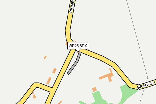
WD25 8DX is located in the Aldenham West electoral ward, within the local authority district of Hertsmere and the English Parliamentary constituency of Hertsmere. The Sub Integrated Care Board (ICB) Location is NHS Hertfordshire and West Essex ICB - 06N and the police force is Hertfordshire. This postcode has been in use since October 2000.


GetTheData
Source: OS OpenMap – Local (Ordnance Survey)
Source: OS VectorMap District (Ordnance Survey)
Licence: Open Government Licence (requires attribution)
| Easting | 514634 |
| Northing | 197892 |
| Latitude | 51.668124 |
| Longitude | -0.343781 |
GetTheData
Source: Open Postcode Geo
Licence: Open Government Licence
| Country | England |
| Postcode District | WD25 |
| ➜ WD25 open data dashboard ➜ See where WD25 is on a map ➜ Where is Patchetts Green? | |
GetTheData
Source: Land Registry Price Paid Data
Licence: Open Government Licence
Elevation or altitude of WD25 8DX as distance above sea level:
| Metres | Feet | |
|---|---|---|
| Elevation | 90m | 295ft |
Elevation is measured from the approximate centre of the postcode, to the nearest point on an OS contour line from OS Terrain 50, which has contour spacing of ten vertical metres.
➜ How high above sea level am I? Find the elevation of your current position using your device's GPS.
GetTheData
Source: Open Postcode Elevation
Licence: Open Government Licence
| Ward | Aldenham West |
| Constituency | Hertsmere |
GetTheData
Source: ONS Postcode Database
Licence: Open Government Licence
| February 2022 | Criminal damage and arson | On or near Summerhouse Lane | 198m |
| November 2021 | Burglary | On or near Summerhouse Lane | 198m |
| November 2021 | Other theft | On or near Summerhouse Lane | 198m |
| ➜ Get more crime data in our Crime section | |||
GetTheData
Source: data.police.uk
Licence: Open Government Licence
| Roundbush Lane (Radlett Road) | Round Bush | 576m |
| Roundbush Lane (Radlett Road) | Round Bush | 586m |
| Morgan Gardens (Church Lane) | Aldenham | 890m |
| Morgan Gardens (Church Lane) | Aldenham | 904m |
| St John's Church (Church Lane) | Aldenham | 906m |
| Radlett Station | 2.6km |
| Watford North Station | 3.3km |
| Garston (Herts) Station | 3.3km |
GetTheData
Source: NaPTAN
Licence: Open Government Licence
| Percentage of properties with Next Generation Access | 100.0% |
| Percentage of properties with Superfast Broadband | 0.0% |
| Percentage of properties with Ultrafast Broadband | 0.0% |
| Percentage of properties with Full Fibre Broadband | 0.0% |
Superfast Broadband is between 30Mbps and 300Mbps
Ultrafast Broadband is > 300Mbps
| Percentage of properties unable to receive 2Mbps | 0.0% |
| Percentage of properties unable to receive 5Mbps | 0.0% |
| Percentage of properties unable to receive 10Mbps | 0.0% |
| Percentage of properties unable to receive 30Mbps | 100.0% |
GetTheData
Source: Ofcom
Licence: Ofcom Terms of Use (requires attribution)
GetTheData
Source: ONS Postcode Database
Licence: Open Government Licence


➜ Get more ratings from the Food Standards Agency
GetTheData
Source: Food Standards Agency
Licence: FSA terms & conditions
| Last Collection | |||
|---|---|---|---|
| Location | Mon-Fri | Sat | Distance |
| Battlers Green P.o | 17:15 | 11:45 | 1,579m |
| Aldenham Avenue South | 17:30 | 12:00 | 1,783m |
| Gills Hill | 17:15 | 11:45 | 2,137m |
GetTheData
Source: Dracos
Licence: Creative Commons Attribution-ShareAlike
| Facility | Distance |
|---|---|
| Aldenham School (Cookes Field) Aldenham Road, Letchmore Heath, Watford Grass Pitches | 840m |
| Aldenham Golf Club Church Lane, Aldenham, Watford Golf | 938m |
| Edge Grove Preparatory School High Cross, Aldenham, Watford Grass Pitches, Sports Hall, Swimming Pool | 1km |
GetTheData
Source: Active Places
Licence: Open Government Licence
| School | Phase of Education | Distance |
|---|---|---|
| Edge Grove School High Cross, Aldenham, Watford, WD25 8NL | Not applicable | 1km |
| Gurukula - The Hare Krishna Primary School Hartspring Cottage, Elton Way, Watford, Hertfordshire, WD25 8HB | Not applicable | 1.1km |
| The Aldenham Foundation Elstree, Elstree, WD6 3AJ | Not applicable | 1.2km |
GetTheData
Source: Edubase
Licence: Open Government Licence
The below table lists the International Territorial Level (ITL) codes (formerly Nomenclature of Territorial Units for Statistics (NUTS) codes) and Local Administrative Units (LAU) codes for WD25 8DX:
| ITL 1 Code | Name |
|---|---|
| TLH | East |
| ITL 2 Code | Name |
| TLH2 | Bedfordshire and Hertfordshire |
| ITL 3 Code | Name |
| TLH23 | Hertfordshire CC |
| LAU 1 Code | Name |
| E07000098 | Hertsmere |
GetTheData
Source: ONS Postcode Directory
Licence: Open Government Licence
The below table lists the Census Output Area (OA), Lower Layer Super Output Area (LSOA), and Middle Layer Super Output Area (MSOA) for WD25 8DX:
| Code | Name | |
|---|---|---|
| OA | E00119494 | |
| LSOA | E01023528 | Hertsmere 010A |
| MSOA | E02004905 | Hertsmere 010 |
GetTheData
Source: ONS Postcode Directory
Licence: Open Government Licence
| WD25 8DY | Grange Lane | 336m |
| WD25 8EA | Grange Lane | 421m |
| WD25 8ET | The Mews | 429m |
| WD25 8EB | Grange Lane | 445m |
| WD25 8BQ | Roundbush Lane | 478m |
| WD25 8ED | New Road | 489m |
| WD25 8EE | Letchmore Cottages | 492m |
| WD25 8ES | The Green | 503m |
| WD25 8ER | The Green | 519m |
| WD25 8EP | The Green | 531m |
GetTheData
Source: Open Postcode Geo; Land Registry Price Paid Data
Licence: Open Government Licence