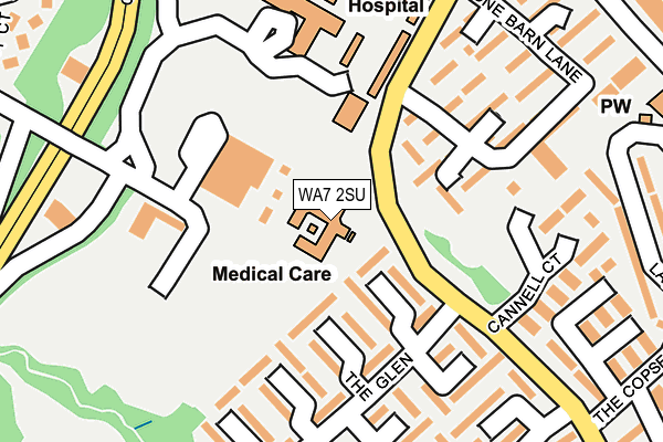
WA7 2SU is located in the Halton Lea electoral ward, within the unitary authority of Halton and the English Parliamentary constituency of Weaver Vale. The Sub Integrated Care Board (ICB) Location is NHS Cheshire and Merseyside ICB - 01F and the police force is Cheshire. This postcode has been in use since August 1993.


GetTheData
Source: OS OpenMap – Local (Ordnance Survey)
Source: OS VectorMap District (Ordnance Survey)
Licence: Open Government Licence (requires attribution)
| Easting | 353867 |
| Northing | 380730 |
| Latitude | 53.321473 |
| Longitude | -2.694021 |
GetTheData
Source: Open Postcode Geo
Licence: Open Government Licence
| Country | England |
| Postcode District | WA7 |
| ➜ WA7 open data dashboard ➜ See where WA7 is on a map ➜ Where is Runcorn? | |
GetTheData
Source: Land Registry Price Paid Data
Licence: Open Government Licence
Elevation or altitude of WA7 2SU as distance above sea level:
| Metres | Feet | |
|---|---|---|
| Elevation | 60m | 197ft |
Elevation is measured from the approximate centre of the postcode, to the nearest point on an OS contour line from OS Terrain 50, which has contour spacing of ten vertical metres.
➜ How high above sea level am I? Find the elevation of your current position using your device's GPS.
GetTheData
Source: Open Postcode Elevation
Licence: Open Government Licence
| Ward | Halton Lea |
| Constituency | Weaver Vale |
GetTheData
Source: ONS Postcode Database
Licence: Open Government Licence
| January 2024 | Violence and sexual offences | On or near Hallwood Park Avenue | 449m |
| October 2023 | Violence and sexual offences | On or near Falcons Way | 427m |
| June 2023 | Anti-social behaviour | On or near Falcons Way | 427m |
| ➜ Get more crime data in our Crime section | |||
GetTheData
Source: data.police.uk
Licence: Open Government Licence
| Halton Hospital (Main Entrance) | Halton Village | 129m |
| The Glen (Palacefields Avenue) | Palace Fields | 195m |
| The Glen (Palacefields Avenue) | Palace Fields | 234m |
| The Glen (Palacefields Avenue) | Palace Fields | 316m |
| Palacefields (Busway (Palacefields)) | Palace Fields | 326m |
| Runcorn East Station | 2km |
| Frodsham Station | 3.5km |
| Runcorn Station | 3.6km |
GetTheData
Source: NaPTAN
Licence: Open Government Licence
| Percentage of properties with Next Generation Access | 100.0% |
| Percentage of properties with Superfast Broadband | 100.0% |
| Percentage of properties with Ultrafast Broadband | 0.0% |
| Percentage of properties with Full Fibre Broadband | 0.0% |
Superfast Broadband is between 30Mbps and 300Mbps
Ultrafast Broadband is > 300Mbps
| Percentage of properties unable to receive 2Mbps | 0.0% |
| Percentage of properties unable to receive 5Mbps | 0.0% |
| Percentage of properties unable to receive 10Mbps | 0.0% |
| Percentage of properties unable to receive 30Mbps | 0.0% |
GetTheData
Source: Ofcom
Licence: Ofcom Terms of Use (requires attribution)
GetTheData
Source: ONS Postcode Database
Licence: Open Government Licence


➜ Get more ratings from the Food Standards Agency
GetTheData
Source: Food Standards Agency
Licence: FSA terms & conditions
| Last Collection | |||
|---|---|---|---|
| Location | Mon-Fri | Sat | Distance |
| The Glen | 16:45 | 11:00 | 149m |
| Hallwood Park | 17:30 | 11:00 | 410m |
| Delivery Office | 18:15 | 12:00 | 499m |
GetTheData
Source: Dracos
Licence: Creative Commons Attribution-ShareAlike
| Facility | Distance |
|---|---|
| Palace Fields Primary Academy Badger Close, Palacefields, Runcorn Grass Pitches | 454m |
| Queen Elizabeth Ii Playing Fields (Woodside) Palacefields Avenue, Brookvale, Runcorn Grass Pitches | 524m |
| Hallwood Park County Primary School Hallwood Park Avenue, Hallwood Park, Runcorn Grass Pitches | 530m |
GetTheData
Source: Active Places
Licence: Open Government Licence
| School | Phase of Education | Distance |
|---|---|---|
| Our Lady Mother of the Saviour Catholic Primary School Lapwing Grove, Palacefields, Runcorn, WA7 2TP | Primary | 412m |
| Palace Fields Primary Academy Badger Close, Palace Fields, Runcorn, WA7 2QW | Primary | 454m |
| Hallwood Park Primary School and Nursery Hallwood Park Avenue, Hallwood Park, Runcorn, WA7 2FL | Primary | 530m |
GetTheData
Source: Edubase
Licence: Open Government Licence
The below table lists the International Territorial Level (ITL) codes (formerly Nomenclature of Territorial Units for Statistics (NUTS) codes) and Local Administrative Units (LAU) codes for WA7 2SU:
| ITL 1 Code | Name |
|---|---|
| TLD | North West (England) |
| ITL 2 Code | Name |
| TLD7 | Merseyside |
| ITL 3 Code | Name |
| TLD71 | East Merseyside |
| LAU 1 Code | Name |
| E06000006 | Halton |
GetTheData
Source: ONS Postcode Directory
Licence: Open Government Licence
The below table lists the Census Output Area (OA), Lower Layer Super Output Area (LSOA), and Middle Layer Super Output Area (MSOA) for WA7 2SU:
| Code | Name | |
|---|---|---|
| OA | E00062594 | |
| LSOA | E01012409 | Halton 015C |
| MSOA | E02002588 | Halton 015 |
GetTheData
Source: ONS Postcode Directory
Licence: Open Government Licence
| WA7 2TE | The Glen | 89m |
| WA7 2PQ | Stone Barn Lane | 171m |
| WA7 2TF | The Glen | 185m |
| WA7 2TD | The Glen | 205m |
| WA7 2TQ | The Glen | 218m |
| WA7 2TG | The Glen | 248m |
| WA7 2TN | The Copse | 251m |
| WA7 2TH | Lapwing Grove | 273m |
| WA7 2QE | Stone Barn Lane | 283m |
| WA7 2NZ | Local Centre | 288m |
GetTheData
Source: Open Postcode Geo; Land Registry Price Paid Data
Licence: Open Government Licence