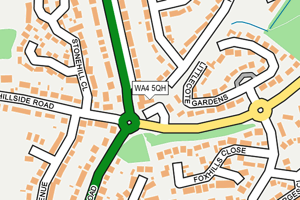
WA4 5QH is located in the Appleton electoral ward, within the unitary authority of Warrington and the English Parliamentary constituency of Warrington South. The Sub Integrated Care Board (ICB) Location is NHS Cheshire and Merseyside ICB - 02E and the police force is Cheshire. This postcode has been in use since May 1994.


GetTheData
Source: OS OpenMap – Local (Ordnance Survey)
Source: OS VectorMap District (Ordnance Survey)
Licence: Open Government Licence (requires attribution)
| Easting | 361852 |
| Northing | 383474 |
| Latitude | 53.346773 |
| Longitude | -2.574487 |
GetTheData
Source: Open Postcode Geo
Licence: Open Government Licence
| Country | England |
| Postcode District | WA4 |
| ➜ WA4 open data dashboard ➜ See where WA4 is on a map ➜ Where is Warrington? | |
GetTheData
Source: Land Registry Price Paid Data
Licence: Open Government Licence
Elevation or altitude of WA4 5QH as distance above sea level:
| Metres | Feet | |
|---|---|---|
| Elevation | 80m | 262ft |
Elevation is measured from the approximate centre of the postcode, to the nearest point on an OS contour line from OS Terrain 50, which has contour spacing of ten vertical metres.
➜ How high above sea level am I? Find the elevation of your current position using your device's GPS.
GetTheData
Source: Open Postcode Elevation
Licence: Open Government Licence
| Ward | Appleton |
| Constituency | Warrington South |
GetTheData
Source: ONS Postcode Database
Licence: Open Government Licence
| October 2023 | Anti-social behaviour | On or near Stonehill Close | 223m |
| September 2023 | Anti-social behaviour | On or near Stonehill Close | 223m |
| September 2023 | Violence and sexual offences | On or near Stonehill Close | 223m |
| ➜ Get more crime data in our Crime section | |||
GetTheData
Source: data.police.uk
Licence: Open Government Licence
| Owens Corner (London Road) | Appleton | 37m |
| Owens Corner (Longwood Road) | Appleton | 64m |
| Owens Corner (Longwood Road) | Appleton | 67m |
| Owens Corner (London Road) | Appleton | 82m |
| Kingsbury Close (Pewterspear Green Road) | Appleton | 271m |
| Warrington Bank Quay Station | 4.7km |
GetTheData
Source: NaPTAN
Licence: Open Government Licence
| Percentage of properties with Next Generation Access | 100.0% |
| Percentage of properties with Superfast Broadband | 100.0% |
| Percentage of properties with Ultrafast Broadband | 0.0% |
| Percentage of properties with Full Fibre Broadband | 0.0% |
Superfast Broadband is between 30Mbps and 300Mbps
Ultrafast Broadband is > 300Mbps
| Percentage of properties unable to receive 2Mbps | 0.0% |
| Percentage of properties unable to receive 5Mbps | 0.0% |
| Percentage of properties unable to receive 10Mbps | 0.0% |
| Percentage of properties unable to receive 30Mbps | 0.0% |
GetTheData
Source: Ofcom
Licence: Ofcom Terms of Use (requires attribution)
GetTheData
Source: ONS Postcode Database
Licence: Open Government Licence


➜ Get more ratings from the Food Standards Agency
GetTheData
Source: Food Standards Agency
Licence: FSA terms & conditions
| Last Collection | |||
|---|---|---|---|
| Location | Mon-Fri | Sat | Distance |
| Hillside Road | 17:30 | 08:30 | 103m |
| Dudlow Green Road | 17:30 | 10:30 | 547m |
| Woodbridge Close | 17:30 | 11:00 | 560m |
GetTheData
Source: Dracos
Licence: Creative Commons Attribution-ShareAlike
| Facility | Distance |
|---|---|
| Village Pond Pitch Pewterspear Green Road, Appleton, Warrington Grass Pitches | 466m |
| Pewterspear Sports Pavilion Beamish Close, Stretton, Warrington Grass Pitches | 550m |
| Stretton St Matthews C Of E Primary School Stretton Road, Stretton, Warrington Grass Pitches | 731m |
GetTheData
Source: Active Places
Licence: Open Government Licence
| School | Phase of Education | Distance |
|---|---|---|
| Stretton St Matthew's CofE Primary School Stretton Road, Stretton, Warrington, WA4 4NT | Primary | 729m |
| Bridgewater High School Broomfields Road, Appleton, Warrington, WA4 3AE | Secondary | 1.8km |
| Broomfields Junior School Bridge Lane, Appleton, Warrington, WA4 3AH | Primary | 1.8km |
GetTheData
Source: Edubase
Licence: Open Government Licence
The below table lists the International Territorial Level (ITL) codes (formerly Nomenclature of Territorial Units for Statistics (NUTS) codes) and Local Administrative Units (LAU) codes for WA4 5QH:
| ITL 1 Code | Name |
|---|---|
| TLD | North West (England) |
| ITL 2 Code | Name |
| TLD6 | Cheshire |
| ITL 3 Code | Name |
| TLD61 | Warrington |
| LAU 1 Code | Name |
| E06000007 | Warrington |
GetTheData
Source: ONS Postcode Directory
Licence: Open Government Licence
The below table lists the Census Output Area (OA), Lower Layer Super Output Area (LSOA), and Middle Layer Super Output Area (MSOA) for WA4 5QH:
| Code | Name | |
|---|---|---|
| OA | E00062781 | |
| LSOA | E01012449 | Warrington 025C |
| MSOA | E02002614 | Warrington 025 |
GetTheData
Source: ONS Postcode Directory
Licence: Open Government Licence
| WA4 5PR | Hillside Road | 117m |
| WA4 5DX | Highfield Avenue | 122m |
| WA4 5DP | London Road | 160m |
| WA4 5PZ | Hillside Road | 161m |
| WA4 5DH | Foxhills Close | 176m |
| WA4 5PP | London Road | 178m |
| WA4 5DL | Littlecote Gardens | 180m |
| WA4 5DR | London Road | 192m |
| WA4 5QD | Stonehill Close | 239m |
| WA4 5PU | Springholm Drive | 243m |
GetTheData
Source: Open Postcode Geo; Land Registry Price Paid Data
Licence: Open Government Licence