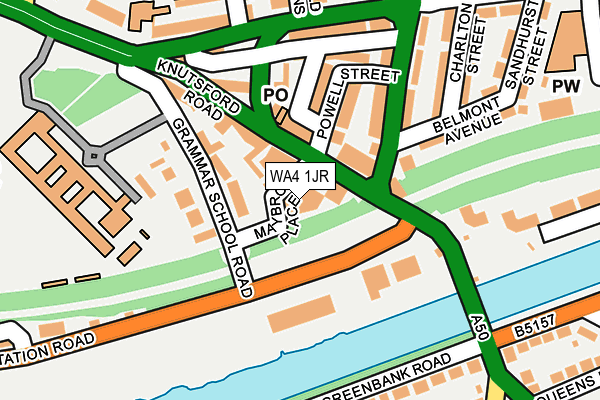
WA4 1JR is located in the Latchford East electoral ward, within the unitary authority of Warrington and the English Parliamentary constituency of Warrington South. The Sub Integrated Care Board (ICB) Location is NHS Cheshire and Merseyside ICB - 02E and the police force is Cheshire. This postcode has been in use since January 2007.


GetTheData
Source: OS OpenMap – Local (Ordnance Survey)
Source: OS VectorMap District (Ordnance Survey)
Licence: Open Government Licence (requires attribution)
| Easting | 362713 |
| Northing | 387104 |
| Latitude | 53.379478 |
| Longitude | -2.561984 |
GetTheData
Source: Open Postcode Geo
Licence: Open Government Licence
| Country | England |
| Postcode District | WA4 |
| ➜ WA4 open data dashboard ➜ See where WA4 is on a map ➜ Where is Warrington? | |
GetTheData
Source: Land Registry Price Paid Data
Licence: Open Government Licence
Elevation or altitude of WA4 1JR as distance above sea level:
| Metres | Feet | |
|---|---|---|
| Elevation | 10m | 33ft |
Elevation is measured from the approximate centre of the postcode, to the nearest point on an OS contour line from OS Terrain 50, which has contour spacing of ten vertical metres.
➜ How high above sea level am I? Find the elevation of your current position using your device's GPS.
GetTheData
Source: Open Postcode Elevation
Licence: Open Government Licence
| Ward | Latchford East |
| Constituency | Warrington South |
GetTheData
Source: ONS Postcode Database
Licence: Open Government Licence
| November 2023 | Robbery | On or near Moss Road | 393m |
| September 2023 | Violence and sexual offences | On or near Moss Road | 393m |
| May 2023 | Other crime | On or near Moss Road | 393m |
| ➜ Get more crime data in our Crime section | |||
GetTheData
Source: data.police.uk
Licence: Open Government Licence
| Kwik Save (Powell Street) | Latchford | 37m |
| Powell Street (Kingsway South) | Latchford | 141m |
| Kingsway South (Thelwall Lane) | Latchford | 194m |
| Garden Centre (Station Road) | Latchford | 208m |
| Cheshire Cheese (Thelwall Lane) | Latchford | 235m |
| Warrington Central Station | 2.5km |
| Warrington Bank Quay Station | 2.8km |
| Padgate Station | 2.9km |
GetTheData
Source: NaPTAN
Licence: Open Government Licence
| Median download speed | 21.9Mbps |
| Average download speed | 25.0Mbps |
| Maximum download speed | 57.83Mbps |
| Median upload speed | 5.0Mbps |
| Average upload speed | 5.6Mbps |
| Maximum upload speed | 12.74Mbps |
GetTheData
Source: Ofcom
Licence: Ofcom Terms of Use (requires attribution)
GetTheData
Source: ONS Postcode Database
Licence: Open Government Licence


➜ Get more ratings from the Food Standards Agency
GetTheData
Source: Food Standards Agency
Licence: FSA terms & conditions
| Last Collection | |||
|---|---|---|---|
| Location | Mon-Fri | Sat | Distance |
| Latchford S.o. | 17:30 | 12:00 | 84m |
| Pillings Garden | 17:30 | 11:00 | 331m |
| Poachers Lane | 17:30 | 11:00 | 429m |
GetTheData
Source: Dracos
Licence: Creative Commons Attribution-ShareAlike
| Facility | Distance |
|---|---|
| Energie Fitness (Warrington) Maybrook Place, Latchford, Warrington Health and Fitness Gym, Studio | 0m |
| Sir Thomas Boteler Church Of England High School Grammar School Road, Warrington Sports Hall, Grass Pitches | 226m |
| Warrington Sports For All Centre Knutsford Road, Latchford, Warrington Sports Hall | 359m |
GetTheData
Source: Active Places
Licence: Open Government Licence
| School | Phase of Education | Distance |
|---|---|---|
| Sir Thomas Boteler Church of England High School Grammar School Road, Latchford, Warrington, WA4 1JL | Secondary | 257m |
| Alderman Bolton Primary School Longdin Street, Latchford, Warrington, WA4 1PW | Primary | 372m |
| St Augustine's Catholic Primary School Henshall Avenue, Latchford, Warrington, WA4 1PY | Primary | 489m |
GetTheData
Source: Edubase
Licence: Open Government Licence
The below table lists the International Territorial Level (ITL) codes (formerly Nomenclature of Territorial Units for Statistics (NUTS) codes) and Local Administrative Units (LAU) codes for WA4 1JR:
| ITL 1 Code | Name |
|---|---|
| TLD | North West (England) |
| ITL 2 Code | Name |
| TLD6 | Cheshire |
| ITL 3 Code | Name |
| TLD61 | Warrington |
| LAU 1 Code | Name |
| E06000007 | Warrington |
GetTheData
Source: ONS Postcode Directory
Licence: Open Government Licence
The below table lists the Census Output Area (OA), Lower Layer Super Output Area (LSOA), and Middle Layer Super Output Area (MSOA) for WA4 1JR:
| Code | Name | |
|---|---|---|
| OA | E00063080 | |
| LSOA | E01012507 | Warrington 020D |
| MSOA | E02002609 | Warrington 020 |
GetTheData
Source: ONS Postcode Directory
Licence: Open Government Licence
| WA4 1JW | Knutsford Road | 84m |
| WA4 1JY | Knutsford Road | 87m |
| WA4 1LB | Station Road Industrial Estate | 108m |
| WA4 1JN | Grammar School Road | 117m |
| WA4 1LA | Powell Street | 118m |
| WA4 1LS | Kingsway South | 127m |
| WA4 1LF | Grammar School Court | 141m |
| WA4 1LT | Kingsway South | 150m |
| WA4 1DL | Clearwater Quays | 172m |
| WA4 1LJ | Thelwall Lane | 173m |
GetTheData
Source: Open Postcode Geo; Land Registry Price Paid Data
Licence: Open Government Licence