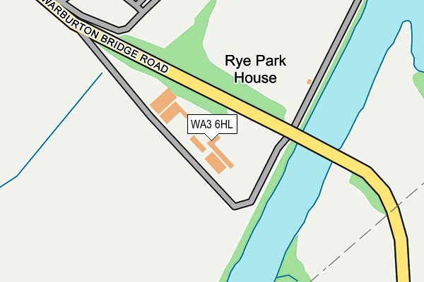
WA3 6HL is located in the Rixton and Woolston electoral ward, within the unitary authority of Warrington and the English Parliamentary constituency of Warrington North. The Sub Integrated Care Board (ICB) Location is NHS Cheshire and Merseyside ICB - 02E and the police force is Cheshire. This postcode has been in use since January 1980.


GetTheData
Source: OS OpenMap – Local (Ordnance Survey)
Source: OS VectorMap District (Ordnance Survey)
Licence: Open Government Licence (requires attribution)
| Easting | 369434 |
| Northing | 390179 |
| Latitude | 53.407551 |
| Longitude | -2.461252 |
GetTheData
Source: Open Postcode Geo
Licence: Open Government Licence
| Country | England |
| Postcode District | WA3 |
| ➜ WA3 open data dashboard ➜ See where WA3 is on a map | |
GetTheData
Source: Land Registry Price Paid Data
Licence: Open Government Licence
Elevation or altitude of WA3 6HL as distance above sea level:
| Metres | Feet | |
|---|---|---|
| Elevation | 20m | 66ft |
Elevation is measured from the approximate centre of the postcode, to the nearest point on an OS contour line from OS Terrain 50, which has contour spacing of ten vertical metres.
➜ How high above sea level am I? Find the elevation of your current position using your device's GPS.
GetTheData
Source: Open Postcode Elevation
Licence: Open Government Licence
| Ward | Rixton And Woolston |
| Constituency | Warrington North |
GetTheData
Source: ONS Postcode Database
Licence: Open Government Licence
| Warburton Bridge Road (Manchester Road) | Rixton | 357m |
| Warburton Bridge Road (Manchester Road) | Rixton | 410m |
| Chapel Lane | Rixton | 571m |
| Chapel Lane | Rixton | 585m |
| Claydon Gardens (Chapel Lane) | Rixton | 587m |
| Glazebrook Station | 2.3km |
| Irlam Station | 3.5km |
| Birchwood Station | 4.3km |
GetTheData
Source: NaPTAN
Licence: Open Government Licence
| Percentage of properties with Next Generation Access | 100.0% |
| Percentage of properties with Superfast Broadband | 100.0% |
| Percentage of properties with Ultrafast Broadband | 0.0% |
| Percentage of properties with Full Fibre Broadband | 0.0% |
Superfast Broadband is between 30Mbps and 300Mbps
Ultrafast Broadband is > 300Mbps
| Percentage of properties unable to receive 2Mbps | 0.0% |
| Percentage of properties unable to receive 5Mbps | 0.0% |
| Percentage of properties unable to receive 10Mbps | 0.0% |
| Percentage of properties unable to receive 30Mbps | 0.0% |
GetTheData
Source: Ofcom
Licence: Ofcom Terms of Use (requires attribution)
GetTheData
Source: ONS Postcode Database
Licence: Open Government Licence


➜ Get more ratings from the Food Standards Agency
GetTheData
Source: Food Standards Agency
Licence: FSA terms & conditions
| Last Collection | |||
|---|---|---|---|
| Location | Mon-Fri | Sat | Distance |
| Chapel Lane | 17:30 | 09:00 | 600m |
| Paddock Lane | 17:30 | 11:00 | 795m |
| Moss Side Lane | 17:30 | 08:30 | 1,386m |
GetTheData
Source: Dracos
Licence: Creative Commons Attribution-ShareAlike
| Facility | Distance |
|---|---|
| Rixton Tennis Club Chapel Lane, Rixton-with-glazebrook, Warrington Outdoor Tennis Courts | 683m |
| Hollins Green St Helens C Of E Primary School Birch Road, Rixton, Warrington Grass Pitches | 812m |
| Wood Lane Playing Fields Wood Lane, Partington, Manchester Grass Pitches | 1.9km |
GetTheData
Source: Active Places
Licence: Open Government Licence
| School | Phase of Education | Distance |
|---|---|---|
| St Helen's Church of England Primary School Birch Road, Hollinfare, Warrington, WA3 6JS | Primary | 818m |
| Forest Gate Academy Daniel Adamson Avenue, Partington, Manchester, M31 4PN | Primary | 1.6km |
| Our Lady of Lourdes Catholic School Lock Lane, Partington, Manchester, M31 4PJ | Primary | 2km |
GetTheData
Source: Edubase
Licence: Open Government Licence
The below table lists the International Territorial Level (ITL) codes (formerly Nomenclature of Territorial Units for Statistics (NUTS) codes) and Local Administrative Units (LAU) codes for WA3 6HL:
| ITL 1 Code | Name |
|---|---|
| TLD | North West (England) |
| ITL 2 Code | Name |
| TLD6 | Cheshire |
| ITL 3 Code | Name |
| TLD61 | Warrington |
| LAU 1 Code | Name |
| E06000007 | Warrington |
GetTheData
Source: ONS Postcode Directory
Licence: Open Government Licence
The below table lists the Census Output Area (OA), Lower Layer Super Output Area (LSOA), and Middle Layer Super Output Area (MSOA) for WA3 6HL:
| Code | Name | |
|---|---|---|
| OA | E00063306 | |
| LSOA | E01012554 | Warrington 002D |
| MSOA | E02002591 | Warrington 002 |
GetTheData
Source: ONS Postcode Directory
Licence: Open Government Licence
| WA3 6HB | Manchester Road | 553m |
| WA3 6HF | Chapel Lane | 578m |
| WA3 6HY | Manchester Road | 584m |
| WA3 6JN | Warburton View | 609m |
| WA3 6JQ | Glen Close | 609m |
| WA3 6LR | Marsh Brook Close | 610m |
| WA3 6JL | Orchard Brow | 650m |
| WA3 6HG | Chapel Lane | 655m |
| WA13 9SS | Church Green | 657m |
| WA3 6HZ | Birch Road | 664m |
GetTheData
Source: Open Postcode Geo; Land Registry Price Paid Data
Licence: Open Government Licence