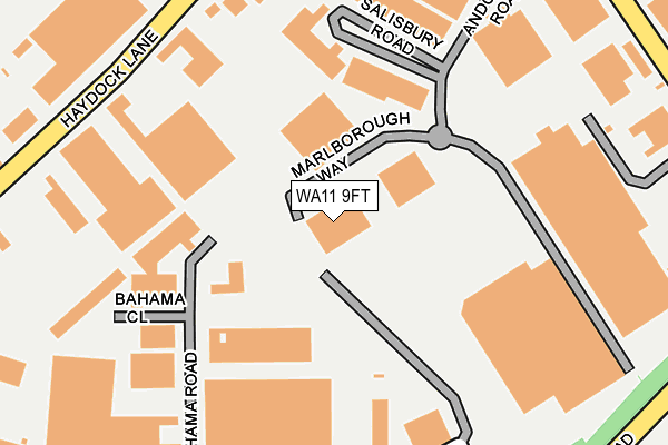
WA11 9FT is located in the Haydock electoral ward, within the metropolitan district of St. Helens and the English Parliamentary constituency of St Helens North. The Sub Integrated Care Board (ICB) Location is NHS Cheshire and Merseyside ICB - 01X and the police force is Merseyside. This postcode has been in use since June 2003.


GetTheData
Source: OS OpenMap – Local (Ordnance Survey)
Source: OS VectorMap District (Ordnance Survey)
Licence: Open Government Licence (requires attribution)
| Easting | 356097 |
| Northing | 397793 |
| Latitude | 53.475024 |
| Longitude | -2.662926 |
GetTheData
Source: Open Postcode Geo
Licence: Open Government Licence
| Country | England |
| Postcode District | WA11 |
| ➜ WA11 open data dashboard ➜ See where WA11 is on a map ➜ Where is Haydock? | |
GetTheData
Source: Land Registry Price Paid Data
Licence: Open Government Licence
Elevation or altitude of WA11 9FT as distance above sea level:
| Metres | Feet | |
|---|---|---|
| Elevation | 60m | 197ft |
Elevation is measured from the approximate centre of the postcode, to the nearest point on an OS contour line from OS Terrain 50, which has contour spacing of ten vertical metres.
➜ How high above sea level am I? Find the elevation of your current position using your device's GPS.
GetTheData
Source: Open Postcode Elevation
Licence: Open Government Licence
| Ward | Haydock |
| Constituency | St Helens North |
GetTheData
Source: ONS Postcode Database
Licence: Open Government Licence
| June 2022 | Violence and sexual offences | On or near Parking Area | 115m |
| June 2022 | Other theft | On or near Bluebell Avenue | 371m |
| June 2022 | Other theft | On or near Bluebell Avenue | 371m |
| ➜ Get more crime data in our Crime section | |||
GetTheData
Source: data.police.uk
Licence: Open Government Licence
| Andover Road (Millfield Lane) | North Florida | 347m |
| Piele Road (Millfield Lane) | North Florida | 356m |
| Andover Road (Millfield Lane) | North Florida | 379m |
| Hall Wood Avenue (Millfield Lane) | North Florida | 383m |
| Elizabeth Road | New Boston | 420m |
| Garswood Station | 1.6km |
| Bryn Station | 3km |
| Earlestown Station | 3.1km |
GetTheData
Source: NaPTAN
Licence: Open Government Licence
GetTheData
Source: ONS Postcode Database
Licence: Open Government Licence


➜ Get more ratings from the Food Standards Agency
GetTheData
Source: Food Standards Agency
Licence: FSA terms & conditions
| Last Collection | |||
|---|---|---|---|
| Location | Mon-Fri | Sat | Distance |
| North Florida Road | 18:15 | 480m | |
| North Florida Road | 18:15 | 07:15 | 481m |
| Kilbuck Lane | 18:15 | 508m | |
GetTheData
Source: Dracos
Licence: Creative Commons Attribution-ShareAlike
| Facility | Distance |
|---|---|
| Haydock Cricket Club Piele Road, Haydock, St. Helens Grass Pitches | 583m |
| Haydock English Martyrs Catholic Primary School Piele Road, Haydock, St. Helens Grass Pitches | 718m |
| St James Ce Primary Academy Lyme Street, Haydock, St. Helens Grass Pitches | 899m |
GetTheData
Source: Active Places
Licence: Open Government Licence
| School | Phase of Education | Distance |
|---|---|---|
| Haydock English Martyrs' Primary School Piele Road, Haydock, St. Helens, WA11 0JY | Primary | 711m |
| St James' Church of England Primary School Lyme Street, Haydock, St Helens, WA11 0NL | Primary | 931m |
| Outwood Academy Haydock Clipsley Lane, Haydock, St. Helens, WA11 0JG | Secondary | 1.4km |
GetTheData
Source: Edubase
Licence: Open Government Licence
The below table lists the International Territorial Level (ITL) codes (formerly Nomenclature of Territorial Units for Statistics (NUTS) codes) and Local Administrative Units (LAU) codes for WA11 9FT:
| ITL 1 Code | Name |
|---|---|
| TLD | North West (England) |
| ITL 2 Code | Name |
| TLD7 | Merseyside |
| ITL 3 Code | Name |
| TLD71 | East Merseyside |
| LAU 1 Code | Name |
| E08000013 | St. Helens |
GetTheData
Source: ONS Postcode Directory
Licence: Open Government Licence
The below table lists the Census Output Area (OA), Lower Layer Super Output Area (LSOA), and Middle Layer Super Output Area (MSOA) for WA11 9FT:
| Code | Name | |
|---|---|---|
| OA | E00034681 | |
| LSOA | E01006840 | St. Helens 005C |
| MSOA | E02001410 | St. Helens 005 |
GetTheData
Source: ONS Postcode Directory
Licence: Open Government Licence
| WA11 9UY | Haydock Lane | 331m |
| WA11 0GR | Galway Crescent | 341m |
| WA11 9TB | Millfield Lane | 355m |
| WA11 0GA | Bluebell Avenue | 363m |
| WA11 0GD | Primrose Grove | 379m |
| WA11 0GB | Peach Grove | 416m |
| WA11 0PP | Elizabeth Road | 434m |
| WA11 0PR | Elizabeth Road | 457m |
| WA11 0PS | Wycliffe Road | 461m |
| WA11 0GN | Cavan Drive | 464m |
GetTheData
Source: Open Postcode Geo; Land Registry Price Paid Data
Licence: Open Government Licence