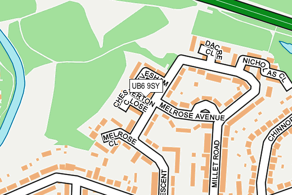
UB6 9SY lies on Marnham Crescent in Greenford. UB6 9SY is located in the Greenford Broadway electoral ward, within the London borough of Ealing and the English Parliamentary constituency of Ealing North. The Sub Integrated Care Board (ICB) Location is NHS North West London ICB - W2U3Z and the police force is Metropolitan Police. This postcode has been in use since January 1980.


GetTheData
Source: OS OpenMap – Local (Ordnance Survey)
Source: OS VectorMap District (Ordnance Survey)
Licence: Open Government Licence (requires attribution)
| Easting | 513754 |
| Northing | 183282 |
| Latitude | 51.536990 |
| Longitude | -0.361235 |
GetTheData
Source: Open Postcode Geo
Licence: Open Government Licence
| Street | Marnham Crescent |
| Town/City | Greenford |
| Country | England |
| Postcode District | UB6 |
| ➜ UB6 open data dashboard ➜ See where UB6 is on a map ➜ Where is Greenford? | |
GetTheData
Source: Land Registry Price Paid Data
Licence: Open Government Licence
Elevation or altitude of UB6 9SY as distance above sea level:
| Metres | Feet | |
|---|---|---|
| Elevation | 30m | 98ft |
Elevation is measured from the approximate centre of the postcode, to the nearest point on an OS contour line from OS Terrain 50, which has contour spacing of ten vertical metres.
➜ How high above sea level am I? Find the elevation of your current position using your device's GPS.
GetTheData
Source: Open Postcode Elevation
Licence: Open Government Licence
| Ward | Greenford Broadway |
| Constituency | Ealing North |
GetTheData
Source: ONS Postcode Database
Licence: Open Government Licence
| May 2023 | Violence and sexual offences | On or near Nicholas Close | 245m |
| May 2023 | Anti-social behaviour | On or near Nicholas Close | 245m |
| April 2023 | Anti-social behaviour | On or near Nicholas Close | 245m |
| ➜ Marnham Crescent crime map and outcomes | |||
GetTheData
Source: data.police.uk
Licence: Open Government Licence
| Marnham Crescent (Ferrymead Avenue) | Greenford | 217m |
| Marnham Crescent (Ferrymead Avenue) | Greenford | 220m |
| Ferrymead Drive (Ferrymead Avenue) | Greenford | 407m |
| West Ridge Gardens (Ferrymead Gardens) | Greenford | 415m |
| West Ridge Gardens (Ferrymead Gardens) | Greenford | 425m |
| Greenford Underground Station | Greenford | 1,216m |
| Northolt Underground Station | Northolt | 1,353m |
| Greenford Station | 1.2km |
| South Greenford Station | 1.7km |
| Northolt Park Station | 2.3km |
GetTheData
Source: NaPTAN
Licence: Open Government Licence
| Percentage of properties with Next Generation Access | 100.0% |
| Percentage of properties with Superfast Broadband | 100.0% |
| Percentage of properties with Ultrafast Broadband | 0.0% |
| Percentage of properties with Full Fibre Broadband | 0.0% |
Superfast Broadband is between 30Mbps and 300Mbps
Ultrafast Broadband is > 300Mbps
| Percentage of properties unable to receive 2Mbps | 0.0% |
| Percentage of properties unable to receive 5Mbps | 0.0% |
| Percentage of properties unable to receive 10Mbps | 0.0% |
| Percentage of properties unable to receive 30Mbps | 0.0% |
GetTheData
Source: Ofcom
Licence: Ofcom Terms of Use (requires attribution)
GetTheData
Source: ONS Postcode Database
Licence: Open Government Licence


➜ Get more ratings from the Food Standards Agency
GetTheData
Source: Food Standards Agency
Licence: FSA terms & conditions
| Last Collection | |||
|---|---|---|---|
| Location | Mon-Fri | Sat | Distance |
| Millet Road | 17:15 | 11:45 | 44m |
| Ferrymead Avenue | 17:00 | 13:00 | 226m |
| Long Drive | 16:15 | 12:15 | 422m |
GetTheData
Source: Dracos
Licence: Creative Commons Attribution-ShareAlike
| Facility | Distance |
|---|---|
| Greenford Lawn Tennis Club Ravenor Park Road, Greenford Outdoor Tennis Courts | 475m |
| Avenue Park (Greenford) Western Avenue, Greenford Grass Pitches | 515m |
| Ealing Golf Driving Range (Closed) Rowdell Road, Northolt Golf | 559m |
GetTheData
Source: Active Places
Licence: Open Government Licence
| School | Phase of Education | Distance |
|---|---|---|
| Ravenor Primary School Greenway Gardens, Greenford, UB6 9TT | Primary | 571m |
| Belvue School Rowdell Road, Northolt, UB5 6AG | Not applicable | 722m |
| The Edward Betham Church of England Primary School Oldfield Lane South, Greenford, UB6 9JU | Primary | 806m |
GetTheData
Source: Edubase
Licence: Open Government Licence
The below table lists the International Territorial Level (ITL) codes (formerly Nomenclature of Territorial Units for Statistics (NUTS) codes) and Local Administrative Units (LAU) codes for UB6 9SY:
| ITL 1 Code | Name |
|---|---|
| TLI | London |
| ITL 2 Code | Name |
| TLI7 | Outer London - West and North West |
| ITL 3 Code | Name |
| TLI73 | Ealing |
| LAU 1 Code | Name |
| E09000009 | Ealing |
GetTheData
Source: ONS Postcode Directory
Licence: Open Government Licence
The below table lists the Census Output Area (OA), Lower Layer Super Output Area (LSOA), and Middle Layer Super Output Area (MSOA) for UB6 9SY:
| Code | Name | |
|---|---|---|
| OA | E00006278 | |
| LSOA | E01001264 | Ealing 010E |
| MSOA | E02000247 | Ealing 010 |
GetTheData
Source: ONS Postcode Directory
Licence: Open Government Licence
| UB6 9TE | Chesterton Close | 52m |
| UB6 9TF | Evesham Close | 61m |
| UB6 9SZ | Marnham Crescent | 62m |
| UB6 9SX | Marnham Crescent | 76m |
| UB6 9SU | Marnham Crescent | 76m |
| UB6 9TA | Melrose Avenue | 97m |
| UB6 9TB | Melrose Avenue | 105m |
| UB6 9TD | Melrose Close | 123m |
| UB6 9SS | Marnham Crescent | 130m |
| UB6 9SL | Millet Road | 146m |
GetTheData
Source: Open Postcode Geo; Land Registry Price Paid Data
Licence: Open Government Licence