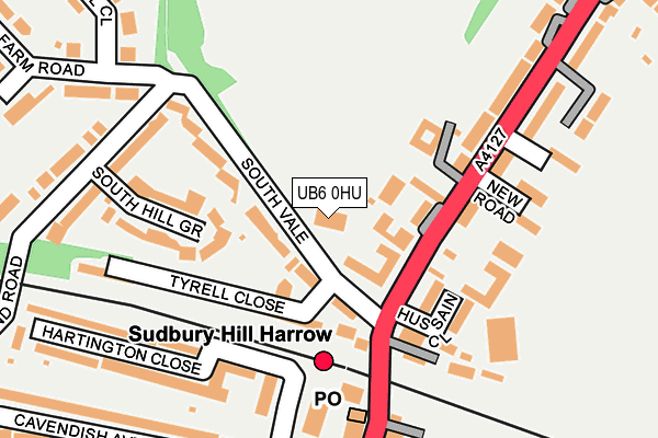
UB6 0HU is located in the Harrow on the Hill electoral ward, within the London borough of Harrow and the English Parliamentary constituency of Harrow West. The Sub Integrated Care Board (ICB) Location is NHS North West London ICB - W2U3Z and the police force is Metropolitan Police. This postcode has been in use since January 1980.


GetTheData
Source: OS OpenMap – Local (Ordnance Survey)
Source: OS VectorMap District (Ordnance Survey)
Licence: Open Government Licence (requires attribution)
| Easting | 515452 |
| Northing | 185843 |
| Latitude | 51.559662 |
| Longitude | -0.335947 |
GetTheData
Source: Open Postcode Geo
Licence: Open Government Licence
| Country | England |
| Postcode District | UB6 |
| ➜ UB6 open data dashboard ➜ See where UB6 is on a map ➜ Where is Harrow? | |
GetTheData
Source: Land Registry Price Paid Data
Licence: Open Government Licence
Elevation or altitude of UB6 0HU as distance above sea level:
| Metres | Feet | |
|---|---|---|
| Elevation | 60m | 197ft |
Elevation is measured from the approximate centre of the postcode, to the nearest point on an OS contour line from OS Terrain 50, which has contour spacing of ten vertical metres.
➜ How high above sea level am I? Find the elevation of your current position using your device's GPS.
GetTheData
Source: Open Postcode Elevation
Licence: Open Government Licence
| Ward | Harrow On The Hill |
| Constituency | Harrow West |
GetTheData
Source: ONS Postcode Database
Licence: Open Government Licence
| January 2024 | Criminal damage and arson | On or near Leabank Close | 485m |
| December 2023 | Violence and sexual offences | On or near Leabank Close | 485m |
| October 2023 | Vehicle crime | On or near Wood End Road | 429m |
| ➜ Get more crime data in our Crime section | |||
GetTheData
Source: data.police.uk
Licence: Open Government Licence
| South Vale (Greenford Road) | Sudbury Hill | 83m |
| Sudbury Hill Harrow | Sudbury Hill | 245m |
| Sudbury Hill Harrow (Greenford Road) | Sudbury Hill | 261m |
| Harrow Road (Ha1) (Greenford Road) | Sudbury Hill | 272m |
| Harrow Road (Ha1) (Greenford Road) | Sudbury Hill | 280m |
| Sudbury Hill Underground Station | Sudbury Hill | 304m |
| South Harrow Underground Station | South Harrow | 1,286m |
| Sudbury Town Underground Station | Sudbury Town | 1,712m |
| Sudbury Hill Harrow Station | 0.1km |
| Sudbury & Harrow Road Station | 1.5km |
| Northolt Park Station | 1.6km |
GetTheData
Source: NaPTAN
Licence: Open Government Licence
GetTheData
Source: ONS Postcode Database
Licence: Open Government Licence


➜ Get more ratings from the Food Standards Agency
GetTheData
Source: Food Standards Agency
Licence: FSA terms & conditions
| Last Collection | |||
|---|---|---|---|
| Location | Mon-Fri | Sat | Distance |
| Sudbury Hill Post Office | 18:15 | 12:45 | 182m |
| Woodend Road | 18:15 | 13:15 | 344m |
| South Hill Avenue | 18:15 | 13:00 | 395m |
GetTheData
Source: Dracos
Licence: Creative Commons Attribution-ShareAlike
| Facility | Distance |
|---|---|
| The Lyonian Pavilion South Vale, Harrow Grass Pitches | 0m |
| London Post Office Sports And Social Association Greenford Road, Greenford Grass Pitches | 180m |
| Harrow Cricket Club Wood End Road, Harrow Grass Pitches | 298m |
GetTheData
Source: Active Places
Licence: Open Government Licence
| School | Phase of Education | Distance |
|---|---|---|
| St George's Primary Catholic Voluntary Academy Sudbury Hill, Harrow, HA1 3SB | Primary | 475m |
| Orley Farm School South Hill Avenue, Harrow, HA1 3NU | Not applicable | 627m |
| St Dominic's Sixth Form College Mount Park Avenue, Harrow-on-the-Hill, Middlesex, HA1 3HX | 16 plus | 842m |
GetTheData
Source: Edubase
Licence: Open Government Licence
The below table lists the International Territorial Level (ITL) codes (formerly Nomenclature of Territorial Units for Statistics (NUTS) codes) and Local Administrative Units (LAU) codes for UB6 0HU:
| ITL 1 Code | Name |
|---|---|
| TLI | London |
| ITL 2 Code | Name |
| TLI7 | Outer London - West and North West |
| ITL 3 Code | Name |
| TLI74 | Harrow and Hillingdon |
| LAU 1 Code | Name |
| E09000015 | Harrow |
GetTheData
Source: ONS Postcode Directory
Licence: Open Government Licence
The below table lists the Census Output Area (OA), Lower Layer Super Output Area (LSOA), and Middle Layer Super Output Area (MSOA) for UB6 0HU:
| Code | Name | |
|---|---|---|
| OA | E00010720 | |
| LSOA | E01002135 | Harrow 029C |
| MSOA | E02000461 | Harrow 029 |
GetTheData
Source: ONS Postcode Directory
Licence: Open Government Licence
| HA1 3PL | South Vale | 69m |
| HA1 3PH | South Vale | 70m |
| HA1 3PJ | South Vale | 82m |
| HA1 3QL | Greenford Road | 115m |
| HA1 3UX | Tyrell Close | 145m |
| HA1 3TH | Hussain Close | 151m |
| HA1 3PR | South Hill Grove | 156m |
| HA1 3QY | New Road | 162m |
| HA1 3QF | Greenford Road | 170m |
| HA1 3RR | Jem Paterson Court | 176m |
GetTheData
Source: Open Postcode Geo; Land Registry Price Paid Data
Licence: Open Government Licence