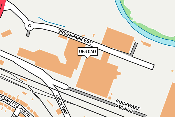
UB6 0AD is located in the Central Greenford electoral ward, within the London borough of Ealing and the English Parliamentary constituency of Ealing North. The Sub Integrated Care Board (ICB) Location is NHS North West London ICB - W2U3Z and the police force is Metropolitan Police. This postcode has been in use since June 2000.


GetTheData
Source: OS OpenMap – Local (Ordnance Survey)
Source: OS VectorMap District (Ordnance Survey)
Licence: Open Government Licence (requires attribution)
| Easting | 515342 |
| Northing | 183870 |
| Latitude | 51.541952 |
| Longitude | -0.338179 |
GetTheData
Source: Open Postcode Geo
Licence: Open Government Licence
| Country | England |
| Postcode District | UB6 |
| ➜ UB6 open data dashboard ➜ See where UB6 is on a map ➜ Where is Greenford? | |
GetTheData
Source: Land Registry Price Paid Data
Licence: Open Government Licence
Elevation or altitude of UB6 0AD as distance above sea level:
| Metres | Feet | |
|---|---|---|
| Elevation | 30m | 98ft |
Elevation is measured from the approximate centre of the postcode, to the nearest point on an OS contour line from OS Terrain 50, which has contour spacing of ten vertical metres.
➜ How high above sea level am I? Find the elevation of your current position using your device's GPS.
GetTheData
Source: Open Postcode Elevation
Licence: Open Government Licence
| Ward | Central Greenford |
| Constituency | Ealing North |
GetTheData
Source: ONS Postcode Database
Licence: Open Government Licence
| January 2024 | Vehicle crime | On or near Uneeda Drive | 478m |
| January 2024 | Violence and sexual offences | On or near Uneeda Drive | 478m |
| December 2023 | Anti-social behaviour | On or near Bennetts Avenue | 280m |
| ➜ Get more crime data in our Crime section | |||
GetTheData
Source: data.police.uk
Licence: Open Government Licence
| Westway Cross Retail Park (Green Park Way) | Sudbury Hill | 211m |
| Greenford (Rockware Avenue) | Greenford | 469m |
| Uneeda Drive (Greenford Road) | Greenford | 489m |
| Rockware Avenue Greenford Stn (Rockware Avenue) | Greenford | 503m |
| Greenford Station Rockware Avenue | Greenford | 525m |
| Greenford Underground Station | Greenford | 548m |
| Perivale Underground Station | Perivale | 1,176m |
| Greenford Station | 0.5km |
| South Greenford Station | 0.9km |
| Sudbury Hill Harrow Station | 1.8km |
GetTheData
Source: NaPTAN
Licence: Open Government Licence
GetTheData
Source: ONS Postcode Database
Licence: Open Government Licence


➜ Get more ratings from the Food Standards Agency
GetTheData
Source: Food Standards Agency
Licence: FSA terms & conditions
| Last Collection | |||
|---|---|---|---|
| Location | Mon-Fri | Sat | Distance |
| Westway Retail Park | 18:00 | 12:45 | 84m |
| Downing Drive | 16:30 | 12:15 | 497m |
| Ingram Way | 16:30 | 12:15 | 556m |
GetTheData
Source: Dracos
Licence: Creative Commons Attribution-ShareAlike
| Facility | Distance |
|---|---|
| Selborne Primary School Conway Crescent, Perivale, Greenford Grass Pitches | 564m |
| Horsendon Hill Berkeley Avenue, Greenford Grass Pitches | 614m |
| Cayton Green Park Cayton Road, Greenford Grass Pitches, Health and Fitness Gym | 618m |
GetTheData
Source: Active Places
Licence: Open Government Licence
| School | Phase of Education | Distance |
|---|---|---|
| Selborne Primary School Conway Crescent, Perivale, Greenford, UB6 8JD | Primary | 590m |
| Ealing Primary Centre 573 Greenford Road, Greenford, London, UB6 8QJ | Not applicable | 655m |
| Oldfield Primary School Oldfield Lane North, Greenford, UB6 8PR | Primary | 795m |
GetTheData
Source: Edubase
Licence: Open Government Licence
The below table lists the International Territorial Level (ITL) codes (formerly Nomenclature of Territorial Units for Statistics (NUTS) codes) and Local Administrative Units (LAU) codes for UB6 0AD:
| ITL 1 Code | Name |
|---|---|
| TLI | London |
| ITL 2 Code | Name |
| TLI7 | Outer London - West and North West |
| ITL 3 Code | Name |
| TLI73 | Ealing |
| LAU 1 Code | Name |
| E09000009 | Ealing |
GetTheData
Source: ONS Postcode Directory
Licence: Open Government Licence
The below table lists the Census Output Area (OA), Lower Layer Super Output Area (LSOA), and Middle Layer Super Output Area (MSOA) for UB6 0AD:
| Code | Name | |
|---|---|---|
| OA | E00006319 | |
| LSOA | E01001266 | Ealing 006B |
| MSOA | E02000243 | Ealing 006 |
GetTheData
Source: ONS Postcode Directory
Licence: Open Government Licence
| UB6 0AQ | Lyon Way | 261m |
| UB6 8AX | Bennetts Avenue | 274m |
| UB6 8AU | Bennetts Avenue | 305m |
| UB6 8AZ | Bennetts Avenue | 305m |
| UB6 0BN | Lyon Way | 321m |
| UB6 8AY | Bennetts Avenue | 351m |
| UB6 8QN | Greenford Road | 355m |
| UB6 8BA | Middleton Avenue | 379m |
| UB6 8BD | Downing Drive | 401m |
| UB6 8JF | Conway Crescent | 406m |
GetTheData
Source: Open Postcode Geo; Land Registry Price Paid Data
Licence: Open Government Licence