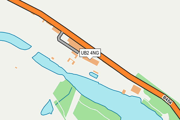
UB2 4NG is located in the Norwood Green electoral ward, within the London borough of Ealing and the English Parliamentary constituency of Ealing, Southall. The Sub Integrated Care Board (ICB) Location is NHS North West London ICB - W2U3Z and the police force is Metropolitan Police. This postcode has been in use since January 1980.


GetTheData
Source: OS OpenMap – Local (Ordnance Survey)
Source: OS VectorMap District (Ordnance Survey)
Licence: Open Government Licence (requires attribution)
| Easting | 514901 |
| Northing | 179009 |
| Latitude | 51.498352 |
| Longitude | -0.346119 |
GetTheData
Source: Open Postcode Geo
Licence: Open Government Licence
| Country | England |
| Postcode District | UB2 |
| ➜ UB2 open data dashboard ➜ See where UB2 is on a map ➜ Where is Southall? | |
GetTheData
Source: Land Registry Price Paid Data
Licence: Open Government Licence
Elevation or altitude of UB2 4NG as distance above sea level:
| Metres | Feet | |
|---|---|---|
| Elevation | 20m | 66ft |
Elevation is measured from the approximate centre of the postcode, to the nearest point on an OS contour line from OS Terrain 50, which has contour spacing of ten vertical metres.
➜ How high above sea level am I? Find the elevation of your current position using your device's GPS.
GetTheData
Source: Open Postcode Elevation
Licence: Open Government Licence
| Ward | Norwood Green |
| Constituency | Ealing, Southall |
GetTheData
Source: ONS Postcode Database
Licence: Open Government Licence
| January 2022 | Anti-social behaviour | On or near Sports/Recreation Area | 301m |
| March 2021 | Drugs | On or near Sports/Recreation Area | 139m |
| March 2021 | Criminal damage and arson | On or near Sports/Recreation Area | 301m |
| ➜ Get more crime data in our Crime section | |||
GetTheData
Source: data.police.uk
Licence: Open Government Licence
| Ealing Hospital | Hanwell | 1,045m |
| Lower Boston Road | Hanwell | 1,049m |
| Cumberland Road (W7) | Hanwell | 1,049m |
| Royal Victoria Boston Road (Boston Road) | Hanwell | 1,050m |
| Ealing Hospital | Hanwell | 1,064m |
| Boston Manor Underground Station | Boston Manor | 1,501m |
| Hanwell Station | 1.6km |
| Drayton Green Station | 2.3km |
| Syon Lane Station | 2.4km |
GetTheData
Source: NaPTAN
Licence: Open Government Licence
| Percentage of properties with Next Generation Access | 0.0% |
| Percentage of properties with Superfast Broadband | 0.0% |
| Percentage of properties with Ultrafast Broadband | 0.0% |
| Percentage of properties with Full Fibre Broadband | 0.0% |
Superfast Broadband is between 30Mbps and 300Mbps
Ultrafast Broadband is > 300Mbps
| Percentage of properties unable to receive 2Mbps | 0.0% |
| Percentage of properties unable to receive 5Mbps | 0.0% |
| Percentage of properties unable to receive 10Mbps | 100.0% |
| Percentage of properties unable to receive 30Mbps | 100.0% |
GetTheData
Source: Ofcom
Licence: Ofcom Terms of Use (requires attribution)
GetTheData
Source: ONS Postcode Database
Licence: Open Government Licence


➜ Get more ratings from the Food Standards Agency
GetTheData
Source: Food Standards Agency
Licence: FSA terms & conditions
| Last Collection | |||
|---|---|---|---|
| Location | Mon-Fri | Sat | Distance |
| Saint Mark's Road | 17:30 | 12:00 | 826m |
| Osterley Park View Road | 17:30 | 12:00 | 880m |
| St Bernards Hospital | 17:45 | 11:45 | 1,030m |
GetTheData
Source: Dracos
Licence: Creative Commons Attribution-ShareAlike
| Facility | Distance |
|---|---|
| Warren Farm Sports Centre (Closed) Windmill Lane, Southall Grass Pitches | 410m |
| Osterley Sports Ground & Osterley Cricket Club Tentelow Lane, Southall Grass Pitches, Health and Fitness Gym | 985m |
| Elthorne Park (Hanwell) Boston Road, Hanwell Outdoor Tennis Courts | 1km |
GetTheData
Source: Active Places
Licence: Open Government Licence
| School | Phase of Education | Distance |
|---|---|---|
| St Mark's Primary School Lower Boston Road, Hanwell, London, W7 2NR | Primary | 1km |
| Elthorne Park High School Westlea Road, Hanwell, London, W7 2AH | Secondary | 1.2km |
| Oaklands Primary School Oaklands Road, Hanwell, London, W7 2DP | Primary | 1.3km |
GetTheData
Source: Edubase
Licence: Open Government Licence
The below table lists the International Territorial Level (ITL) codes (formerly Nomenclature of Territorial Units for Statistics (NUTS) codes) and Local Administrative Units (LAU) codes for UB2 4NG:
| ITL 1 Code | Name |
|---|---|
| TLI | London |
| ITL 2 Code | Name |
| TLI7 | Outer London - West and North West |
| ITL 3 Code | Name |
| TLI73 | Ealing |
| LAU 1 Code | Name |
| E09000009 | Ealing |
GetTheData
Source: ONS Postcode Directory
Licence: Open Government Licence
The below table lists the Census Output Area (OA), Lower Layer Super Output Area (LSOA), and Middle Layer Super Output Area (MSOA) for UB2 4NG:
| Code | Name | |
|---|---|---|
| OA | E00006643 | |
| LSOA | E01001337 | Ealing 029D |
| MSOA | E02000266 | Ealing 029 |
GetTheData
Source: ONS Postcode Directory
Licence: Open Government Licence
| W7 2QD | Trumpers Way | 490m |
| UB2 4NE | Warren Farm Sports Centre | 500m |
| W7 2QA | Trumpers Way | 557m |
| W7 2PH | Grand Union Canal | 622m |
| UB2 4NF | Windmill Lane | 643m |
| W7 2PX | Mallard Close | 655m |
| W7 2PY | Billets Hart Close | 656m |
| W7 2QL | Jessop Place | 662m |
| W7 2QN | Dock Meadow Reach | 670m |
| W7 2PE | Green Lane | 673m |
GetTheData
Source: Open Postcode Geo; Land Registry Price Paid Data
Licence: Open Government Licence