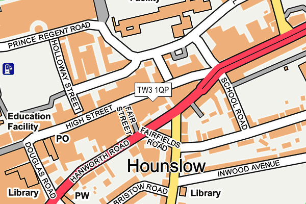
TW3 1QP is located in the Hounslow Central electoral ward, within the London borough of Hounslow and the English Parliamentary constituency of Brentford and Isleworth. The Sub Integrated Care Board (ICB) Location is NHS North West London ICB - W2U3Z and the police force is Metropolitan Police. This postcode has been in use since January 1980.


GetTheData
Source: OS OpenMap – Local (Ordnance Survey)
Source: OS VectorMap District (Ordnance Survey)
Licence: Open Government Licence (requires attribution)
| Easting | 514093 |
| Northing | 175773 |
| Latitude | 51.469431 |
| Longitude | -0.358798 |
GetTheData
Source: Open Postcode Geo
Licence: Open Government Licence
| Country | England |
| Postcode District | TW3 |
| ➜ TW3 open data dashboard ➜ See where TW3 is on a map ➜ Where is London? | |
GetTheData
Source: Land Registry Price Paid Data
Licence: Open Government Licence
Elevation or altitude of TW3 1QP as distance above sea level:
| Metres | Feet | |
|---|---|---|
| Elevation | 20m | 66ft |
Elevation is measured from the approximate centre of the postcode, to the nearest point on an OS contour line from OS Terrain 50, which has contour spacing of ten vertical metres.
➜ How high above sea level am I? Find the elevation of your current position using your device's GPS.
GetTheData
Source: Open Postcode Elevation
Licence: Open Government Licence
| Ward | Hounslow Central |
| Constituency | Brentford And Isleworth |
GetTheData
Source: ONS Postcode Database
Licence: Open Government Licence
| January 2024 | Criminal damage and arson | On or near Parking Area | 134m |
| January 2024 | Public order | On or near Parking Area | 134m |
| January 2024 | Other theft | On or near School Road | 160m |
| ➜ Get more crime data in our Crime section | |||
GetTheData
Source: data.police.uk
Licence: Open Government Licence
| Fairfields Road (Hanworth Road) | Hounslow | 52m |
| Hounslow High Street (Hanworth Road) | Hounslow | 55m |
| Fair Street (Hounslow High Street) | Hounslow | 92m |
| Douglas Road (Tw3) (Hanworth Road) | Hounslow | 167m |
| School Road (Tw3) (Kingsley Road) | Hounslow | 220m |
| Hounslow East Underground Station | Hounslow East | 450m |
| Hounslow Central Underground Station | Hounslow Central | 579m |
| Osterley Underground Station | Osterley | 1,394m |
| Hounslow Station | 0.9km |
| Isleworth Station | 1.6km |
| Whitton Station | 2.2km |
GetTheData
Source: NaPTAN
Licence: Open Government Licence
GetTheData
Source: ONS Postcode Database
Licence: Open Government Licence


➜ Get more ratings from the Food Standards Agency
GetTheData
Source: Food Standards Agency
Licence: FSA terms & conditions
| Last Collection | |||
|---|---|---|---|
| Location | Mon-Fri | Sat | Distance |
| Broadway | 18:30 | 11:15 | 31m |
| Hounslow Cfpo | 19:00 | 12:30 | 170m |
| St Stephen's Road | 17:00 | 11:15 | 177m |
GetTheData
Source: Dracos
Licence: Creative Commons Attribution-ShareAlike
| Facility | Distance |
|---|---|
| Kingsley Academy Cecil Road, Hounslow Sports Hall | 164m |
| Hounslow Town Primary School School Road, Hounslow Artificial Grass Pitch | 180m |
| Anytime Fitness (Hounslow) High Street, Hounslow Health and Fitness Gym, Studio | 188m |
GetTheData
Source: Active Places
Licence: Open Government Licence
| School | Phase of Education | Distance |
|---|---|---|
| Kingsley Academy Cecil Road, Hounslow, TW3 1AX | Secondary | 164m |
| Hounslow Town Primary School School Road, Hounslow, TW3 1QZ | Primary | 180m |
| Oak Heights Independent School 3 Red Lion Court, Hounslow, TW3 1JS | Not applicable | 317m |
GetTheData
Source: Edubase
Licence: Open Government Licence
The below table lists the International Territorial Level (ITL) codes (formerly Nomenclature of Territorial Units for Statistics (NUTS) codes) and Local Administrative Units (LAU) codes for TW3 1QP:
| ITL 1 Code | Name |
|---|---|
| TLI | London |
| ITL 2 Code | Name |
| TLI7 | Outer London - West and North West |
| ITL 3 Code | Name |
| TLI75 | Hounslow and Richmond upon Thames |
| LAU 1 Code | Name |
| E09000018 | Hounslow |
GetTheData
Source: ONS Postcode Directory
Licence: Open Government Licence
The below table lists the Census Output Area (OA), Lower Layer Super Output Area (LSOA), and Middle Layer Super Output Area (MSOA) for TW3 1QP:
| Code | Name | |
|---|---|---|
| OA | E00168886 | |
| LSOA | E01033084 | Hounslow 018G |
| MSOA | E02000543 | Hounslow 018 |
GetTheData
Source: ONS Postcode Directory
Licence: Open Government Licence
| TW3 1UE | Hanworth Road | 43m |
| TW3 1QL | High Street | 45m |
| TW3 1QT | High Street | 48m |
| TW3 1NA | High Street | 59m |
| TW3 1UY | Fairfields Road | 65m |
| TW3 1XE | Inwood Road | 83m |
| TW3 1UA | Hanworth Road | 90m |
| TW3 1NH | High Street | 95m |
| TW3 1QQ | Prince Regent Road | 107m |
| TW3 1LR | High Street | 108m |
GetTheData
Source: Open Postcode Geo; Land Registry Price Paid Data
Licence: Open Government Licence