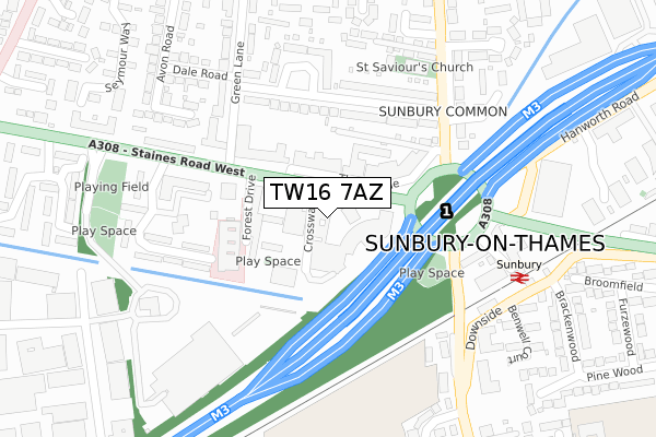
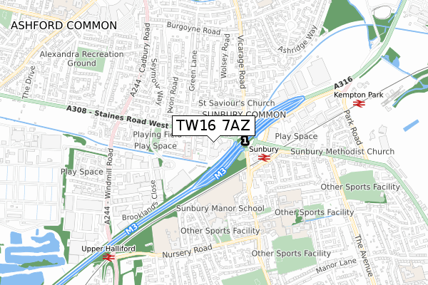
TW16 7AZ is located in the Sunbury Common electoral ward, within the local authority district of Spelthorne and the English Parliamentary constituency of Spelthorne. The Sub Integrated Care Board (ICB) Location is NHS Surrey Heartlands ICB - 92A and the police force is Surrey. This postcode has been in use since January 1980.


GetTheData
Source: OS Open Zoomstack (Ordnance Survey)
Licence: Open Government Licence (requires attribution)
Attribution: Contains OS data © Crown copyright and database right 2024
Source: Open Postcode Geo
Licence: Open Government Licence (requires attribution)
Attribution: Contains OS data © Crown copyright and database right 2024; Contains Royal Mail data © Royal Mail copyright and database right 2024; Source: Office for National Statistics licensed under the Open Government Licence v.3.0
| Easting | 509877 |
| Northing | 170088 |
| Latitude | 51.419168 |
| Longitude | -0.421212 |
GetTheData
Source: Open Postcode Geo
Licence: Open Government Licence
| Country | England |
| Postcode District | TW16 |
| ➜ TW16 open data dashboard ➜ See where TW16 is on a map ➜ Where is Sunbury-on-Thames? | |
GetTheData
Source: Land Registry Price Paid Data
Licence: Open Government Licence
Elevation or altitude of TW16 7AZ as distance above sea level:
| Metres | Feet | |
|---|---|---|
| Elevation | 20m | 66ft |
Elevation is measured from the approximate centre of the postcode, to the nearest point on an OS contour line from OS Terrain 50, which has contour spacing of ten vertical metres.
➜ How high above sea level am I? Find the elevation of your current position using your device's GPS.
GetTheData
Source: Open Postcode Elevation
Licence: Open Government Licence
| Ward | Sunbury Common |
| Constituency | Spelthorne |
GetTheData
Source: ONS Postcode Database
Licence: Open Government Licence
| October 2023 | Violence and sexual offences | On or near Percy Bryant Road | 447m |
| August 2023 | Violence and sexual offences | On or near Percy Bryant Road | 447m |
| July 2023 | Public order | On or near Percy Bryant Road | 447m |
| ➜ Get more crime data in our Crime section | |||
GetTheData
Source: data.police.uk
Licence: Open Government Licence
| Sunbury Cross Shopping Centre (Staines Road West) | Sunbury | 25m |
| Sunbury Cross Shopping Centre (Staines Road West) | Sunbury | 43m |
| Green Street | Sunbury | 172m |
| Green Street | Sunbury | 191m |
| Sunbury Cross (Vicarage Road) | Sunbury | 223m |
| Sunbury Station | 0.3km |
| Kempton Park Station | 0.8km |
| Upper Halliford Station | 1km |
GetTheData
Source: NaPTAN
Licence: Open Government Licence
| Median download speed | 15.1Mbps |
| Average download speed | 29.8Mbps |
| Maximum download speed | 80.00Mbps |
| Median upload speed | 1.0Mbps |
| Average upload speed | 5.6Mbps |
| Maximum upload speed | 20.00Mbps |
GetTheData
Source: Ofcom
Licence: Ofcom Terms of Use (requires attribution)
GetTheData
Source: ONS Postcode Database
Licence: Open Government Licence


➜ Get more ratings from the Food Standards Agency
GetTheData
Source: Food Standards Agency
Licence: FSA terms & conditions
| Last Collection | |||
|---|---|---|---|
| Location | Mon-Fri | Sat | Distance |
| P.o. 25 Staines Road West | 18:30 | 12:15 | 73m |
| St Ignatius School, The Riding | 17:00 | 11:45 | 542m |
| Pinewood / Staines Road East | 17:00 | 11:30 | 580m |
GetTheData
Source: Dracos
Licence: Creative Commons Attribution-ShareAlike
| Facility | Distance |
|---|---|
| The Gym Group (London Sunbury) Sunbury Cross Centre, Staines Road West, Sunbury-on-thames Health and Fitness Gym | 28m |
| Sunbury Leisure Centre Nursery Road, Sunbury-on-thames Sports Hall, Swimming Pool, Health and Fitness Gym, Studio | 484m |
| Springfield Primary School Nursery Road, Sunbury-on-thames Grass Pitches | 651m |
GetTheData
Source: Active Places
Licence: Open Government Licence
| School | Phase of Education | Distance |
|---|---|---|
| Sunbury Manor School Nursery Road, Sunbury-on-Thames, TW16 6LF | Secondary | 491m |
| St Ignatius Catholic Primary School Green Street, Sunbury on Thames, TW16 6QG | Primary | 552m |
| Springfield Primary School Nursery Road, Sunbury-on-Thames, TW16 6LY | Primary | 651m |
GetTheData
Source: Edubase
Licence: Open Government Licence
The below table lists the International Territorial Level (ITL) codes (formerly Nomenclature of Territorial Units for Statistics (NUTS) codes) and Local Administrative Units (LAU) codes for TW16 7AZ:
| ITL 1 Code | Name |
|---|---|
| TLJ | South East (England) |
| ITL 2 Code | Name |
| TLJ2 | Surrey, East and West Sussex |
| ITL 3 Code | Name |
| TLJ25 | West Surrey |
| LAU 1 Code | Name |
| E07000213 | Spelthorne |
GetTheData
Source: ONS Postcode Directory
Licence: Open Government Licence
The below table lists the Census Output Area (OA), Lower Layer Super Output Area (LSOA), and Middle Layer Super Output Area (MSOA) for TW16 7AZ:
| Code | Name | |
|---|---|---|
| OA | E00156806 | |
| LSOA | E01030751 | Spelthorne 008D |
| MSOA | E02006410 | Spelthorne 008 |
GetTheData
Source: ONS Postcode Directory
Licence: Open Government Licence
| TW16 7BE | Staines Road West | 8m |
| TW16 7BD | Staines Road West | 50m |
| TW16 7BB | Sunbury Cross Centre | 74m |
| TW16 7AH | Staines Road West | 87m |
| TW16 7AU | Staines Road West | 87m |
| TW16 7AB | Staines Road West | 91m |
| TW16 7AT | Staines Road West | 94m |
| TW16 7SP | Heathcroft Avenue | 150m |
| TW16 7SR | Heathcroft Avenue | 187m |
| TW16 7TL | Heathcroft Avenue | 193m |
GetTheData
Source: Open Postcode Geo; Land Registry Price Paid Data
Licence: Open Government Licence