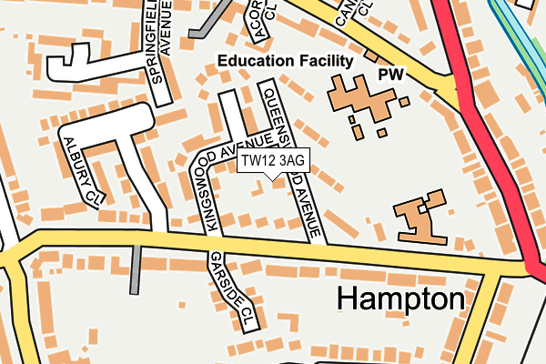
TW12 3AG is located in the Hampton North electoral ward, within the London borough of Richmond upon Thames and the English Parliamentary constituency of Twickenham. The Sub Integrated Care Board (ICB) Location is NHS South West London ICB - 36L and the police force is Metropolitan Police. This postcode has been in use since July 1990.


GetTheData
Source: OS OpenMap – Local (Ordnance Survey)
Source: OS VectorMap District (Ordnance Survey)
Licence: Open Government Licence (requires attribution)
| Easting | 513702 |
| Northing | 170671 |
| Latitude | 51.423654 |
| Longitude | -0.366062 |
GetTheData
Source: Open Postcode Geo
Licence: Open Government Licence
| Country | England |
| Postcode District | TW12 |
| ➜ TW12 open data dashboard ➜ See where TW12 is on a map ➜ Where is Hampton? | |
GetTheData
Source: Land Registry Price Paid Data
Licence: Open Government Licence
Elevation or altitude of TW12 3AG as distance above sea level:
| Metres | Feet | |
|---|---|---|
| Elevation | 20m | 66ft |
Elevation is measured from the approximate centre of the postcode, to the nearest point on an OS contour line from OS Terrain 50, which has contour spacing of ten vertical metres.
➜ How high above sea level am I? Find the elevation of your current position using your device's GPS.
GetTheData
Source: Open Postcode Elevation
Licence: Open Government Licence
| Ward | Hampton North |
| Constituency | Twickenham |
GetTheData
Source: ONS Postcode Database
Licence: Open Government Licence
| June 2022 | Public order | On or near Cannon Close | 221m |
| June 2022 | Public order | On or near Cannon Close | 221m |
| June 2022 | Violence and sexual offences | On or near Cannon Close | 221m |
| ➜ Get more crime data in our Crime section | |||
GetTheData
Source: data.police.uk
Licence: Open Government Licence
| Albury Close (Broad Lane) | Hampton | 108m |
| Carlisle School (Broad Lane) | Hampton | 156m |
| Albury Close (Broad Lane) | Hampton | 203m |
| Carlisle School (Broad Lane) | Hampton | 223m |
| Hanworth Road (Uxbridge Road) | Hampton Hill | 235m |
| Hampton (London) Station | 1km |
| Fulwell Station | 1.6km |
| Teddington Station | 2.3km |
GetTheData
Source: NaPTAN
Licence: Open Government Licence
| Percentage of properties with Next Generation Access | 100.0% |
| Percentage of properties with Superfast Broadband | 100.0% |
| Percentage of properties with Ultrafast Broadband | 100.0% |
| Percentage of properties with Full Fibre Broadband | 0.0% |
Superfast Broadband is between 30Mbps and 300Mbps
Ultrafast Broadband is > 300Mbps
| Percentage of properties unable to receive 2Mbps | 0.0% |
| Percentage of properties unable to receive 5Mbps | 0.0% |
| Percentage of properties unable to receive 10Mbps | 0.0% |
| Percentage of properties unable to receive 30Mbps | 0.0% |
GetTheData
Source: Ofcom
Licence: Ofcom Terms of Use (requires attribution)
GetTheData
Source: ONS Postcode Database
Licence: Open Government Licence

➜ Get more ratings from the Food Standards Agency
GetTheData
Source: Food Standards Agency
Licence: FSA terms & conditions
| Last Collection | |||
|---|---|---|---|
| Location | Mon-Fri | Sat | Distance |
| 15 Hanworth Road | 17:30 | 12:15 | 185m |
| Gloucester Road | 17:30 | 12:00 | 256m |
| Nightingale Road | 17:30 | 12:15 | 298m |
GetTheData
Source: Dracos
Licence: Creative Commons Attribution-ShareAlike
| Facility | Distance |
|---|---|
| Clarendon School Hanworth Road, Hampton Grass Pitches, Sports Hall | 134m |
| Carlisle Park Carlisle Road, Hampton Grass Pitches, Outdoor Tennis Courts | 212m |
| Lady Eleanor Holles School Hanworth Road, Hampton Sports Hall, Swimming Pool, Grass Pitches, Outdoor Tennis Courts | 473m |
GetTheData
Source: Active Places
Licence: Open Government Licence
| School | Phase of Education | Distance |
|---|---|---|
| Carlisle Infant School Broad Lane, Hampton, TW12 3AJ | Primary | 177m |
| Jack and Jill School 30 Nightingale Road, Hampton, TW12 3HX | Not applicable | 386m |
| Lady Eleanor Holles School Hanworth Road, Hampton, TW12 3HF | Not applicable | 508m |
GetTheData
Source: Edubase
Licence: Open Government Licence
The below table lists the International Territorial Level (ITL) codes (formerly Nomenclature of Territorial Units for Statistics (NUTS) codes) and Local Administrative Units (LAU) codes for TW12 3AG:
| ITL 1 Code | Name |
|---|---|
| TLI | London |
| ITL 2 Code | Name |
| TLI7 | Outer London - West and North West |
| ITL 3 Code | Name |
| TLI75 | Hounslow and Richmond upon Thames |
| LAU 1 Code | Name |
| E09000027 | Richmond upon Thames |
GetTheData
Source: ONS Postcode Directory
Licence: Open Government Licence
The below table lists the Census Output Area (OA), Lower Layer Super Output Area (LSOA), and Middle Layer Super Output Area (MSOA) for TW12 3AG:
| Code | Name | |
|---|---|---|
| OA | E00019263 | |
| LSOA | E01003830 | Richmond upon Thames 020C |
| MSOA | E02000803 | Richmond upon Thames 020 |
GetTheData
Source: ONS Postcode Directory
Licence: Open Government Licence
| TW12 3AR | Queenswood Avenue | 52m |
| TW12 3AW | Broad Lane | 55m |
| TW12 3AS | Queenswood Avenue | 67m |
| TW12 3AP | Queenswood Avenue | 84m |
| TW12 3AU | Kingswood Avenue | 88m |
| TW12 3AT | Queenswood Avenue | 109m |
| TW12 3AL | Broad Lane | 139m |
| TW12 3AN | Garside Close | 150m |
| TW12 3AX | Broad Lane | 169m |
| TW12 3DT | Springfield Avenue | 174m |
GetTheData
Source: Open Postcode Geo; Land Registry Price Paid Data
Licence: Open Government Licence