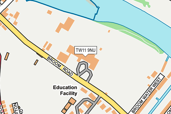
TW11 9NU is located in the Hampton Wick & South Teddington electoral ward, within the London borough of Richmond upon Thames and the English Parliamentary constituency of Twickenham. The Sub Integrated Care Board (ICB) Location is NHS South West London ICB - 36L and the police force is Metropolitan Police. This postcode has been in use since January 1980.


GetTheData
Source: OS OpenMap – Local (Ordnance Survey)
Source: OS VectorMap District (Ordnance Survey)
Licence: Open Government Licence (requires attribution)
| Easting | 516967 |
| Northing | 171221 |
| Latitude | 51.427933 |
| Longitude | -0.318943 |
GetTheData
Source: Open Postcode Geo
Licence: Open Government Licence
| Country | England |
| Postcode District | TW11 |
➜ See where TW11 is on a map ➜ Where is Teddington? | |
GetTheData
Source: Land Registry Price Paid Data
Licence: Open Government Licence
Elevation or altitude of TW11 9NU as distance above sea level:
| Metres | Feet | |
|---|---|---|
| Elevation | 10m | 33ft |
Elevation is measured from the approximate centre of the postcode, to the nearest point on an OS contour line from OS Terrain 50, which has contour spacing of ten vertical metres.
➜ How high above sea level am I? Find the elevation of your current position using your device's GPS.
GetTheData
Source: Open Postcode Elevation
Licence: Open Government Licence
| Ward | Hampton Wick & South Teddington |
| Constituency | Twickenham |
GetTheData
Source: ONS Postcode Database
Licence: Open Government Licence
| Marston Road (Kingston Road) | Teddington | 337m |
| Marston Road (Kingston Road) | Teddington | 348m |
| Teddington Lock (Kingston Road) | Teddington | 359m |
| Teddington Lock (Ferry Road) | Teddington | 407m |
| Teddington Lock (Ferry Road) | Teddington | 440m |
| Teddington Station | 1km |
| Hampton Wick Station | 1.6km |
| Strawberry Hill Station | 1.9km |
GetTheData
Source: NaPTAN
Licence: Open Government Licence
GetTheData
Source: ONS Postcode Database
Licence: Open Government Licence


➜ Get more ratings from the Food Standards Agency
GetTheData
Source: Food Standards Agency
Licence: FSA terms & conditions
| Last Collection | |||
|---|---|---|---|
| Location | Mon-Fri | Sat | Distance |
| St Winifred's Road | 17:30 | 11:45 | 270m |
| Ferry Road | 17:30 | 11:45 | 380m |
| Langham Road | 17:30 | 11:45 | 472m |
GetTheData
Source: Dracos
Licence: Creative Commons Attribution-ShareAlike
| Risk of TW11 9NU flooding from rivers and sea | Medium |
| ➜ TW11 9NU flood map | |
GetTheData
Source: Open Flood Risk by Postcode
Licence: Open Government Licence
The below table lists the International Territorial Level (ITL) codes (formerly Nomenclature of Territorial Units for Statistics (NUTS) codes) and Local Administrative Units (LAU) codes for TW11 9NU:
| ITL 1 Code | Name |
|---|---|
| TLI | London |
| ITL 2 Code | Name |
| TLI7 | Outer London - West and North West |
| ITL 3 Code | Name |
| TLI75 | Hounslow and Richmond upon Thames |
| LAU 1 Code | Name |
| E09000027 | Richmond upon Thames |
GetTheData
Source: ONS Postcode Directory
Licence: Open Government Licence
The below table lists the Census Output Area (OA), Lower Layer Super Output Area (LSOA), and Middle Layer Super Output Area (MSOA) for TW11 9NU:
| Code | Name | |
|---|---|---|
| OA | E00019282 | |
| LSOA | E01003835 | Richmond upon Thames 022B |
| MSOA | E02000805 | Richmond upon Thames 022 |
GetTheData
Source: ONS Postcode Directory
Licence: Open Government Licence
| TW11 9NX | Broom Road | 122m |
| TW11 9NS | Broom Road | 181m |
| TW11 9NW | Broom Road | 182m |
| TW11 9NL | Rivermead Close | 192m |
| TW11 9NP | Broom Road | 202m |
| TW11 9NR | Broom Road | 249m |
| TW11 9JT | St Winifreds Road | 260m |
| TW11 9QH | Broom Water West | 269m |
| TW11 9NY | Broom Road | 278m |
| TW11 9JU | Marston Road | 325m |
GetTheData
Source: Open Postcode Geo; Land Registry Price Paid Data
Licence: Open Government Licence