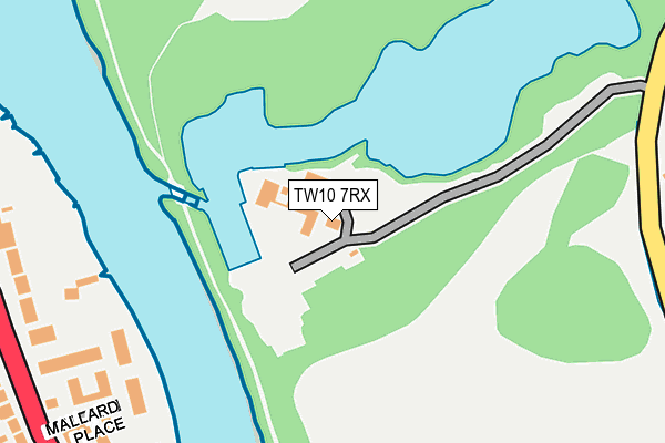
TW10 7RX is located in the Ham, Petersham & Richmond Riverside electoral ward, within the London borough of Richmond upon Thames and the English Parliamentary constituency of Richmond Park. The Sub Integrated Care Board (ICB) Location is NHS South West London ICB - 36L and the police force is Metropolitan Police. This postcode has been in use since January 1980.


GetTheData
Source: OS OpenMap – Local (Ordnance Survey)
Source: OS VectorMap District (Ordnance Survey)
Licence: Open Government Licence (requires attribution)
| Easting | 516397 |
| Northing | 172304 |
| Latitude | 51.437784 |
| Longitude | -0.326783 |
GetTheData
Source: Open Postcode Geo
Licence: Open Government Licence
| Country | England |
| Postcode District | TW10 |
| ➜ TW10 open data dashboard ➜ See where TW10 is on a map ➜ Where is London? | |
GetTheData
Source: Land Registry Price Paid Data
Licence: Open Government Licence
Elevation or altitude of TW10 7RX as distance above sea level:
| Metres | Feet | |
|---|---|---|
| Elevation | 10m | 33ft |
Elevation is measured from the approximate centre of the postcode, to the nearest point on an OS contour line from OS Terrain 50, which has contour spacing of ten vertical metres.
➜ How high above sea level am I? Find the elevation of your current position using your device's GPS.
GetTheData
Source: Open Postcode Elevation
Licence: Open Government Licence
| Ward | Ham, Petersham & Richmond Riverside |
| Constituency | Richmond Park |
GetTheData
Source: ONS Postcode Database
Licence: Open Government Licence
| June 2022 | Theft from the person | On or near Mallard Place | 288m |
| June 2022 | Violence and sexual offences | On or near Strawberry Vale | 318m |
| June 2022 | Violence and sexual offences | On or near Strawberry Vale | 318m |
| ➜ Get more crime data in our Crime section | |||
GetTheData
Source: data.police.uk
Licence: Open Government Licence
| Mallard Place (Strawberry Vale) | Strawberry Hill | 296m |
| Mallard Place | Strawberry Hill | 308m |
| Michelham Gardens (Strawberry Vale) | Strawberry Hill | 361m |
| Michelham Gardens (Strawberry Vale) | Strawberry Hill | 417m |
| Strawberry Vale (Tw1) | Strawberry Hill | 505m |
| Strawberry Hill Station | 0.9km |
| Twickenham Station | 1.4km |
| Teddington Station | 1.5km |
GetTheData
Source: NaPTAN
Licence: Open Government Licence
GetTheData
Source: ONS Postcode Database
Licence: Open Government Licence


➜ Get more ratings from the Food Standards Agency
GetTheData
Source: Food Standards Agency
Licence: FSA terms & conditions
| Last Collection | |||
|---|---|---|---|
| Location | Mon-Fri | Sat | Distance |
| Waldegrave Park | 18:30 | 11:15 | 151m |
| Michelham Gardens | 18:30 | 11:15 | 353m |
| Ferrymoor, Ham | 17:15 | 11:00 | 457m |
GetTheData
Source: Dracos
Licence: Creative Commons Attribution-ShareAlike
| Facility | Distance |
|---|---|
| Richmond Baseball Club Ham Fields, Richmond Grass Pitches | 537m |
| Ham Playing Fields Ham Fields, Richmond Grass Pitches, Artificial Grass Pitch | 555m |
| Radnor House Twickenham Cross Deep, Twickenham Outdoor Tennis Courts | 569m |
GetTheData
Source: Active Places
Licence: Open Government Licence
| School | Phase of Education | Distance |
|---|---|---|
| St Richard's Church of England Primary School Ashburnham Road, Ham, Richmond, TW10 7NL | Primary | 541m |
| Radnor House Pope's Villa, Cross Deep, Twickenham, TW1 4QG | Not applicable | 586m |
| St Mary's University, Twickenham Waldegrave Road, Strawberry Hill, Twickenham, TW1 4SX | Not applicable | 594m |
GetTheData
Source: Edubase
Licence: Open Government Licence
The below table lists the International Territorial Level (ITL) codes (formerly Nomenclature of Territorial Units for Statistics (NUTS) codes) and Local Administrative Units (LAU) codes for TW10 7RX:
| ITL 1 Code | Name |
|---|---|
| TLI | London |
| ITL 2 Code | Name |
| TLI7 | Outer London - West and North West |
| ITL 3 Code | Name |
| TLI75 | Hounslow and Richmond upon Thames |
| LAU 1 Code | Name |
| E09000027 | Richmond upon Thames |
GetTheData
Source: ONS Postcode Directory
Licence: Open Government Licence
The below table lists the Census Output Area (OA), Lower Layer Super Output Area (LSOA), and Middle Layer Super Output Area (MSOA) for TW10 7RX:
| Code | Name | |
|---|---|---|
| OA | E00019200 | |
| LSOA | E01003819 | Richmond upon Thames 017B |
| MSOA | E02000800 | Richmond upon Thames 017 |
GetTheData
Source: ONS Postcode Directory
Licence: Open Government Licence
| TW1 4SW | Mallard Place | 252m |
| TW1 4SR | Mallard Place | 291m |
| TW1 4RX | Strawberry Vale | 299m |
| TW10 7SF | Breamwater Gardens | 328m |
| TW1 4SJ | Strawberry Vale | 336m |
| TW1 4SE | Strawberry Vale | 340m |
| TW10 7SG | Breamwater Gardens | 350m |
| TW10 7SH | Breamwater Gardens | 360m |
| TW1 4SF | Vale Close | 370m |
| TW1 4RU | Strawberry Vale | 371m |
GetTheData
Source: Open Postcode Geo; Land Registry Price Paid Data
Licence: Open Government Licence