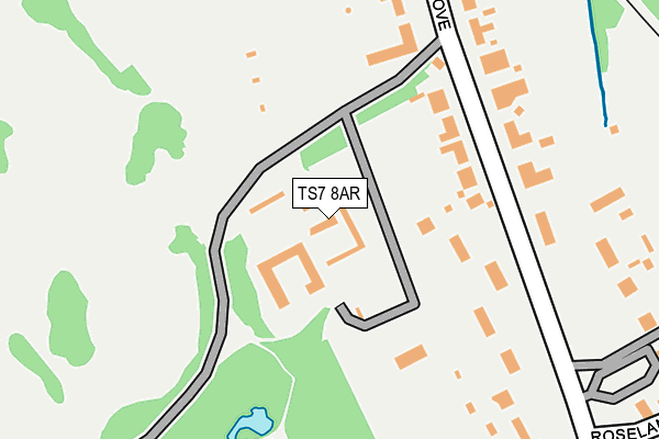
TS7 8AR is located in the Marton East electoral ward, within the unitary authority of Middlesbrough and the English Parliamentary constituency of Middlesbrough South and East Cleveland. The Sub Integrated Care Board (ICB) Location is NHS North East and North Cumbria ICB - 16C and the police force is Cleveland. This postcode has been in use since January 1980.


GetTheData
Source: OS OpenMap – Local (Ordnance Survey)
Source: OS VectorMap District (Ordnance Survey)
Licence: Open Government Licence (requires attribution)
| Easting | 451883 |
| Northing | 516412 |
| Latitude | 54.540335 |
| Longitude | -1.199613 |
GetTheData
Source: Open Postcode Geo
Licence: Open Government Licence
| Country | England |
| Postcode District | TS7 |
| ➜ TS7 open data dashboard ➜ See where TS7 is on a map ➜ Where is Middlesbrough? | |
GetTheData
Source: Land Registry Price Paid Data
Licence: Open Government Licence
Elevation or altitude of TS7 8AR as distance above sea level:
| Metres | Feet | |
|---|---|---|
| Elevation | 40m | 131ft |
Elevation is measured from the approximate centre of the postcode, to the nearest point on an OS contour line from OS Terrain 50, which has contour spacing of ten vertical metres.
➜ How high above sea level am I? Find the elevation of your current position using your device's GPS.
GetTheData
Source: Open Postcode Elevation
Licence: Open Government Licence
| Ward | Marton East |
| Constituency | Middlesbrough South And East Cleveland |
GetTheData
Source: ONS Postcode Database
Licence: Open Government Licence
| January 2024 | Anti-social behaviour | On or near Stewart Park | 319m |
| October 2023 | Anti-social behaviour | On or near Stewart Park | 319m |
| July 2023 | Anti-social behaviour | On or near Stewart Park | 319m |
| ➜ Get more crime data in our Crime section | |||
GetTheData
Source: data.police.uk
Licence: Open Government Licence
| The Ladle (Ladgate Lane) | Marton | 417m |
| Marton Station (Ladgate Lane) | Marton | 440m |
| Marton Station (Ladgate Lane) | Marton | 446m |
| Crossroads (Ladgate Lane) | Marton | 539m |
| Gainsborough Road (Stokesley Road) | Marton | 589m |
| Marton Station | 0.5km |
| James Cook University Hospital Station | 1.4km |
| Gypsy Lane Station | 1.5km |
GetTheData
Source: NaPTAN
Licence: Open Government Licence
GetTheData
Source: ONS Postcode Database
Licence: Open Government Licence


➜ Get more ratings from the Food Standards Agency
GetTheData
Source: Food Standards Agency
Licence: FSA terms & conditions
| Last Collection | |||
|---|---|---|---|
| Location | Mon-Fri | Sat | Distance |
| Ormesby Bank | 17:15 | 11:15 | 1,805m |
| Coulby Farm Way | 17:00 | 09:45 | 1,812m |
| Norfolk Place Post Office | 17:00 | 11:45 | 2,359m |
GetTheData
Source: Dracos
Licence: Creative Commons Attribution-ShareAlike
| Facility | Distance |
|---|---|
| Tennis World Alan Peacock Way, Middlesbrough Indoor Tennis Centre, Outdoor Tennis Courts | 670m |
| Prissick (Closed) Prissick School Base, Marton Road, Middlesbrough Grass Pitches | 686m |
| Middlesbrough Sports Village Alan Peacock Way, Middlesbrough Athletics, Artificial Grass Pitch, Health and Fitness Gym, Sports Hall, Grass Pitches, Cycling, Studio | 831m |
GetTheData
Source: Active Places
Licence: Open Government Licence
| School | Phase of Education | Distance |
|---|---|---|
| Captain Cook Primary School Stokesley Road, Marton, TS7 8DU | Primary | 938m |
| Marton Manor Primary School The Derby, Marton Manor, Middlesbrough, TS7 8RH | Primary | 984m |
| Park End Primary School Overdale Road, Park End, Middlesbrough, TS3 0AA | Primary | 1.1km |
GetTheData
Source: Edubase
Licence: Open Government Licence
The below table lists the International Territorial Level (ITL) codes (formerly Nomenclature of Territorial Units for Statistics (NUTS) codes) and Local Administrative Units (LAU) codes for TS7 8AR:
| ITL 1 Code | Name |
|---|---|
| TLC | North East (England) |
| ITL 2 Code | Name |
| TLC1 | Tees Valley and Durham |
| ITL 3 Code | Name |
| TLC12 | South Teesside |
| LAU 1 Code | Name |
| E06000002 | Middlesbrough |
GetTheData
Source: ONS Postcode Directory
Licence: Open Government Licence
The below table lists the Census Output Area (OA), Lower Layer Super Output Area (LSOA), and Middle Layer Super Output Area (MSOA) for TS7 8AR:
| Code | Name | |
|---|---|---|
| OA | E00060840 | |
| LSOA | E01012064 | Middlesbrough 020C |
| MSOA | E02006811 | Middlesbrough 020 |
GetTheData
Source: ONS Postcode Directory
Licence: Open Government Licence
| TS7 8AJ | The Grove | 122m |
| TS7 8AL | The Grove | 187m |
| TS7 8AP | The Grove | 255m |
| TS7 8AN | The Grove | 309m |
| TS7 8AG | The Grove | 333m |
| TS7 8AQ | Roseland Drive | 350m |
| TS7 8AF | The Grove | 404m |
| TS7 8AH | Roseland Crescent | 435m |
| TS4 3SL | The Ladle | 500m |
| TS7 8AA | The Grove | 532m |
GetTheData
Source: Open Postcode Geo; Land Registry Price Paid Data
Licence: Open Government Licence