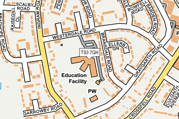
TS3 7QH is located in the Berwick Hills & Pallister electoral ward, within the unitary authority of Middlesbrough and the English Parliamentary constituency of Middlesbrough. The Sub Integrated Care Board (ICB) Location is NHS North East and North Cumbria ICB - 16C and the police force is Cleveland. This postcode has been in use since January 1980.


GetTheData
Source: OS OpenMap – Local (Ordnance Survey)
Source: OS VectorMap District (Ordnance Survey)
Licence: Open Government Licence (requires attribution)
| Easting | 451213 |
| Northing | 518655 |
| Latitude | 54.560546 |
| Longitude | -1.209564 |
GetTheData
Source: Open Postcode Geo
Licence: Open Government Licence
| Country | England |
| Postcode District | TS3 |
| ➜ TS3 open data dashboard ➜ See where TS3 is on a map ➜ Where is Middlesbrough? | |
GetTheData
Source: Land Registry Price Paid Data
Licence: Open Government Licence
Elevation or altitude of TS3 7QH as distance above sea level:
| Metres | Feet | |
|---|---|---|
| Elevation | 10m | 33ft |
Elevation is measured from the approximate centre of the postcode, to the nearest point on an OS contour line from OS Terrain 50, which has contour spacing of ten vertical metres.
➜ How high above sea level am I? Find the elevation of your current position using your device's GPS.
GetTheData
Source: Open Postcode Elevation
Licence: Open Government Licence
| Ward | Berwick Hills & Pallister |
| Constituency | Middlesbrough |
GetTheData
Source: ONS Postcode Database
Licence: Open Government Licence
| January 2024 | Anti-social behaviour | On or near Norfolk Place Shops | 348m |
| January 2024 | Anti-social behaviour | On or near Norfolk Place Shops | 348m |
| January 2024 | Bicycle theft | On or near Norfolk Place Shops | 348m |
| ➜ Get more crime data in our Crime section | |||
GetTheData
Source: data.police.uk
Licence: Open Government Licence
| Newcastle House (Ingram Road) | Berwick Hills | 142m |
| Newcastle House (Ingram Road) | Berwick Hills | 167m |
| Crossfell Road (Ingram Road) | Berwick Hills | 237m |
| Chevin Walk (Crossfell Road) | Berwick Hills | 249m |
| Greenhow Road (Ingram Road) | Berwick Hills | 303m |
| James Cook University Hospital Station | 0.9km |
| Marton Station | 1.9km |
| Middlesbrough Station | 2.6km |
GetTheData
Source: NaPTAN
Licence: Open Government Licence
GetTheData
Source: ONS Postcode Database
Licence: Open Government Licence


➜ Get more ratings from the Food Standards Agency
GetTheData
Source: Food Standards Agency
Licence: FSA terms & conditions
| Last Collection | |||
|---|---|---|---|
| Location | Mon-Fri | Sat | Distance |
| Norfolk Place Post Office | 17:00 | 11:45 | 280m |
| North Ormesby Post Office | 18:00 | 12:15 | 1,240m |
| Victoria Road | 17:15 | 12:45 | 1,579m |
GetTheData
Source: Dracos
Licence: Creative Commons Attribution-ShareAlike
| Facility | Distance |
|---|---|
| Neptune Centre Ormesby Road, Middlesbrough Swimming Pool, Health and Fitness Gym, Studio | 315m |
| Old Vicarage Field Ormesby Road, Middlesbrough Grass Pitches | 384m |
| Pallister Park Ormesby Road, Middlesbrough Grass Pitches, Artificial Grass Pitch, Outdoor Tennis Courts | 576m |
GetTheData
Source: Active Places
Licence: Open Government Licence
| School | Phase of Education | Distance |
|---|---|---|
| Berwick Hills Primary School Westerdale Road, Middlesbrough, TS3 7QH | Primary | 46m |
| Pallister Park Primary School Gribdale Road, Pallister Park, Middlesbrough, TS3 8PW | Primary | 628m |
| St Pius X Catholic Primary School, a Catholic Voluntary Academy Amersham Road, Park End, Middlesbrough, TS3 7HD | Primary | 749m |
GetTheData
Source: Edubase
Licence: Open Government Licence
The below table lists the International Territorial Level (ITL) codes (formerly Nomenclature of Territorial Units for Statistics (NUTS) codes) and Local Administrative Units (LAU) codes for TS3 7QH:
| ITL 1 Code | Name |
|---|---|
| TLC | North East (England) |
| ITL 2 Code | Name |
| TLC1 | Tees Valley and Durham |
| ITL 3 Code | Name |
| TLC12 | South Teesside |
| LAU 1 Code | Name |
| E06000002 | Middlesbrough |
GetTheData
Source: ONS Postcode Directory
Licence: Open Government Licence
The below table lists the Census Output Area (OA), Lower Layer Super Output Area (LSOA), and Middle Layer Super Output Area (MSOA) for TS3 7QH:
| Code | Name | |
|---|---|---|
| OA | E00060903 | |
| LSOA | E01012074 | Middlesbrough 004A |
| MSOA | E02002499 | Middlesbrough 004 |
GetTheData
Source: ONS Postcode Directory
Licence: Open Government Licence
| TS3 7QG | Bransdale Road | 42m |
| TS3 7RE | Westerdale Road | 75m |
| TS3 7QQ | Bransdale Road | 76m |
| TS3 7QL | Ellerby Green | 109m |
| TS3 7QF | Eastcroft | 117m |
| TS3 7RB | Westerdale Road | 124m |
| TS3 7BU | Ingram Road | 133m |
| TS3 7QN | Fewston Close | 134m |
| TS3 7QB | Westcroft | 150m |
| TS3 7QW | Graygarth Road | 160m |
GetTheData
Source: Open Postcode Geo; Land Registry Price Paid Data
Licence: Open Government Licence