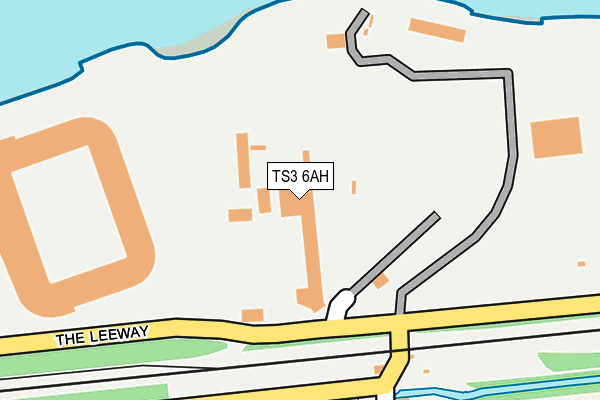
TS3 6AH is located in the Central electoral ward, within the unitary authority of Middlesbrough and the English Parliamentary constituency of Middlesbrough. The Sub Integrated Care Board (ICB) Location is NHS North East and North Cumbria ICB - 16C and the police force is Cleveland. This postcode has been in use since May 1994.


GetTheData
Source: OS OpenMap – Local (Ordnance Survey)
Source: OS VectorMap District (Ordnance Survey)
Licence: Open Government Licence (requires attribution)
| Easting | 451036 |
| Northing | 520547 |
| Latitude | 54.577578 |
| Longitude | -1.211988 |
GetTheData
Source: Open Postcode Geo
Licence: Open Government Licence
| Country | England |
| Postcode District | TS3 |
| ➜ TS3 open data dashboard ➜ See where TS3 is on a map ➜ Where is Middlesbrough? | |
GetTheData
Source: Land Registry Price Paid Data
Licence: Open Government Licence
Elevation or altitude of TS3 6AH as distance above sea level:
| Metres | Feet | |
|---|---|---|
| Elevation | 10m | 33ft |
Elevation is measured from the approximate centre of the postcode, to the nearest point on an OS contour line from OS Terrain 50, which has contour spacing of ten vertical metres.
➜ How high above sea level am I? Find the elevation of your current position using your device's GPS.
GetTheData
Source: Open Postcode Elevation
Licence: Open Government Licence
| Ward | Central |
| Constituency | Middlesbrough |
GetTheData
Source: ONS Postcode Database
Licence: Open Government Licence
| June 2022 | Public order | On or near Riverside Stadium | 326m |
| June 2022 | Public order | On or near Riverside Stadium | 326m |
| June 2022 | Public order | On or near Riverside Stadium | 326m |
| ➜ Get more crime data in our Crime section | |||
GetTheData
Source: data.police.uk
Licence: Open Government Licence
| The Halyard | Middlehaven | 491m |
| The Halyard (Windward Way) | Middlehaven | 575m |
| Health Village (Borough Road) | North Ormesby | 648m |
| Health Village (Borough Road) | North Ormesby | 651m |
| Market Place (King's Road) | North Ormesby | 755m |
| Middlesbrough Station | 1.5km |
| South Bank Station | 2.4km |
| James Cook University Hospital Station | 2.9km |
GetTheData
Source: NaPTAN
Licence: Open Government Licence
GetTheData
Source: ONS Postcode Database
Licence: Open Government Licence


➜ Get more ratings from the Food Standards Agency
GetTheData
Source: Food Standards Agency
Licence: FSA terms & conditions
| Last Collection | |||
|---|---|---|---|
| Location | Mon-Fri | Sat | Distance |
| North Ormesby Post Office | 18:00 | 12:15 | 700m |
| Borough Road | 17:15 | 12:45 | 1,264m |
| Rede House | 18:30 | 12:45 | 1,318m |
GetTheData
Source: Dracos
Licence: Creative Commons Attribution-ShareAlike
| Facility | Distance |
|---|---|
| Middlesbrough Fc (Riverside Stadium) Middlehaven Way, Middlesbrough Grass Pitches | 379m |
| Middlesbrough College Dock Street, Middlesbrough Sports Hall, Health and Fitness Gym, Studio, Artificial Grass Pitch | 995m |
| Dw Sports Fitness (Middlesbrough) (Closed) North Ormesby Road, Middlesbrough Swimming Pool, Health and Fitness Gym, Studio | 1km |
GetTheData
Source: Active Places
Licence: Open Government Licence
| School | Phase of Education | Distance |
|---|---|---|
| North Ormesby Primary Academy James Street, North Ormesby, Middlesbrough, TS3 6LB | Primary | 605m |
| St Alphonsus' Catholic Primary School Cadogan Street, North Ormesby, Middlesbrough, TS3 6PX | Primary | 954m |
| Outwood Academy Riverside 100 Russell Street, Middlehaven, Middlesbrough, TS1 2AD | Secondary | 1km |
GetTheData
Source: Edubase
Licence: Open Government Licence
The below table lists the International Territorial Level (ITL) codes (formerly Nomenclature of Territorial Units for Statistics (NUTS) codes) and Local Administrative Units (LAU) codes for TS3 6AH:
| ITL 1 Code | Name |
|---|---|
| TLC | North East (England) |
| ITL 2 Code | Name |
| TLC1 | Tees Valley and Durham |
| ITL 3 Code | Name |
| TLC12 | South Teesside |
| LAU 1 Code | Name |
| E06000002 | Middlesbrough |
GetTheData
Source: ONS Postcode Directory
Licence: Open Government Licence
The below table lists the Census Output Area (OA), Lower Layer Super Output Area (LSOA), and Middle Layer Super Output Area (MSOA) for TS3 6AH:
| Code | Name | |
|---|---|---|
| OA | E00060874 | |
| LSOA | E01033468 | Middlesbrough 001G |
| MSOA | E02002496 | Middlesbrough 001 |
GetTheData
Source: ONS Postcode Directory
Licence: Open Government Licence
| TS3 6AT | Heath Road | 406m |
| TS3 6LU | Saxon Close | 422m |
| TS3 6LT | Orme Court | 456m |
| TS3 6LS | Kildale Court | 478m |
| TS3 6LP | Conyers Way | 501m |
| TS3 6LQ | Market Walk | 531m |
| TS3 6LX | James Street | 552m |
| TS3 6LW | Church Walk | 554m |
| TS3 6DF | 625m | |
| TS3 6LG | Leven Road | 638m |
GetTheData
Source: Open Postcode Geo; Land Registry Price Paid Data
Licence: Open Government Licence