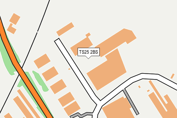
TS25 2BS lies on Tofts Farm Industrial Estate East in Hartlepool. TS25 2BS is located in the Seaton electoral ward, within the unitary authority of Hartlepool and the English Parliamentary constituency of Hartlepool. The Sub Integrated Care Board (ICB) Location is NHS North East and North Cumbria ICB - 16C and the police force is Cleveland. This postcode has been in use since October 1985.


GetTheData
Source: OS OpenMap – Local (Ordnance Survey)
Source: OS VectorMap District (Ordnance Survey)
Licence: Open Government Licence (requires attribution)
| Easting | 451599 |
| Northing | 528558 |
| Latitude | 54.649505 |
| Longitude | -1.201872 |
GetTheData
Source: Open Postcode Geo
Licence: Open Government Licence
| Street | Tofts Farm Industrial Estate East |
| Town/City | Hartlepool |
| Country | England |
| Postcode District | TS25 |
| ➜ TS25 open data dashboard ➜ See where TS25 is on a map ➜ Where is Hartlepool? | |
GetTheData
Source: Land Registry Price Paid Data
Licence: Open Government Licence
Elevation or altitude of TS25 2BS as distance above sea level:
| Metres | Feet | |
|---|---|---|
| Elevation | 10m | 33ft |
Elevation is measured from the approximate centre of the postcode, to the nearest point on an OS contour line from OS Terrain 50, which has contour spacing of ten vertical metres.
➜ How high above sea level am I? Find the elevation of your current position using your device's GPS.
GetTheData
Source: Open Postcode Elevation
Licence: Open Government Licence
| Ward | Seaton |
| Constituency | Hartlepool |
GetTheData
Source: ONS Postcode Database
Licence: Open Government Licence
| May 2023 | Burglary | On or near Tofts Farm Industrial Estate East | 297m |
| April 2023 | Other theft | On or near Tofts Farm Industrial Estate East | 297m |
| March 2023 | Other theft | On or near Tofts Farm Industrial Estate East | 297m |
| ➜ Get more crime data in our Crime section | |||
GetTheData
Source: data.police.uk
Licence: Open Government Licence
| Clydesdale Forge (Brenda Road) | Brenda Road | 73m |
| Clydesdale Forge (Brenda Road) | Brenda Road | 115m |
| Tofts Road East | Brenda Road | 148m |
| Tofts Road East | Brenda Road | 154m |
| Tofts Farm (Brenda Road) | Brenda Road | 229m |
| Seaton Carew Station | 1km |
| Hartlepool Station | 4.2km |
| Billingham Station | 7km |
GetTheData
Source: NaPTAN
Licence: Open Government Licence
Estimated total energy consumption in TS25 2BS by fuel type, 2015.
| Consumption (kWh) | 112,865 |
|---|---|
| Meter count | 7 |
| Mean (kWh/meter) | 16,124 |
| Median (kWh/meter) | 14,312 |
GetTheData
Source: Postcode level gas estimates: 2015 (experimental)
Source: Postcode level electricity estimates: 2015 (experimental)
Licence: Open Government Licence
GetTheData
Source: ONS Postcode Database
Licence: Open Government Licence


➜ Get more ratings from the Food Standards Agency
GetTheData
Source: Food Standards Agency
Licence: FSA terms & conditions
| Last Collection | |||
|---|---|---|---|
| Location | Mon-Fri | Sat | Distance |
| Catcote Road | 17:30 | 13:00 | 2,221m |
| North End, Greatham | 16:15 | 11:45 | 2,545m |
| Clark Street Delivery Office | 18:30 | 13:15 | 3,633m |
GetTheData
Source: Dracos
Licence: Creative Commons Attribution-ShareAlike
| Facility | Distance |
|---|---|
| The Football Dome @jd Sports Domes (Closed) Tees Road, Hartlepool Health and Fitness Gym, Artificial Grass Pitch, Studio, Indoor Bowls | 692m |
| Fitness Connexion (Hartlepool) (Closed) Brenda Road, Hartlepool Health and Fitness Gym, Studio | 800m |
| Seaton Youth & Community Centre (Closed) Elizabeth Way, Hartlepool Sports Hall | 994m |
GetTheData
Source: Active Places
Licence: Open Government Licence
| School | Phase of Education | Distance |
|---|---|---|
| Golden Flatts Primary School Seaton Lane, Hartlepool, TS25 1HN | Primary | 1.2km |
| Holy Trinity Church of England Primary School Holy Trinity C of E Primary, Crawford Street, Seaton Carew, Hartlepool, TS25 1BZ | Primary | 1.2km |
| Cambian Hartlepool School Unit E, Sovereign Way, Sovereign Park, Hartlepool, TS25 1NN | Not applicable | 1.4km |
GetTheData
Source: Edubase
Licence: Open Government Licence
The below table lists the International Territorial Level (ITL) codes (formerly Nomenclature of Territorial Units for Statistics (NUTS) codes) and Local Administrative Units (LAU) codes for TS25 2BS:
| ITL 1 Code | Name |
|---|---|
| TLC | North East (England) |
| ITL 2 Code | Name |
| TLC1 | Tees Valley and Durham |
| ITL 3 Code | Name |
| TLC11 | Hartlepool and Stockton-on-Tees |
| LAU 1 Code | Name |
| E06000001 | Hartlepool |
GetTheData
Source: ONS Postcode Directory
Licence: Open Government Licence
The below table lists the Census Output Area (OA), Lower Layer Super Output Area (LSOA), and Middle Layer Super Output Area (MSOA) for TS25 2BS:
| Code | Name | |
|---|---|---|
| OA | E00060506 | |
| LSOA | E01011998 | Hartlepool 011D |
| MSOA | E02002493 | Hartlepool 011 |
GetTheData
Source: ONS Postcode Directory
Licence: Open Government Licence
| TS25 2AJ | Lingdale Drive | 512m |
| TS25 2AR | Kildale Grove | 525m |
| TS25 2AL | Roxby Close | 533m |
| TS25 2AH | Bilsdale Road | 538m |
| TS25 2DY | Handley Close | 656m |
| TS25 2BF | Vickers Lane | 674m |
| TS25 2AS | Kildale Grove | 681m |
| TS25 2AP | Westerdale Road | 683m |
| TS25 2DN | Vickers Lane | 686m |
| TS25 2PE | Pavilion Close | 697m |
GetTheData
Source: Open Postcode Geo; Land Registry Price Paid Data
Licence: Open Government Licence