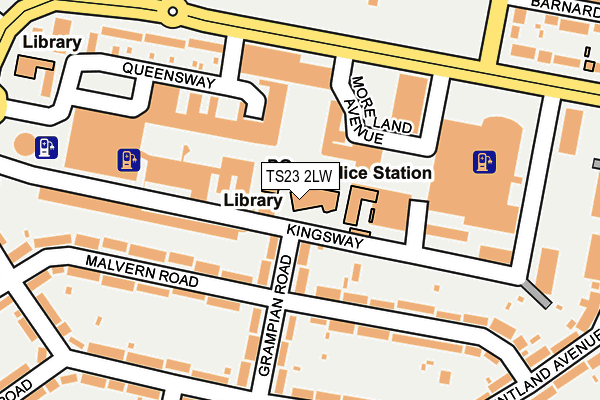
TS23 2LW is located in the Billingham Central electoral ward, within the unitary authority of Stockton-on-Tees and the English Parliamentary constituency of Stockton North. The Sub Integrated Care Board (ICB) Location is NHS North East and North Cumbria ICB - 16C and the police force is Cleveland. This postcode has been in use since January 1980.


GetTheData
Source: OS OpenMap – Local (Ordnance Survey)
Source: OS VectorMap District (Ordnance Survey)
Licence: Open Government Licence (requires attribution)
| Easting | 445889 |
| Northing | 523740 |
| Latitude | 54.606750 |
| Longitude | -1.291094 |
GetTheData
Source: Open Postcode Geo
Licence: Open Government Licence
| Country | England |
| Postcode District | TS23 |
| ➜ TS23 open data dashboard ➜ See where TS23 is on a map ➜ Where is Billingham? | |
GetTheData
Source: Land Registry Price Paid Data
Licence: Open Government Licence
Elevation or altitude of TS23 2LW as distance above sea level:
| Metres | Feet | |
|---|---|---|
| Elevation | 20m | 66ft |
Elevation is measured from the approximate centre of the postcode, to the nearest point on an OS contour line from OS Terrain 50, which has contour spacing of ten vertical metres.
➜ How high above sea level am I? Find the elevation of your current position using your device's GPS.
GetTheData
Source: Open Postcode Elevation
Licence: Open Government Licence
| Ward | Billingham Central |
| Constituency | Stockton North |
GetTheData
Source: ONS Postcode Database
Licence: Open Government Licence
| January 2024 | Criminal damage and arson | On or near Police Station | 56m |
| January 2024 | Shoplifting | On or near Police Station | 56m |
| January 2024 | Shoplifting | On or near Police Station | 56m |
| ➜ Get more crime data in our Crime section | |||
GetTheData
Source: data.police.uk
Licence: Open Government Licence
| Library (Kingsway) | Billingham | 33m |
| Town Centre (The Causeway) | Billingham | 148m |
| Medical Centre (Kingsway) | Billingham | 149m |
| Town Centre (The Causeway) | Billingham | 154m |
| Town Centre (The Causeway) | Billingham | 161m |
| Billingham Station | 0.7km |
| Stockton Station | 4.5km |
| Middlesbrough Station | 4.8km |
GetTheData
Source: NaPTAN
Licence: Open Government Licence
GetTheData
Source: ONS Postcode Database
Licence: Open Government Licence


➜ Get more ratings from the Food Standards Agency
GetTheData
Source: Food Standards Agency
Licence: FSA terms & conditions
| Last Collection | |||
|---|---|---|---|
| Location | Mon-Fri | Sat | Distance |
| Roseberry Road | 17:30 | 12:30 | 532m |
| Marsh House Avenue | 17:30 | 12:30 | 584m |
| Wolviston Court | 17:00 | 11:45 | 1,285m |
GetTheData
Source: Dracos
Licence: Creative Commons Attribution-ShareAlike
| Facility | Distance |
|---|---|
| Billingham Forum Moreland Avenue, Billingham Sports Hall, Ice Rinks, Swimming Pool, Health and Fitness Gym, Indoor Bowls, Squash Courts, Studio | 176m |
| Pentland Primary School Pentland Avenue, Billingham Grass Pitches | 258m |
| John Whitehead Park The Causeway, Billingham Outdoor Tennis Courts | 306m |
GetTheData
Source: Active Places
Licence: Open Government Licence
| School | Phase of Education | Distance |
|---|---|---|
| Pentland Primary School Pentland Avenue, Billingham, TS23 2RG | Primary | 259m |
| Roseberry Primary School Marsh House Avenue, Billingham, TS23 2HJ | Primary | 516m |
| Our Lady of the Most Holy Rosary Catholic Academy Rievaulx Avenue, Billingham, TS23 2BS | Primary | 798m |
GetTheData
Source: Edubase
Licence: Open Government Licence
The below table lists the International Territorial Level (ITL) codes (formerly Nomenclature of Territorial Units for Statistics (NUTS) codes) and Local Administrative Units (LAU) codes for TS23 2LW:
| ITL 1 Code | Name |
|---|---|
| TLC | North East (England) |
| ITL 2 Code | Name |
| TLC1 | Tees Valley and Durham |
| ITL 3 Code | Name |
| TLC11 | Hartlepool and Stockton-on-Tees |
| LAU 1 Code | Name |
| E06000004 | Stockton-on-Tees |
GetTheData
Source: ONS Postcode Directory
Licence: Open Government Licence
The below table lists the Census Output Area (OA), Lower Layer Super Output Area (LSOA), and Middle Layer Super Output Area (MSOA) for TS23 2LW:
| Code | Name | |
|---|---|---|
| OA | E00061909 | |
| LSOA | E01012276 | Stockton-on-Tees 002E |
| MSOA | E02002536 | Stockton-on-Tees 002 |
GetTheData
Source: ONS Postcode Directory
Licence: Open Government Licence
| TS23 2NT | Queensway | 66m |
| TS23 2PH | Grampian Road | 124m |
| TS23 2PJ | Malvern Road | 159m |
| TS23 2PQ | Malvern Road | 195m |
| TS23 2LD | Roseberry Flats | 212m |
| TS23 2RQ | Pentland Avenue | 223m |
| TS23 2PN | Pentland Avenue | 232m |
| TS23 2RF | Pentland Avenue | 239m |
| TS23 3RF | Kennedy Gardens | 258m |
| TS23 3RG | Kennedy Gardens | 258m |
GetTheData
Source: Open Postcode Geo; Land Registry Price Paid Data
Licence: Open Government Licence