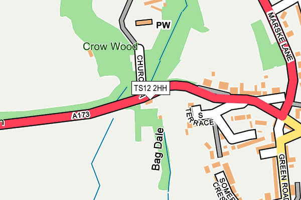
TS12 2HH is located in the Skelton West electoral ward, within the unitary authority of Redcar and Cleveland and the English Parliamentary constituency of Middlesbrough South and East Cleveland. The Sub Integrated Care Board (ICB) Location is NHS North East and North Cumbria ICB - 16C and the police force is Cleveland. This postcode has been in use since January 1980.


GetTheData
Source: OS OpenMap – Local (Ordnance Survey)
Source: OS VectorMap District (Ordnance Survey)
Licence: Open Government Licence (requires attribution)
| Easting | 465267 |
| Northing | 518882 |
| Latitude | 54.560985 |
| Longitude | -0.992234 |
GetTheData
Source: Open Postcode Geo
Licence: Open Government Licence
| Country | England |
| Postcode District | TS12 |
| ➜ TS12 open data dashboard ➜ See where TS12 is on a map ➜ Where is Skelton? | |
GetTheData
Source: Land Registry Price Paid Data
Licence: Open Government Licence
Elevation or altitude of TS12 2HH as distance above sea level:
| Metres | Feet | |
|---|---|---|
| Elevation | 80m | 262ft |
Elevation is measured from the approximate centre of the postcode, to the nearest point on an OS contour line from OS Terrain 50, which has contour spacing of ten vertical metres.
➜ How high above sea level am I? Find the elevation of your current position using your device's GPS.
GetTheData
Source: Open Postcode Elevation
Licence: Open Government Licence
| Ward | Skelton West |
| Constituency | Middlesbrough South And East Cleveland |
GetTheData
Source: ONS Postcode Database
Licence: Open Government Licence
| June 2022 | Violence and sexual offences | On or near Church Lane | 57m |
| June 2022 | Criminal damage and arson | On or near Church Lane | 57m |
| June 2022 | Violence and sexual offences | On or near Marske Lane | 325m |
| ➜ Get more crime data in our Crime section | |||
GetTheData
Source: data.police.uk
Licence: Open Government Licence
| Guisborough Road (High Street) | Skelton | 335m |
| Rydal Road (Coniston Road) | Skelton | 339m |
| Guisborough Road (High Street) | Skelton | 376m |
| Barns Farm (A173 - Guisborough Lane) | Skelton | 392m |
| Skelton Castle (Marske Lane) | Skelton | 392m |
| Saltburn Station | 2.8km |
| Marske Station | 3.4km |
| Longbeck Station | 4km |
GetTheData
Source: NaPTAN
Licence: Open Government Licence
| Percentage of properties with Next Generation Access | 0.0% |
| Percentage of properties with Superfast Broadband | 0.0% |
| Percentage of properties with Ultrafast Broadband | 0.0% |
| Percentage of properties with Full Fibre Broadband | 0.0% |
Superfast Broadband is between 30Mbps and 300Mbps
Ultrafast Broadband is > 300Mbps
| Percentage of properties unable to receive 2Mbps | 0.0% |
| Percentage of properties unable to receive 5Mbps | 0.0% |
| Percentage of properties unable to receive 10Mbps | 0.0% |
| Percentage of properties unable to receive 30Mbps | 100.0% |
GetTheData
Source: Ofcom
Licence: Ofcom Terms of Use (requires attribution)
GetTheData
Source: ONS Postcode Database
Licence: Open Government Licence


➜ Get more ratings from the Food Standards Agency
GetTheData
Source: Food Standards Agency
Licence: FSA terms & conditions
| Last Collection | |||
|---|---|---|---|
| Location | Mon-Fri | Sat | Distance |
| High Street, Skelton | 16:30 | 10:30 | 707m |
| Cotswold Drive | 16:30 | 10:30 | 941m |
| Rifts Avenue | 17:15 | 11:30 | 1,056m |
GetTheData
Source: Dracos
Licence: Creative Commons Attribution-ShareAlike
| Facility | Distance |
|---|---|
| Freebrough Community College (Closed) Marske Lane, Skelton-in-cleveland, Saltburn-by-the-sea Grass Pitches | 422m |
| De Brus Centre And Playing Fields Marske Lane, Marske Lane, Skelton-in-cleveland, Saltburn-by-the-sea Sports Hall, Grass Pitches | 486m |
| Holly Bush Station Lane, Skelton-in-cleveland, Saltburn-by-the-sea Grass Pitches | 1.2km |
GetTheData
Source: Active Places
Licence: Open Government Licence
| School | Phase of Education | Distance |
|---|---|---|
| Skelton Primary School Station Lane, Skelton, Saltburn-by-the-Sea, TS12 2LR | Primary | 1.5km |
| Huntcliff School Marske Mill Lane, Saltburn By the Sea, TS12 1HJ | Secondary | 2km |
| Lockwood Primary School Lockwood Primary School, Margrove Road, Boosbeck, Saltburn-by-the-Sea, TS12 3BL | Primary | 2.2km |
GetTheData
Source: Edubase
Licence: Open Government Licence
The below table lists the International Territorial Level (ITL) codes (formerly Nomenclature of Territorial Units for Statistics (NUTS) codes) and Local Administrative Units (LAU) codes for TS12 2HH:
| ITL 1 Code | Name |
|---|---|
| TLC | North East (England) |
| ITL 2 Code | Name |
| TLC1 | Tees Valley and Durham |
| ITL 3 Code | Name |
| TLC12 | South Teesside |
| LAU 1 Code | Name |
| E06000003 | Redcar and Cleveland |
GetTheData
Source: ONS Postcode Directory
Licence: Open Government Licence
The below table lists the Census Output Area (OA), Lower Layer Super Output Area (LSOA), and Middle Layer Super Output Area (MSOA) for TS12 2HH:
| Code | Name | |
|---|---|---|
| OA | E00061346 | |
| LSOA | E01012164 | Redcar and Cleveland 012C |
| MSOA | E02002526 | Redcar and Cleveland 012 |
GetTheData
Source: ONS Postcode Directory
Licence: Open Government Licence
| TS12 2EW | South Terrace | 129m |
| TS12 2ES | North Terrace | 190m |
| TS12 2FR | Lawns Gill | 212m |
| TS12 2BP | Somerset Crescent | 230m |
| TS12 2EJ | South Terrace | 279m |
| TS12 2BQ | Green Road | 289m |
| TS12 2EL | East Terrace | 293m |
| TS12 2BS | Devon Crescent | 300m |
| TS12 2EU | Marske Lane | 306m |
| TS12 2HA | Marske Lane | 310m |
GetTheData
Source: Open Postcode Geo; Land Registry Price Paid Data
Licence: Open Government Licence