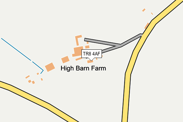
TR8 4AF is located in the St Columb Major, St Mawgan & St Wenn electoral ward, within the unitary authority of Cornwall and the English Parliamentary constituency of St Austell and Newquay. The Sub Integrated Care Board (ICB) Location is NHS Cornwall and the Isles of Scilly ICB - 11N and the police force is Devon & Cornwall. This postcode has been in use since January 1980.


GetTheData
Source: OS OpenMap – Local (Ordnance Survey)
Source: OS VectorMap District (Ordnance Survey)
Licence: Open Government Licence (requires attribution)
| Easting | 186606 |
| Northing | 65511 |
| Latitude | 50.450534 |
| Longitude | -5.007284 |
GetTheData
Source: Open Postcode Geo
Licence: Open Government Licence
| Country | England |
| Postcode District | TR8 |
| ➜ TR8 open data dashboard ➜ See where TR8 is on a map | |
GetTheData
Source: Land Registry Price Paid Data
Licence: Open Government Licence
Elevation or altitude of TR8 4AF as distance above sea level:
| Metres | Feet | |
|---|---|---|
| Elevation | 80m | 262ft |
Elevation is measured from the approximate centre of the postcode, to the nearest point on an OS contour line from OS Terrain 50, which has contour spacing of ten vertical metres.
➜ How high above sea level am I? Find the elevation of your current position using your device's GPS.
GetTheData
Source: Open Postcode Elevation
Licence: Open Government Licence
| Ward | St Columb Major, St Mawgan & St Wenn |
| Constituency | St Austell And Newquay |
GetTheData
Source: ONS Postcode Database
Licence: Open Government Licence
| Newquay Airport | St Mawgan | 405m |
| Carloggas Close (Ball Lane) | Carloggas | 680m |
| Carloggas Close (Ball Lane) | Carloggas | 691m |
| St Mawgan Junction | Carloggas | 767m |
| The Falcoln Inn | St Mawgan | 778m |
GetTheData
Source: NaPTAN
Licence: Open Government Licence
| Percentage of properties with Next Generation Access | 0.0% |
| Percentage of properties with Superfast Broadband | 0.0% |
| Percentage of properties with Ultrafast Broadband | 0.0% |
| Percentage of properties with Full Fibre Broadband | 0.0% |
Superfast Broadband is between 30Mbps and 300Mbps
Ultrafast Broadband is > 300Mbps
| Median download speed | 12.0Mbps |
| Average download speed | 12.4Mbps |
| Maximum download speed | 20.44Mbps |
| Median upload speed | 0.9Mbps |
| Average upload speed | 0.9Mbps |
| Maximum upload speed | 1.28Mbps |
| Percentage of properties unable to receive 2Mbps | 0.0% |
| Percentage of properties unable to receive 5Mbps | 0.0% |
| Percentage of properties unable to receive 10Mbps | 0.0% |
| Percentage of properties unable to receive 30Mbps | 100.0% |
GetTheData
Source: Ofcom
Licence: Ofcom Terms of Use (requires attribution)
GetTheData
Source: ONS Postcode Database
Licence: Open Government Licence


➜ Get more ratings from the Food Standards Agency
GetTheData
Source: Food Standards Agency
Licence: FSA terms & conditions
| Last Collection | |||
|---|---|---|---|
| Location | Mon-Fri | Sat | Distance |
| Trebarber | 15:20 | 07:45 | 2,511m |
| Mawgan Porth | 16:10 | 10:20 | 2,725m |
| Tregaswith | 11:30 | 11:00 | 3,891m |
GetTheData
Source: Dracos
Licence: Creative Commons Attribution-ShareAlike
| Facility | Distance |
|---|---|
| Trevarrian Holiday Park Trevarrian, Newquay Grass Pitches, Swimming Pool, Outdoor Tennis Courts | 1.5km |
| Raf St. Mawgan Physical Education Centre St. Mawgan, Newquay Health and Fitness Gym, Sports Hall, Squash Courts, Outdoor Tennis Courts | 1.7km |
| Merlin Golf Course Mawgan Porth, Newquay Golf | 2.2km |
GetTheData
Source: Active Places
Licence: Open Government Licence
| School | Phase of Education | Distance |
|---|---|---|
| Mawgan-In-Pydar Primary School St Mawgan Village, Newquay, TR8 4EP | Primary | 836m |
| Trevisker Primary School Warwick Crescent, St Eval, Wadebridge, PL27 7UD | Primary | 3.7km |
| St Columb Minor Academy Porth Bean Road, St Columb Minor, Newquay, TR7 3JF | Primary | 4.5km |
GetTheData
Source: Edubase
Licence: Open Government Licence
The below table lists the International Territorial Level (ITL) codes (formerly Nomenclature of Territorial Units for Statistics (NUTS) codes) and Local Administrative Units (LAU) codes for TR8 4AF:
| ITL 1 Code | Name |
|---|---|
| TLK | South West (England) |
| ITL 2 Code | Name |
| TLK3 | Cornwall and Isles of Scilly |
| ITL 3 Code | Name |
| TLK30 | Cornwall and Isles of Scilly |
| LAU 1 Code | Name |
| E06000052 | Cornwall |
GetTheData
Source: ONS Postcode Directory
Licence: Open Government Licence
The below table lists the Census Output Area (OA), Lower Layer Super Output Area (LSOA), and Middle Layer Super Output Area (MSOA) for TR8 4AF:
| Code | Name | |
|---|---|---|
| OA | E00096320 | |
| LSOA | E01019060 | Cornwall 019A |
| MSOA | E02003953 | Cornwall 019 |
GetTheData
Source: ONS Postcode Directory
Licence: Open Government Licence
| TR8 4EH | Ball | 519m |
| TR8 4ES | 635m | |
| TR8 4EQ | Carloggas | 688m |
| TR8 4AZ | Pen Y Morfa Close | 709m |
| TR8 4EW | 712m | |
| TR8 4EF | Council Houses | 715m |
| TR8 4EN | 731m | |
| TR8 4HJ | Carloggas Close | 754m |
| TR8 4EL | Lanherne Avenue | 772m |
| TR8 4EJ | Challis Avenue | 795m |
GetTheData
Source: Open Postcode Geo; Land Registry Price Paid Data
Licence: Open Government Licence