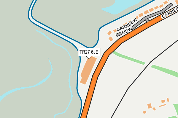
TR27 6JE is located in the Hayle West electoral ward, within the unitary authority of Cornwall and the English Parliamentary constituency of Camborne and Redruth. The Sub Integrated Care Board (ICB) Location is NHS Cornwall and the Isles of Scilly ICB - 11N and the police force is Devon & Cornwall. This postcode has been in use since January 1980.


GetTheData
Source: OS OpenMap – Local (Ordnance Survey)
Source: OS VectorMap District (Ordnance Survey)
Licence: Open Government Licence (requires attribution)
| Easting | 155216 |
| Northing | 36970 |
| Latitude | 50.182063 |
| Longitude | -5.430150 |
GetTheData
Source: Open Postcode Geo
Licence: Open Government Licence
| Country | England |
| Postcode District | TR27 |
| ➜ TR27 open data dashboard ➜ See where TR27 is on a map | |
GetTheData
Source: Land Registry Price Paid Data
Licence: Open Government Licence
Elevation or altitude of TR27 6JE as distance above sea level:
| Metres | Feet | |
|---|---|---|
| Elevation | 10m | 33ft |
Elevation is measured from the approximate centre of the postcode, to the nearest point on an OS contour line from OS Terrain 50, which has contour spacing of ten vertical metres.
➜ How high above sea level am I? Find the elevation of your current position using your device's GPS.
GetTheData
Source: Open Postcode Elevation
Licence: Open Government Licence
| Ward | Hayle West |
| Constituency | Camborne And Redruth |
GetTheData
Source: ONS Postcode Database
Licence: Open Government Licence
| May 2022 | Criminal damage and arson | On or near Foundry Hill | 489m |
| December 2021 | Anti-social behaviour | On or near Foundry Hill | 489m |
| November 2021 | Anti-social behaviour | On or near Plantation Lane | 441m |
| ➜ Get more crime data in our Crime section | |||
GetTheData
Source: data.police.uk
Licence: Open Government Licence
| St Michaels Hospital (Foundry Hill) | Hayle | 521m |
| St Michaels Hospital (Mellanear Road) | Hayle | 577m |
| Foundry Hill | Hayle | 625m |
| Foundry Hill | Hayle | 633m |
| Barclays Bank | Hayle | 650m |
| Lelant Station | 0.5km |
| Hayle Station | 0.8km |
| Lelant Saltings Station | 0.9km |
GetTheData
Source: NaPTAN
Licence: Open Government Licence
GetTheData
Source: ONS Postcode Database
Licence: Open Government Licence


➜ Get more ratings from the Food Standards Agency
GetTheData
Source: Food Standards Agency
Licence: FSA terms & conditions
| Last Collection | |||
|---|---|---|---|
| Location | Mon-Fri | Sat | Distance |
| Hayle Delivery Office | 17:15 | 11:45 | 691m |
| Hayle Post Office | 18:00 | 11:00 | 738m |
| Lelant Post Office | 17:00 | 10:00 | 744m |
GetTheData
Source: Dracos
Licence: Creative Commons Attribution-ShareAlike
| Facility | Distance |
|---|---|
| Lelant Saltings (St Ives Town Fc) Saltings Reach, Lelant, St. Ives Grass Pitches | 848m |
| Ellis Park Penpol Avenue, Hayle Grass Pitches | 899m |
| Hayle Outdoor Pool King George Memorial Walk, Phillack, Hayle Swimming Pool | 949m |
GetTheData
Source: Active Places
Licence: Open Government Licence
| School | Phase of Education | Distance |
|---|---|---|
| St Piran's School (Gb) Ltd 14 Trelissick Road, Hayle, TR27 4HY | Not applicable | 523m |
| Penpol School 2 St George's Road, Hayle, TR27 4AH | Primary | 815m |
| Hayle Academy 3 High Lanes, Hayle, TR27 4DN | Secondary | 1.4km |
GetTheData
Source: Edubase
Licence: Open Government Licence
The below table lists the International Territorial Level (ITL) codes (formerly Nomenclature of Territorial Units for Statistics (NUTS) codes) and Local Administrative Units (LAU) codes for TR27 6JE:
| ITL 1 Code | Name |
|---|---|
| TLK | South West (England) |
| ITL 2 Code | Name |
| TLK3 | Cornwall and Isles of Scilly |
| ITL 3 Code | Name |
| TLK30 | Cornwall and Isles of Scilly |
| LAU 1 Code | Name |
| E06000052 | Cornwall |
GetTheData
Source: ONS Postcode Directory
Licence: Open Government Licence
The below table lists the Census Output Area (OA), Lower Layer Super Output Area (LSOA), and Middle Layer Super Output Area (MSOA) for TR27 6JE:
| Code | Name | |
|---|---|---|
| OA | E00095893 | |
| LSOA | E01018983 | Cornwall 057D |
| MSOA | E02003944 | Cornwall 057 |
GetTheData
Source: ONS Postcode Directory
Licence: Open Government Licence
| TR27 4JW | Carnsew Meadow | 230m |
| TR27 4HP | Plantation Lane | 454m |
| TR27 4HW | Foundry Hill | 500m |
| TR26 3DQ | St Annes Close | 514m |
| TR26 3DU | Wharf Road | 560m |
| TR27 4QS | Mellanear Road | 591m |
| TR27 4HT | Foundry Square | 593m |
| TR27 4HY | Trelissick Road | 599m |
| TR27 4QR | St Michaels Close | 602m |
| TR27 4HX | Millpond Avenue | 604m |
GetTheData
Source: Open Postcode Geo; Land Registry Price Paid Data
Licence: Open Government Licence