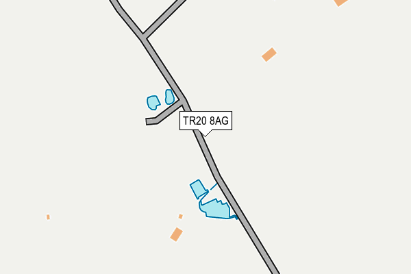
TR20 8AG is located in the Ludgvan, Madron, Gulval & Heamoor electoral ward, within the unitary authority of Cornwall and the English Parliamentary constituency of St Ives. The Sub Integrated Care Board (ICB) Location is NHS Cornwall and the Isles of Scilly ICB - 11N and the police force is Devon & Cornwall. This postcode has been in use since April 2013.


GetTheData
Source: OS OpenMap – Local (Ordnance Survey)
Source: OS VectorMap District (Ordnance Survey)
Licence: Open Government Licence (requires attribution)
| Easting | 148436 |
| Northing | 34301 |
| Latitude | 50.155254 |
| Longitude | -5.523222 |
GetTheData
Source: Open Postcode Geo
Licence: Open Government Licence
| Country | England |
| Postcode District | TR20 |
| ➜ TR20 open data dashboard ➜ See where TR20 is on a map | |
GetTheData
Source: Land Registry Price Paid Data
Licence: Open Government Licence
Elevation or altitude of TR20 8AG as distance above sea level:
| Metres | Feet | |
|---|---|---|
| Elevation | 160m | 525ft |
Elevation is measured from the approximate centre of the postcode, to the nearest point on an OS contour line from OS Terrain 50, which has contour spacing of ten vertical metres.
➜ How high above sea level am I? Find the elevation of your current position using your device's GPS.
GetTheData
Source: Open Postcode Elevation
Licence: Open Government Licence
| Ward | Ludgvan, Madron, Gulval & Heamoor |
| Constituency | St Ives |
GetTheData
Source: ONS Postcode Database
Licence: Open Government Licence
| Lay By (B3311) | Castle Gate | 651m |
| Lay By | Castle Gate | 657m |
| Badgers Lodge (B3311) | Badgers Cross | 1,120m |
| Badgers Lodge (B3311) | Badgers Cross | 1,121m |
| Treassowe Manor (Castle Road) | Castle Gate | 1,336m |
| Penzance Station | 3.8km |
| Carbis Bay Station | 6.3km |
GetTheData
Source: NaPTAN
Licence: Open Government Licence
GetTheData
Source: ONS Postcode Database
Licence: Open Government Licence


➜ Get more ratings from the Food Standards Agency
GetTheData
Source: Food Standards Agency
Licence: FSA terms & conditions
| Last Collection | |||
|---|---|---|---|
| Location | Mon-Fri | Sat | Distance |
| Angwinnack | 10:30 | 10:30 | 2,259m |
| Ludgvan Churchtown | 16:20 | 10:00 | 2,419m |
| Newmill | 09:00 | 09:00 | 2,641m |
GetTheData
Source: Dracos
Licence: Creative Commons Attribution-ShareAlike
| Facility | Distance |
|---|---|
| Gulval Cricket Club Four Moors, Higher Kenegie, Gulval Grass Pitches | 1.6km |
| Nancledra Primary School Nancledra, Penzance Grass Pitches | 2.6km |
| Ludgvan Community Centre Ludgvan Leaze, Ludgvan Grass Pitches, Sports Hall, Health and Fitness Gym | 3km |
GetTheData
Source: Active Places
Licence: Open Government Licence
| School | Phase of Education | Distance |
|---|---|---|
| Gulval School School Lane, Gulval, Penzance, TR18 3BJ | Primary | 2.6km |
| Nancledra School Nancledra, Penzance, TR20 8NB | Primary | 2.6km |
| Ludgvan School Lower Quarter, Ludgvan, Penzance, TR20 8EX | Primary | 3.2km |
GetTheData
Source: Edubase
Licence: Open Government Licence
The below table lists the International Territorial Level (ITL) codes (formerly Nomenclature of Territorial Units for Statistics (NUTS) codes) and Local Administrative Units (LAU) codes for TR20 8AG:
| ITL 1 Code | Name |
|---|---|
| TLK | South West (England) |
| ITL 2 Code | Name |
| TLK3 | Cornwall and Isles of Scilly |
| ITL 3 Code | Name |
| TLK30 | Cornwall and Isles of Scilly |
| LAU 1 Code | Name |
| E06000052 | Cornwall |
GetTheData
Source: ONS Postcode Directory
Licence: Open Government Licence
The below table lists the Census Output Area (OA), Lower Layer Super Output Area (LSOA), and Middle Layer Super Output Area (MSOA) for TR20 8AG:
| Code | Name | |
|---|---|---|
| OA | E00095927 | |
| LSOA | E01018989 | Cornwall 065B |
| MSOA | E02003947 | Cornwall 065 |
GetTheData
Source: ONS Postcode Directory
Licence: Open Government Licence
| TR20 8BQ | Castle Gate | 532m |
| TR20 8BG | Castle Gate | 657m |
| TR20 8XD | 789m | |
| TR20 8BE | 1048m | |
| TR20 8XE | Badgers Cross | 1072m |
| TR20 8BL | 1259m | |
| TR20 8BD | 1319m | |
| TR20 8XQ | Treassowe Mews | 1384m |
| TR20 8YR | 1619m | |
| TR20 8XG | 1623m |
GetTheData
Source: Open Postcode Geo; Land Registry Price Paid Data
Licence: Open Government Licence