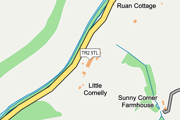
TR2 5TL is located in the St Goran, Tregony & the Roseland electoral ward, within the unitary authority of Cornwall and the English Parliamentary constituency of Truro and Falmouth. The Sub Integrated Care Board (ICB) Location is NHS Cornwall and the Isles of Scilly ICB - 11N and the police force is Devon & Cornwall. This postcode has been in use since February 1984.


GetTheData
Source: OS OpenMap – Local (Ordnance Survey)
Source: OS VectorMap District (Ordnance Survey)
Licence: Open Government Licence (requires attribution)
| Easting | 191825 |
| Northing | 44369 |
| Latitude | 50.262511 |
| Longitude | -4.922225 |
GetTheData
Source: Open Postcode Geo
Licence: Open Government Licence
| Country | England |
| Postcode District | TR2 |
| ➜ TR2 open data dashboard ➜ See where TR2 is on a map | |
GetTheData
Source: Land Registry Price Paid Data
Licence: Open Government Licence
Elevation or altitude of TR2 5TL as distance above sea level:
| Metres | Feet | |
|---|---|---|
| Elevation | 10m | 33ft |
Elevation is measured from the approximate centre of the postcode, to the nearest point on an OS contour line from OS Terrain 50, which has contour spacing of ten vertical metres.
➜ How high above sea level am I? Find the elevation of your current position using your device's GPS.
GetTheData
Source: Open Postcode Elevation
Licence: Open Government Licence
| Ward | St Goran, Tregony & The Roseland |
| Constituency | Truro And Falmouth |
GetTheData
Source: ONS Postcode Database
Licence: Open Government Licence
| Springfield (Tregony Hill) | Tregony | 488m |
| Springfield (Tregony Hill) | Tregony | 497m |
| The Square (Well Street) | Tregony | 770m |
| Tregony Square (Fore Street) | Tregony | 792m |
| Old School (Fore Street) | Tregony | 1,110m |
GetTheData
Source: NaPTAN
Licence: Open Government Licence
GetTheData
Source: ONS Postcode Database
Licence: Open Government Licence


➜ Get more ratings from the Food Standards Agency
GetTheData
Source: Food Standards Agency
Licence: FSA terms & conditions
| Last Collection | |||
|---|---|---|---|
| Location | Mon-Fri | Sat | Distance |
| Tregony Bridge | 17:20 | 11:10 | 430m |
| Reskivers | 17:30 | 11:05 | 532m |
| Tregony Post Office | 17:25 | 11:15 | 656m |
GetTheData
Source: Dracos
Licence: Creative Commons Attribution-ShareAlike
| Facility | Distance |
|---|---|
| Tregony Sports Centre Back Lane, Tregony Grass Pitches | 1.2km |
| Roseland Academy Sports Field Tregony, Truro Grass Pitches | 1.5km |
| Roseland Academy Tregony, Truro Sports Hall, Grass Pitches, Studio | 1.5km |
GetTheData
Source: Active Places
Licence: Open Government Licence
| School | Phase of Education | Distance |
|---|---|---|
| Tregony Community Primary School Back Lane, Tregony, Truro, TR2 5RP | Primary | 1.4km |
| The Roseland Academy Tregony, Truro, TR2 5SE | Secondary | 1.5km |
| Probus Primary School Ladock Road, Probus, Truro, TR2 4LE | Primary | 4.1km |
GetTheData
Source: Edubase
Licence: Open Government Licence
The below table lists the International Territorial Level (ITL) codes (formerly Nomenclature of Territorial Units for Statistics (NUTS) codes) and Local Administrative Units (LAU) codes for TR2 5TL:
| ITL 1 Code | Name |
|---|---|
| TLK | South West (England) |
| ITL 2 Code | Name |
| TLK3 | Cornwall and Isles of Scilly |
| ITL 3 Code | Name |
| TLK30 | Cornwall and Isles of Scilly |
| LAU 1 Code | Name |
| E06000052 | Cornwall |
GetTheData
Source: ONS Postcode Directory
Licence: Open Government Licence
The below table lists the Census Output Area (OA), Lower Layer Super Output Area (LSOA), and Middle Layer Super Output Area (MSOA) for TR2 5TL:
| Code | Name | |
|---|---|---|
| OA | E00172791 | |
| LSOA | E01018846 | Cornwall 048B |
| MSOA | E02003912 | Cornwall 048 |
GetTheData
Source: ONS Postcode Directory
Licence: Open Government Licence
| TR2 5TD | 389m | |
| TR2 5TY | 475m | |
| TR2 5TE | Reskivers | 553m |
| TR2 5RU | Tregony Hill | 621m |
| TR2 5RT | Well Street | 673m |
| TR2 5SB | Frog Lane | 697m |
| TR2 5SZ | Warne Close | 722m |
| TR2 5RX | Mill Lane | 739m |
| TR2 5RS | The Square | 768m |
| TR2 5SA | Roseland Crescent | 775m |
GetTheData
Source: Open Postcode Geo; Land Registry Price Paid Data
Licence: Open Government Licence