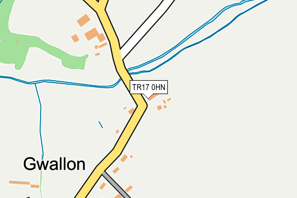
TR17 0HN lies on Gwallon in Marazion. TR17 0HN is located in the Long Rock, Marazion & St Erth electoral ward, within the unitary authority of Cornwall and the English Parliamentary constituency of St Ives. The Sub Integrated Care Board (ICB) Location is NHS Cornwall and the Isles of Scilly ICB - 11N and the police force is Devon & Cornwall. This postcode has been in use since January 1980.


GetTheData
Source: OS OpenMap – Local (Ordnance Survey)
Source: OS VectorMap District (Ordnance Survey)
Licence: Open Government Licence (requires attribution)
| Easting | 152641 |
| Northing | 32097 |
| Latitude | 50.137238 |
| Longitude | -5.463037 |
GetTheData
Source: Open Postcode Geo
Licence: Open Government Licence
| Street | Gwallon |
| Town/City | Marazion |
| Country | England |
| Postcode District | TR17 |
| ➜ TR17 open data dashboard ➜ See where TR17 is on a map ➜ Where is Gwallon? | |
GetTheData
Source: Land Registry Price Paid Data
Licence: Open Government Licence
Elevation or altitude of TR17 0HN as distance above sea level:
| Metres | Feet | |
|---|---|---|
| Elevation | 10m | 33ft |
Elevation is measured from the approximate centre of the postcode, to the nearest point on an OS contour line from OS Terrain 50, which has contour spacing of ten vertical metres.
➜ How high above sea level am I? Find the elevation of your current position using your device's GPS.
GetTheData
Source: Open Postcode Elevation
Licence: Open Government Licence
| Ward | Long Rock, Marazion & St Erth |
| Constituency | St Ives |
GetTheData
Source: ONS Postcode Database
Licence: Open Government Licence
| January 2022 | Public order | On or near Parking Area | 378m |
| August 2021 | Public order | On or near Parking Area | 378m |
| April 2021 | Violence and sexual offences | On or near Parking Area | 378m |
| ➜ Get more crime data in our Crime section | |||
GetTheData
Source: data.police.uk
Licence: Open Government Licence
| Orillia | Gwallon | 164m |
| Orillia | Gwallon | 173m |
| Wheal Rodney | Gwallon | 701m |
| Wheal Rodney Carvan Park | Gwallon | 817m |
| Wheal Rodney Caravan Park | Gwallon | 844m |
| St Erth Station | 3.9km |
| Lelant Saltings Station | 4.9km |
GetTheData
Source: NaPTAN
Licence: Open Government Licence
| Percentage of properties with Next Generation Access | 100.0% |
| Percentage of properties with Superfast Broadband | 0.0% |
| Percentage of properties with Ultrafast Broadband | 0.0% |
| Percentage of properties with Full Fibre Broadband | 0.0% |
Superfast Broadband is between 30Mbps and 300Mbps
Ultrafast Broadband is > 300Mbps
| Percentage of properties unable to receive 2Mbps | 0.0% |
| Percentage of properties unable to receive 5Mbps | 0.0% |
| Percentage of properties unable to receive 10Mbps | 0.0% |
| Percentage of properties unable to receive 30Mbps | 100.0% |
GetTheData
Source: Ofcom
Licence: Ofcom Terms of Use (requires attribution)
GetTheData
Source: ONS Postcode Database
Licence: Open Government Licence


➜ Get more ratings from the Food Standards Agency
GetTheData
Source: Food Standards Agency
Licence: FSA terms & conditions
| Last Collection | |||
|---|---|---|---|
| Location | Mon-Fri | Sat | Distance |
| Plain An Gwarry | 09:45 | 09:45 | 1,103m |
| Green Lane | 16:45 | 11:45 | 1,373m |
| Crowlas Post Office | 16:35 | 10:30 | 1,506m |
GetTheData
Source: Dracos
Licence: Creative Commons Attribution-ShareAlike
| Facility | Distance |
|---|---|
| Marazion Playing Fields Trevenner Lane, Marazion Grass Pitches | 1.2km |
| Ludgvan Community Centre Ludgvan Leaze, Ludgvan Grass Pitches, Sports Hall, Health and Fitness Gym | 1.8km |
| Ludgvan Lions Jfc Fairfield, Ludgvan, Penzance Grass Pitches | 1.8km |
GetTheData
Source: Active Places
Licence: Open Government Licence
| School | Phase of Education | Distance |
|---|---|---|
| Marazion School School Lane, Marazion, TR17 0DG | Primary | 1.3km |
| Ludgvan School Lower Quarter, Ludgvan, Penzance, TR20 8EX | Primary | 1.6km |
| St Hilary School School Lane, St Hilary, Penzance, TR20 9DR | Primary | 3km |
GetTheData
Source: Edubase
Licence: Open Government Licence
The below table lists the International Territorial Level (ITL) codes (formerly Nomenclature of Territorial Units for Statistics (NUTS) codes) and Local Administrative Units (LAU) codes for TR17 0HN:
| ITL 1 Code | Name |
|---|---|
| TLK | South West (England) |
| ITL 2 Code | Name |
| TLK3 | Cornwall and Isles of Scilly |
| ITL 3 Code | Name |
| TLK30 | Cornwall and Isles of Scilly |
| LAU 1 Code | Name |
| E06000052 | Cornwall |
GetTheData
Source: ONS Postcode Directory
Licence: Open Government Licence
The below table lists the Census Output Area (OA), Lower Layer Super Output Area (LSOA), and Middle Layer Super Output Area (MSOA) for TR17 0HN:
| Code | Name | |
|---|---|---|
| OA | E00096041 | |
| LSOA | E01019007 | Cornwall 061E |
| MSOA | E02003946 | Cornwall 061 |
GetTheData
Source: ONS Postcode Directory
Licence: Open Government Licence
| TR17 0HJ | Gwallon | 227m |
| TR20 9BL | 337m | |
| TR17 0HL | Gwallon | 697m |
| TR17 0DR | Plain An Gwarry | 944m |
| TR17 0HH | Green Lane West | 1222m |
| TR17 0DX | Old Smithy Close | 1240m |
| TR17 0BJ | Trevenner Square | 1268m |
| TR17 0DW | Mount View Terrace | 1276m |
| TR20 9BU | 1282m | |
| TR17 0DD | Cormoran Court | 1324m |
GetTheData
Source: Open Postcode Geo; Land Registry Price Paid Data
Licence: Open Government Licence