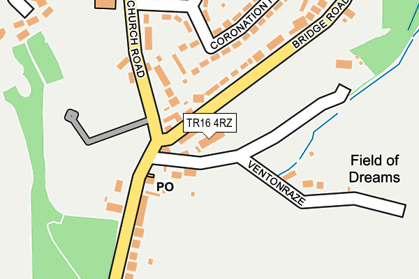
TR16 4RZ lies on Ventonraze Terrace in Illogan, Redruth. TR16 4RZ is located in the Illogan & Portreath electoral ward, within the unitary authority of Cornwall and the English Parliamentary constituency of Camborne and Redruth. The Sub Integrated Care Board (ICB) Location is NHS Cornwall and the Isles of Scilly ICB - 11N and the police force is Devon & Cornwall. This postcode has been in use since January 1980.


GetTheData
Source: OS OpenMap – Local (Ordnance Survey)
Source: OS VectorMap District (Ordnance Survey)
Licence: Open Government Licence (requires attribution)
| Easting | 167287 |
| Northing | 43788 |
| Latitude | 50.248138 |
| Longitude | -5.265594 |
GetTheData
Source: Open Postcode Geo
Licence: Open Government Licence
| Street | Ventonraze Terrace |
| Locality | Illogan |
| Town/City | Redruth |
| Country | England |
| Postcode District | TR16 |
| ➜ TR16 open data dashboard ➜ See where TR16 is on a map ➜ Where is Illogan? | |
GetTheData
Source: Land Registry Price Paid Data
Licence: Open Government Licence
Elevation or altitude of TR16 4RZ as distance above sea level:
| Metres | Feet | |
|---|---|---|
| Elevation | 70m | 230ft |
Elevation is measured from the approximate centre of the postcode, to the nearest point on an OS contour line from OS Terrain 50, which has contour spacing of ten vertical metres.
➜ How high above sea level am I? Find the elevation of your current position using your device's GPS.
GetTheData
Source: Open Postcode Elevation
Licence: Open Government Licence
| Ward | Illogan & Portreath |
| Constituency | Camborne And Redruth |
GetTheData
Source: ONS Postcode Database
Licence: Open Government Licence
| June 2022 | Anti-social behaviour | On or near Coronation Road | 215m |
| June 2022 | Violence and sexual offences | On or near Oxland Road | 220m |
| June 2022 | Violence and sexual offences | On or near Oxland Road | 220m |
| ➜ Get more crime data in our Crime section | |||
GetTheData
Source: data.police.uk
Licence: Open Government Licence
| Bridge Road | Paynter's Lane End | 48m |
| Bottom Of Church Road | Paynter's Lane End | 89m |
| Robartes Arms (Robartes Terrace) | Illogan | 267m |
| Church Road | Nance | 267m |
| Robartes Arms (Robartes Terrace) | Illogan | 275m |
| Redruth Station | 3.3km |
| Camborne Station | 4.8km |
GetTheData
Source: NaPTAN
Licence: Open Government Licence
| Percentage of properties with Next Generation Access | 100.0% |
| Percentage of properties with Superfast Broadband | 100.0% |
| Percentage of properties with Ultrafast Broadband | 0.0% |
| Percentage of properties with Full Fibre Broadband | 0.0% |
Superfast Broadband is between 30Mbps and 300Mbps
Ultrafast Broadband is > 300Mbps
| Percentage of properties unable to receive 2Mbps | 0.0% |
| Percentage of properties unable to receive 5Mbps | 0.0% |
| Percentage of properties unable to receive 10Mbps | 0.0% |
| Percentage of properties unable to receive 30Mbps | 0.0% |
GetTheData
Source: Ofcom
Licence: Ofcom Terms of Use (requires attribution)
GetTheData
Source: ONS Postcode Database
Licence: Open Government Licence


➜ Get more ratings from the Food Standards Agency
GetTheData
Source: Food Standards Agency
Licence: FSA terms & conditions
| Last Collection | |||
|---|---|---|---|
| Location | Mon-Fri | Sat | Distance |
| Illogan | 17:00 | 10:15 | 275m |
| Pool | 17:00 | 11:30 | 1,874m |
| Barncoose Terrace | 17:30 | 09:00 | 2,313m |
GetTheData
Source: Dracos
Licence: Creative Commons Attribution-ShareAlike
| Facility | Distance |
|---|---|
| Illogan Primary School (Closed) Churchtown, Illogan, Redruth Grass Pitches | 456m |
| Illogan Park Sports Ground Paynters Lane End, Redruth Grass Pitches | 567m |
| Oxland Park Richards Lane, Paynters Lane, Redruth Grass Pitches | 737m |
GetTheData
Source: Active Places
Licence: Open Government Licence
| School | Phase of Education | Distance |
|---|---|---|
| Illogan School Churchtown, Illogan, Churchtown, Illogan, Redruth, TR16 4SW | Primary | 417m |
| Portreath Community Primary School Penberthy Road, Portreath, Redruth, TR16 4LU | Primary | 1.8km |
| Treloweth Community Primary School Higher Broadlane, Redruth, TR15 3JL | Primary | 1.8km |
GetTheData
Source: Edubase
Licence: Open Government Licence
The below table lists the International Territorial Level (ITL) codes (formerly Nomenclature of Territorial Units for Statistics (NUTS) codes) and Local Administrative Units (LAU) codes for TR16 4RZ:
| ITL 1 Code | Name |
|---|---|
| TLK | South West (England) |
| ITL 2 Code | Name |
| TLK3 | Cornwall and Isles of Scilly |
| ITL 3 Code | Name |
| TLK30 | Cornwall and Isles of Scilly |
| LAU 1 Code | Name |
| E06000052 | Cornwall |
GetTheData
Source: ONS Postcode Directory
Licence: Open Government Licence
The below table lists the Census Output Area (OA), Lower Layer Super Output Area (LSOA), and Middle Layer Super Output Area (MSOA) for TR16 4RZ:
| Code | Name | |
|---|---|---|
| OA | E00095385 | |
| LSOA | E01018889 | Cornwall 045A |
| MSOA | E02003918 | Cornwall 045 |
GetTheData
Source: ONS Postcode Directory
Licence: Open Government Licence
| TR16 4RY | Ventonraze | 28m |
| TR16 4SR | Church Road | 170m |
| TR16 4RX | Robartes Terrace | 200m |
| TR16 4SQ | Coronation Road | 200m |
| TR16 4SA | Bridge Road | 211m |
| TR16 4SG | Coronation Road | 215m |
| TR16 4SH | Oxland Road | 232m |
| TR16 4SS | 278m | |
| TR16 4QY | Langwedh Estate | 321m |
| TR16 4SJ | Churchtown Road | 324m |
GetTheData
Source: Open Postcode Geo; Land Registry Price Paid Data
Licence: Open Government Licence