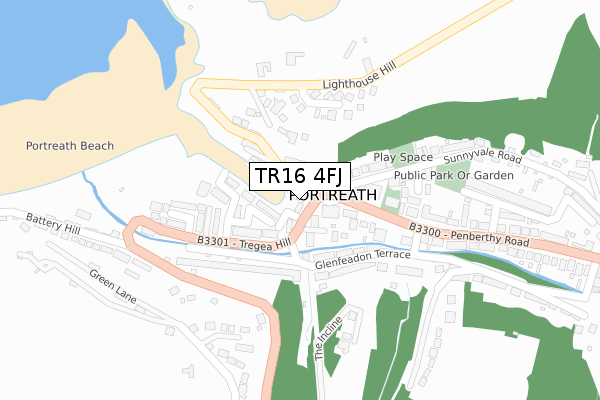
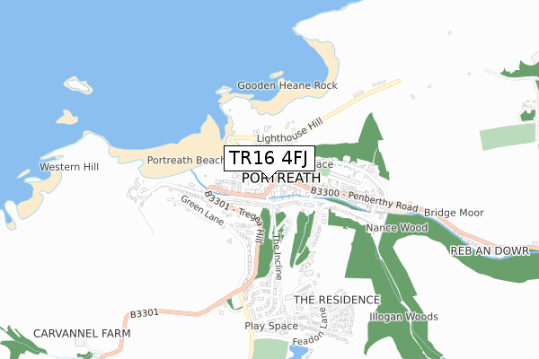
TR16 4FJ is located in the Illogan & Portreath electoral ward, within the unitary authority of Cornwall and the English Parliamentary constituency of Camborne and Redruth. The Sub Integrated Care Board (ICB) Location is NHS Cornwall and the Isles of Scilly ICB - 11N and the police force is Devon & Cornwall. This postcode has been in use since May 2018.


GetTheData
Source: OS Open Zoomstack (Ordnance Survey)
Licence: Open Government Licence (requires attribution)
Attribution: Contains OS data © Crown copyright and database right 2024
Source: Open Postcode Geo
Licence: Open Government Licence (requires attribution)
Attribution: Contains OS data © Crown copyright and database right 2024; Contains Royal Mail data © Royal Mail copyright and database right 2024; Source: Office for National Statistics licensed under the Open Government Licence v.3.0
| Easting | 165693 |
| Northing | 45313 |
| Latitude | 50.261200 |
| Longitude | -5.288857 |
GetTheData
Source: Open Postcode Geo
Licence: Open Government Licence
| Country | England |
| Postcode District | TR16 |
| ➜ TR16 open data dashboard ➜ See where TR16 is on a map ➜ Where is Portreath? | |
GetTheData
Source: Land Registry Price Paid Data
Licence: Open Government Licence
| Ward | Illogan & Portreath |
| Constituency | Camborne And Redruth |
GetTheData
Source: ONS Postcode Database
Licence: Open Government Licence
AN DYJI, PORTREATH HARBOUR, PORTREATH, REDRUTH, TR16 4FJ 2016 26 FEB £50,000 |
GetTheData
Source: HM Land Registry Price Paid Data
Licence: Contains HM Land Registry data © Crown copyright and database right 2024. This data is licensed under the Open Government Licence v3.0.
| August 2022 | Other theft | On or near Battery Hill | 437m |
| August 2022 | Other theft | On or near Battery Hill | 437m |
| August 2022 | Anti-social behaviour | On or near Battery Hill | 437m |
| ➜ Get more crime data in our Crime section | |||
GetTheData
Source: data.police.uk
Licence: Open Government Licence
| The Square | Portreath | 20m |
| The Square (Tregea Terrace) | Portreath | 54m |
| Tregea Terrace | Portreath | 83m |
| Tregea Terrace | Portreath | 87m |
| Beach Car Park | Portreath | 256m |
| Redruth Station | 5.5km |
GetTheData
Source: NaPTAN
Licence: Open Government Licence
GetTheData
Source: ONS Postcode Database
Licence: Open Government Licence


➜ Get more ratings from the Food Standards Agency
GetTheData
Source: Food Standards Agency
Licence: FSA terms & conditions
| Last Collection | |||
|---|---|---|---|
| Location | Mon-Fri | Sat | Distance |
| Portreath Beach | 16:35 | 10:15 | 258m |
| Illogan | 17:00 | 10:15 | 2,114m |
| Pool | 17:00 | 11:30 | 3,383m |
GetTheData
Source: Dracos
Licence: Creative Commons Attribution-ShareAlike
| Facility | Distance |
|---|---|
| Portreath Community Primary School Penberthy Road, Portreath, Redruth Grass Pitches | 525m |
| Raf Portreath Portreath, Redruth Grass Pitches | 1.4km |
| Harris Mill Village Hall (Closed) Bridge, Redruth Sports Hall | 1.7km |
GetTheData
Source: Active Places
Licence: Open Government Licence
| School | Phase of Education | Distance |
|---|---|---|
| Portreath Community Primary School Penberthy Road, Portreath, Redruth, TR16 4LU | Primary | 525m |
| Illogan School Churchtown, Illogan, Churchtown, Illogan, Redruth, TR16 4SW | Primary | 1.8km |
| Pool Academy Church Road, Pool, Redruth, TR15 3PZ | Secondary | 3.8km |
GetTheData
Source: Edubase
Licence: Open Government Licence
| Risk of TR16 4FJ flooding from rivers and sea | High |
| ➜ TR16 4FJ flood map | |
GetTheData
Source: Open Flood Risk by Postcode
Licence: Open Government Licence
The below table lists the International Territorial Level (ITL) codes (formerly Nomenclature of Territorial Units for Statistics (NUTS) codes) and Local Administrative Units (LAU) codes for TR16 4FJ:
| ITL 1 Code | Name |
|---|---|
| TLK | South West (England) |
| ITL 2 Code | Name |
| TLK3 | Cornwall and Isles of Scilly |
| ITL 3 Code | Name |
| TLK30 | Cornwall and Isles of Scilly |
| LAU 1 Code | Name |
| E06000052 | Cornwall |
GetTheData
Source: ONS Postcode Directory
Licence: Open Government Licence
The below table lists the Census Output Area (OA), Lower Layer Super Output Area (LSOA), and Middle Layer Super Output Area (MSOA) for TR16 4FJ:
| Code | Name | |
|---|---|---|
| OA | E00095401 | |
| LSOA | E01018892 | Cornwall 045D |
| MSOA | E02003918 | Cornwall 045 |
GetTheData
Source: ONS Postcode Directory
Licence: Open Government Licence
| TR16 4LG | Cayforth | 29m |
| TR16 4NH | Harbour Court | 49m |
| TR16 4LA | The Square | 53m |
| TR16 4LE | Cliff Terrace | 56m |
| TR16 4NQ | Forth An Nance | 60m |
| TR16 4LX | Kingsley Terrace | 75m |
| TR16 4LF | Harbour Terrace | 110m |
| TR16 4LD | Railway Terrace | 122m |
| TR16 4LN | Penberthy Road | 129m |
| TR16 4NL | Chynance | 137m |
GetTheData
Source: Open Postcode Geo; Land Registry Price Paid Data
Licence: Open Government Licence