Harris Mill Village Hall (Closed) - Bridge
Harris Mill Village Hall (Closed) is located in Bridge, Redruth (TR16).
| Address | Bridge, Redruth, TR16 4QW |
| Car Park | Yes |
| Car Park Capacity | 10 |
| Management Type | Community Organisation |
| Management Group | Others |
| Owner Type | Community Organisation |
| Owner Group | Community Organisation |
| Education Phase | Not applicable |
| Closure Date | 1st Jun 2019 |
| Closure Reason | Strategic Review - facility/site not being replaced |
Aliases
Harris Mill Village Hall (Closed) is also known as:
Facilities
| Status Notes | Roof problem so building is shut - looking for funding to amend this |
| Closure Date | 1st Jun 2019 |
| Closure Reason | Strategic Review - facility/site not being replaced |
| Accessibility | Sports Club / Community Association |
| Management Type | Community Organisation |
| Year Built | 1960 |
| Changing Rooms | No |
| Date Record Checked | 21st Jan 2022 |
Opening times
| Access description | Sports Club / Community Association |
|---|
| Opening time | 09:00 |
| Closing time | 22:00 |
| Period open for | Every day |
Facility specifics
| Area | 180m² |
| Floor Matting | Don't Know |
| Gymnastics Trampoline Use | Don't Know |
| Length | 18m |
| Moveable Balance Apparatus | Don't Know |
| Moveable Large Apparatus | Don't Know |
| Moveable Rebound Apparatus | Don't Know |
| Moveable Trampolines | Don't Know |
| Width | 10m |
| Small Apparatus | Don't Know |
| Swinging and Hanging Apparatus | Don't Know |
Disabled access
| Disabled Access | Yes |
| Doorways | Yes |
Contact
Disabled access
Disabled access for Harris Mill Village Hall (Closed)
| Disabled Access | Yes |
| Doorways | Yes |
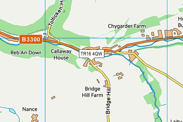
Where is Harris Mill Village Hall (Closed)?
| Sub Building Name | |
| Building Name | |
| Building Number | 0 |
| Dependent Thoroughfare | |
| Thoroughfare Name | |
| Double Dependent Locality | |
| Dependent Locality | BRIDGE |
| PostTown | REDRUTH |
| Postcode | TR16 4QW |
Harris Mill Village Hall (Closed) on a map

Harris Mill Village Hall (Closed) geodata
| Easting | 167330.48 |
| Northing | 44792.46 |
| Latitude | 50.257183 |
| Longitude | -5.265553 |
| Local Authority Name | Cornwall |
| Local Authority Code | E06000052 |
| Parliamentary Constituency Name | Camborne and Redruth |
| Parliamentary Constituency Code | E14000616 |
| Region Name | South West |
| Region Code | E15000009 |
| Ward Name | Mount Hawke and Portreath |
| Ward Code | E05009214 |
| Output Area Code | E00095400 |
About this data
This data is open data sourced from Active Places Power and licenced under the Active Places Open Data Licence.
| Created On | 10th Feb 2014 |
| Audited On | 17th Nov 2020 |
| Checked On | 18th Jan 2022 |
