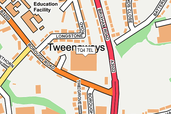
TQ4 7EL is located in the Collaton St Mary electoral ward, within the unitary authority of Torbay and the English Parliamentary constituency of Totnes. The Sub Integrated Care Board (ICB) Location is NHS Devon ICB - 15N and the police force is Devon & Cornwall. This postcode has been in use since April 1987.


GetTheData
Source: OS OpenMap – Local (Ordnance Survey)
Source: OS VectorMap District (Ordnance Survey)
Licence: Open Government Licence (requires attribution)
| Easting | 287232 |
| Northing | 59653 |
| Latitude | 50.425874 |
| Longitude | -3.588912 |
GetTheData
Source: Open Postcode Geo
Licence: Open Government Licence
| Country | England |
| Postcode District | TQ4 |
| ➜ TQ4 open data dashboard ➜ See where TQ4 is on a map ➜ Where is Paignton? | |
GetTheData
Source: Land Registry Price Paid Data
Licence: Open Government Licence
Elevation or altitude of TQ4 7EL as distance above sea level:
| Metres | Feet | |
|---|---|---|
| Elevation | 50m | 164ft |
Elevation is measured from the approximate centre of the postcode, to the nearest point on an OS contour line from OS Terrain 50, which has contour spacing of ten vertical metres.
➜ How high above sea level am I? Find the elevation of your current position using your device's GPS.
GetTheData
Source: Open Postcode Elevation
Licence: Open Government Licence
| Ward | Collaton St Mary |
| Constituency | Totnes |
GetTheData
Source: ONS Postcode Database
Licence: Open Government Licence
| June 2022 | Anti-social behaviour | On or near Sports/Recreation Area | 86m |
| June 2022 | Shoplifting | On or near Sports/Recreation Area | 86m |
| June 2022 | Violence and sexual offences | On or near Longstone Road | 169m |
| ➜ Get more crime data in our Crime section | |||
GetTheData
Source: data.police.uk
Licence: Open Government Licence
| Bookers (Brixham Road) | Paignton | 94m |
| Bookers (Brixham Road) | Paignton | 108m |
| Borough Road | Yalberton | 122m |
| Harbourne Avenue (Roselands Drive) | Roselands | 285m |
| Roselands Drive | Roselands | 297m |
| Paignton Station | 2km |
| Torquay Station | 5.1km |
GetTheData
Source: NaPTAN
Licence: Open Government Licence
GetTheData
Source: ONS Postcode Database
Licence: Open Government Licence


➜ Get more ratings from the Food Standards Agency
GetTheData
Source: Food Standards Agency
Licence: FSA terms & conditions
| Last Collection | |||
|---|---|---|---|
| Location | Mon-Fri | Sat | Distance |
| Ayreville | 17:15 | 08:30 | 757m |
| Lulworth Close | 17:15 | 12:30 | 961m |
| Kings Ash Hill | 17:30 | 12:30 | 1,065m |
GetTheData
Source: Dracos
Licence: Creative Commons Attribution-ShareAlike
| Facility | Distance |
|---|---|
| Paignton Community & Sports Academy (Borough Road) Borough Road, Paignton Sports Hall, Swimming Pool, Health and Fitness Gym, Grass Pitches, Studio | 293m |
| Paignton Community & Sports Academy (Waterleat Road) Waterleat Road, Paignton Sports Hall, Artificial Grass Pitch, Grass Pitches | 516m |
| Winners 2000 Fitness Limited (Paignton) Aspen Way, Paignton Health and Fitness Gym, Studio | 641m |
GetTheData
Source: Active Places
Licence: Open Government Licence
| School | Phase of Education | Distance |
|---|---|---|
| Cambian Devon School Intek House, 52 Borough Road, Paignton, TQ4 7DQ | Not applicable | 193m |
| Paignton Academy Waterleat Road, Paignton, TQ3 3WA | Secondary | 517m |
| Hayes School Hayes Road, Paignton, TQ4 5PJ | Primary | 893m |
GetTheData
Source: Edubase
Licence: Open Government Licence
The below table lists the International Territorial Level (ITL) codes (formerly Nomenclature of Territorial Units for Statistics (NUTS) codes) and Local Administrative Units (LAU) codes for TQ4 7EL:
| ITL 1 Code | Name |
|---|---|
| TLK | South West (England) |
| ITL 2 Code | Name |
| TLK4 | Devon |
| ITL 3 Code | Name |
| TLK42 | Torbay |
| LAU 1 Code | Name |
| E06000027 | Torbay |
GetTheData
Source: ONS Postcode Directory
Licence: Open Government Licence
The below table lists the Census Output Area (OA), Lower Layer Super Output Area (LSOA), and Middle Layer Super Output Area (MSOA) for TQ4 7EL:
| Code | Name | |
|---|---|---|
| OA | E00076785 | |
| LSOA | E01015195 | Torbay 013F |
| MSOA | E02003166 | Torbay 013 |
GetTheData
Source: ONS Postcode Directory
Licence: Open Government Licence
| TQ4 7AY | Cleatlands Close | 90m |
| TQ4 7HN | Longstone Road | 104m |
| TQ4 7DQ | Borough Road | 129m |
| TQ4 7EZ | Battersway Road | 132m |
| TQ4 7HG | Brixham Road | 136m |
| TQ4 7HL | Longstone Road | 144m |
| TQ4 7DL | The Grove | 154m |
| TQ4 7HJ | Kingsland Drive | 159m |
| TQ4 7DH | Borough Road | 190m |
| TQ4 7HQ | Brixham Road | 192m |
GetTheData
Source: Open Postcode Geo; Land Registry Price Paid Data
Licence: Open Government Licence