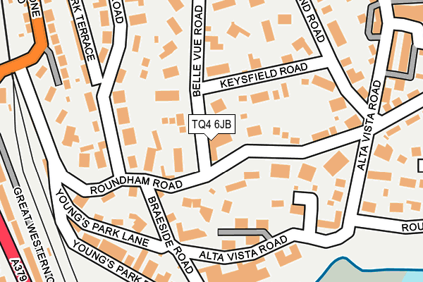
TQ4 6JB is located in the Roundham with Hyde electoral ward, within the unitary authority of Torbay and the English Parliamentary constituency of Torbay. The Sub Integrated Care Board (ICB) Location is NHS Devon ICB - 15N and the police force is Devon & Cornwall. This postcode has been in use since October 2004.


GetTheData
Source: OS OpenMap – Local (Ordnance Survey)
Source: OS VectorMap District (Ordnance Survey)
Licence: Open Government Licence (requires attribution)
| Easting | 289237 |
| Northing | 60046 |
| Latitude | 50.429774 |
| Longitude | -3.560829 |
GetTheData
Source: Open Postcode Geo
Licence: Open Government Licence
| Country | England |
| Postcode District | TQ4 |
| ➜ TQ4 open data dashboard ➜ See where TQ4 is on a map ➜ Where is Paignton? | |
GetTheData
Source: Land Registry Price Paid Data
Licence: Open Government Licence
Elevation or altitude of TQ4 6JB as distance above sea level:
| Metres | Feet | |
|---|---|---|
| Elevation | 30m | 98ft |
Elevation is measured from the approximate centre of the postcode, to the nearest point on an OS contour line from OS Terrain 50, which has contour spacing of ten vertical metres.
➜ How high above sea level am I? Find the elevation of your current position using your device's GPS.
GetTheData
Source: Open Postcode Elevation
Licence: Open Government Licence
| Ward | Roundham With Hyde |
| Constituency | Torbay |
GetTheData
Source: ONS Postcode Database
Licence: Open Government Licence
| June 2022 | Criminal damage and arson | On or near Braeside Road | 168m |
| June 2022 | Violence and sexual offences | On or near Cleveland Road | 223m |
| June 2022 | Violence and sexual offences | On or near Cleveland Road | 223m |
| ➜ Get more crime data in our Crime section | |||
GetTheData
Source: data.police.uk
Licence: Open Government Licence
| Braeside Road (Alta Vista Road) | Paignton | 162m |
| Alta Vista Road | Roundham Head | 193m |
| Alta Vista Road | Paignton | 198m |
| Youngs Park (Young's Park Road) | Paignton | 239m |
| Harbour (Roundham Road) | Paignton | 325m |
| Goodrington (Paignton And Dartmouth Railway) (Tanners Road) | Paignton | 496m |
| Paignton (Paignton And Dartmouth Railway) (Great Western Road) | Paignton | 610m |
| Paignton Station | 0.6km |
| Torquay Station | 3.7km |
| Torre Station | 4.9km |
GetTheData
Source: NaPTAN
Licence: Open Government Licence
GetTheData
Source: ONS Postcode Database
Licence: Open Government Licence


➜ Get more ratings from the Food Standards Agency
GetTheData
Source: Food Standards Agency
Licence: FSA terms & conditions
| Last Collection | |||
|---|---|---|---|
| Location | Mon-Fri | Sat | Distance |
| Alta Vista | 17:30 | 12:00 | 208m |
| Sands Road | 17:30 | 12:00 | 331m |
| The Harbour Post Office | 17:00 | 12:00 | 346m |
GetTheData
Source: Dracos
Licence: Creative Commons Attribution-ShareAlike
| Facility | Distance |
|---|---|
| Queens Park Sports Club Queens Road, Paignton Grass Pitches | 493m |
| Splashdown Quaywest Tanners Road, Paignton Swimming Pool | 599m |
| Torbay Leisure Centre Penwill Way, Paignton Sports Hall, Swimming Pool, Health and Fitness Gym, Artificial Grass Pitch, Studio, Squash Courts | 652m |
GetTheData
Source: Active Places
Licence: Open Government Licence
| School | Phase of Education | Distance |
|---|---|---|
| Curledge Street Academy Curledge Street, Paignton, TQ4 5BA | Primary | 667m |
| St Michael's Church of England Academy Fisher Street, Paignton, TQ4 5EW | Primary | 710m |
| Hayes School Hayes Road, Paignton, TQ4 5PJ | Primary | 1.2km |
GetTheData
Source: Edubase
Licence: Open Government Licence
The below table lists the International Territorial Level (ITL) codes (formerly Nomenclature of Territorial Units for Statistics (NUTS) codes) and Local Administrative Units (LAU) codes for TQ4 6JB:
| ITL 1 Code | Name |
|---|---|
| TLK | South West (England) |
| ITL 2 Code | Name |
| TLK4 | Devon |
| ITL 3 Code | Name |
| TLK42 | Torbay |
| LAU 1 Code | Name |
| E06000027 | Torbay |
GetTheData
Source: ONS Postcode Directory
Licence: Open Government Licence
The below table lists the Census Output Area (OA), Lower Layer Super Output Area (LSOA), and Middle Layer Super Output Area (MSOA) for TQ4 6JB:
| Code | Name | |
|---|---|---|
| OA | E00076963 | |
| LSOA | E01015235 | Torbay 014F |
| MSOA | E02003167 | Torbay 014 |
GetTheData
Source: ONS Postcode Directory
Licence: Open Government Licence
| TQ4 6JA | Roundham Road | 0m |
| TQ4 6HD | Belle Vue Road | 62m |
| TQ4 6DN | Roundham Road | 73m |
| TQ4 6BR | Keysfield Road | 77m |
| TQ4 6EP | Keysfield Road | 84m |
| TQ4 6DR | Roundham Road | 92m |
| TQ4 6JP | Keysfield Road | 99m |
| TQ4 6PA | Belle Vue Road | 110m |
| TQ4 6EA | Belle Vue Road | 123m |
| TQ4 6ET | Belle Vue Road | 136m |
GetTheData
Source: Open Postcode Geo; Land Registry Price Paid Data
Licence: Open Government Licence