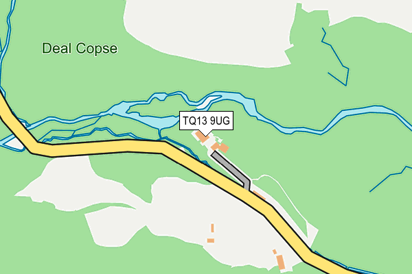
TQ13 9UG is in Manaton, Newton Abbot. TQ13 9UG is located in the Moretonhampstead electoral ward, within the local authority district of Teignbridge and the English Parliamentary constituency of Central Devon. The Sub Integrated Care Board (ICB) Location is NHS Devon ICB - 15N and the police force is Devon & Cornwall. This postcode has been in use since January 1980.


GetTheData
Source: OS OpenMap – Local (Ordnance Survey)
Source: OS VectorMap District (Ordnance Survey)
Licence: Open Government Licence (requires attribution)
| Easting | 276045 |
| Northing | 80043 |
| Latitude | 50.606888 |
| Longitude | -3.753125 |
GetTheData
Source: Open Postcode Geo
Licence: Open Government Licence
| Locality | Manaton |
| Town/City | Newton Abbot |
| Country | England |
| Postcode District | TQ13 |
| ➜ TQ13 open data dashboard ➜ See where TQ13 is on a map | |
GetTheData
Source: Land Registry Price Paid Data
Licence: Open Government Licence
Elevation or altitude of TQ13 9UG as distance above sea level:
| Metres | Feet | |
|---|---|---|
| Elevation | 220m | 722ft |
Elevation is measured from the approximate centre of the postcode, to the nearest point on an OS contour line from OS Terrain 50, which has contour spacing of ten vertical metres.
➜ How high above sea level am I? Find the elevation of your current position using your device's GPS.
GetTheData
Source: Open Postcode Elevation
Licence: Open Government Licence
| Ward | Moretonhampstead |
| Constituency | Central Devon |
GetTheData
Source: ONS Postcode Database
Licence: Open Government Licence
| Becky Falls | Manaton | 208m |
| Becky Falls | Manaton | 211m |
| The Forge | Manaton | 880m |
| The Forge | Manaton | 884m |
| Bus Shelter | Manaton | 1,522m |
GetTheData
Source: NaPTAN
Licence: Open Government Licence
| Percentage of properties with Next Generation Access | 100.0% |
| Percentage of properties with Superfast Broadband | 33.3% |
| Percentage of properties with Ultrafast Broadband | 0.0% |
| Percentage of properties with Full Fibre Broadband | 0.0% |
Superfast Broadband is between 30Mbps and 300Mbps
Ultrafast Broadband is > 300Mbps
| Percentage of properties unable to receive 2Mbps | 0.0% |
| Percentage of properties unable to receive 5Mbps | 0.0% |
| Percentage of properties unable to receive 10Mbps | 0.0% |
| Percentage of properties unable to receive 30Mbps | 66.7% |
GetTheData
Source: Ofcom
Licence: Ofcom Terms of Use (requires attribution)
GetTheData
Source: ONS Postcode Database
Licence: Open Government Licence


➜ Get more ratings from the Food Standards Agency
GetTheData
Source: Food Standards Agency
Licence: FSA terms & conditions
| Last Collection | |||
|---|---|---|---|
| Location | Mon-Fri | Sat | Distance |
| Old Manaton Post Office | 12:00 | 11:30 | 798m |
| Manaton Green | 15:30 | 11:30 | 1,555m |
| Ashburton Post Office | 17:30 | 12:30 | 2,715m |
GetTheData
Source: Dracos
Licence: Creative Commons Attribution-ShareAlike
| Facility | Distance |
|---|---|
| Lustleigh Cricket Field Wreylands Sports Field, Lustleigh, Newton Abbot Grass Pitches | 2.9km |
| Ilsington Country House Hotel Ilsington, Newton Abbot Health and Fitness Gym, Swimming Pool | 4.4km |
| Ilsington Playing Field Honeywell Lane, Ilsington Grass Pitches, Outdoor Tennis Courts | 4.6km |
GetTheData
Source: Active Places
Licence: Open Government Licence
| School | Phase of Education | Distance |
|---|---|---|
| Ilsington Church of England Primary School Ilsington, Newton Abbot, TQ13 9RE | Primary | 4.6km |
| Widecombe-in-the-Moor Primary Widecombe-in-the-Moor, Newton Abbot, TQ13 7TB | Primary | 5.4km |
GetTheData
Source: Edubase
Licence: Open Government Licence
The below table lists the International Territorial Level (ITL) codes (formerly Nomenclature of Territorial Units for Statistics (NUTS) codes) and Local Administrative Units (LAU) codes for TQ13 9UG:
| ITL 1 Code | Name |
|---|---|
| TLK | South West (England) |
| ITL 2 Code | Name |
| TLK4 | Devon |
| ITL 3 Code | Name |
| TLK43 | Devon CC |
| LAU 1 Code | Name |
| E07000045 | Teignbridge |
GetTheData
Source: ONS Postcode Directory
Licence: Open Government Licence
The below table lists the Census Output Area (OA), Lower Layer Super Output Area (LSOA), and Middle Layer Super Output Area (MSOA) for TQ13 9UG:
| Code | Name | |
|---|---|---|
| OA | E00102605 | |
| LSOA | E01020259 | Teignbridge 003C |
| MSOA | E02004203 | Teignbridge 003 |
GetTheData
Source: ONS Postcode Directory
Licence: Open Government Licence
| TQ13 9XH | 378m | |
| TQ13 9UE | Mellowmead | 718m |
| TQ13 9UB | 778m | |
| TQ13 9UF | 783m | |
| TQ13 9UA | 845m | |
| TQ13 9UW | 984m | |
| TQ13 9UP | 997m | |
| TQ13 9UH | 1025m | |
| TQ13 9UJ | 1657m | |
| TQ13 9UL | 1690m |
GetTheData
Source: Open Postcode Geo; Land Registry Price Paid Data
Licence: Open Government Licence