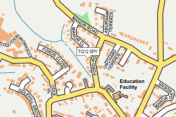
TQ12 5PY lies on Abbotswell Cottages in Abbotskerswell, Newton Abbot. TQ12 5PY is located in the Ambrook electoral ward, within the local authority district of Teignbridge and the English Parliamentary constituency of Newton Abbot. The Sub Integrated Care Board (ICB) Location is NHS Devon ICB - 15N and the police force is Devon & Cornwall. This postcode has been in use since January 1980.


GetTheData
Source: OS OpenMap – Local (Ordnance Survey)
Source: OS VectorMap District (Ordnance Survey)
Licence: Open Government Licence (requires attribution)
| Easting | 285534 |
| Northing | 69059 |
| Latitude | 50.510100 |
| Longitude | -3.615687 |
GetTheData
Source: Open Postcode Geo
Licence: Open Government Licence
| Street | Abbotswell Cottages |
| Locality | Abbotskerswell |
| Town/City | Newton Abbot |
| Country | England |
| Postcode District | TQ12 |
| ➜ TQ12 open data dashboard ➜ See where TQ12 is on a map ➜ Where is Abbotskerswell? | |
GetTheData
Source: Land Registry Price Paid Data
Licence: Open Government Licence
Elevation or altitude of TQ12 5PY as distance above sea level:
| Metres | Feet | |
|---|---|---|
| Elevation | 40m | 131ft |
Elevation is measured from the approximate centre of the postcode, to the nearest point on an OS contour line from OS Terrain 50, which has contour spacing of ten vertical metres.
➜ How high above sea level am I? Find the elevation of your current position using your device's GPS.
GetTheData
Source: Open Postcode Elevation
Licence: Open Government Licence
| Ward | Ambrook |
| Constituency | Newton Abbot |
GetTheData
Source: ONS Postcode Database
Licence: Open Government Licence
| June 2022 | Anti-social behaviour | On or near South View | 351m |
| December 2021 | Shoplifting | On or near The Orchard | 210m |
| October 2021 | Vehicle crime | On or near Manor Gardens | 293m |
| ➜ Get more crime data in our Crime section | |||
GetTheData
Source: data.police.uk
Licence: Open Government Licence
| Abbots Stores (Slade Lane) | Abbotskerswell | 177m |
| Model Cottages (Slade Lane) | Abbotskerswell | 232m |
| Corn Park Road (Wilton Way) | Abbotskerswell | 311m |
| Corn Park Road (Wilton Way) | Abbotskerswell | 315m |
| Beechcroft (Odle Hill) | Abbotskerswell | 353m |
| Newton Abbot Station | 2.5km |
| Torre Station | 6.4km |
GetTheData
Source: NaPTAN
Licence: Open Government Licence
| Percentage of properties with Next Generation Access | 100.0% |
| Percentage of properties with Superfast Broadband | 100.0% |
| Percentage of properties with Ultrafast Broadband | 0.0% |
| Percentage of properties with Full Fibre Broadband | 0.0% |
Superfast Broadband is between 30Mbps and 300Mbps
Ultrafast Broadband is > 300Mbps
| Percentage of properties unable to receive 2Mbps | 0.0% |
| Percentage of properties unable to receive 5Mbps | 0.0% |
| Percentage of properties unable to receive 10Mbps | 0.0% |
| Percentage of properties unable to receive 30Mbps | 0.0% |
GetTheData
Source: Ofcom
Licence: Ofcom Terms of Use (requires attribution)
GetTheData
Source: ONS Postcode Database
Licence: Open Government Licence


➜ Get more ratings from the Food Standards Agency
GetTheData
Source: Food Standards Agency
Licence: FSA terms & conditions
| Last Collection | |||
|---|---|---|---|
| Location | Mon-Fri | Sat | Distance |
| Canada Hill | 17:15 | 11:45 | 1,393m |
| South Road | 17:30 | 13:00 | 1,622m |
| Ogwell Green | 17:00 | 11:45 | 1,690m |
GetTheData
Source: Dracos
Licence: Creative Commons Attribution-ShareAlike
| Facility | Distance |
|---|---|
| Abbotskerswell Recreation Ground Barnfield Terrace, Abbotskerswell Grass Pitches | 530m |
| Abbotskerswell Cricket Club Road From Two Mile Oak To Spinners Moon, Two Mile Oak Grass Pitches | 1km |
| Canada Hill Community Primary School Abbotsridge Drive, Ogwell, Newton Abbot Grass Pitches | 1.4km |
GetTheData
Source: Active Places
Licence: Open Government Licence
| School | Phase of Education | Distance |
|---|---|---|
| Abbotskerswell Primary School Slade Lane, Abbotskerswell, Newton Abbot, TQ12 5NS | Primary | 159m |
| Canada Hill Community Primary School Abbotsridge Drive, East Ogwell, Newton Abbot, TQ12 6YS | Primary | 1.4km |
| Decoy Primary School Deer Park Road, Newton Abbot, TQ12 1DH | Primary | 1.7km |
GetTheData
Source: Edubase
Licence: Open Government Licence
The below table lists the International Territorial Level (ITL) codes (formerly Nomenclature of Territorial Units for Statistics (NUTS) codes) and Local Administrative Units (LAU) codes for TQ12 5PY:
| ITL 1 Code | Name |
|---|---|
| TLK | South West (England) |
| ITL 2 Code | Name |
| TLK4 | Devon |
| ITL 3 Code | Name |
| TLK43 | Devon CC |
| LAU 1 Code | Name |
| E07000045 | Teignbridge |
GetTheData
Source: ONS Postcode Directory
Licence: Open Government Licence
The below table lists the Census Output Area (OA), Lower Layer Super Output Area (LSOA), and Middle Layer Super Output Area (MSOA) for TQ12 5PY:
| Code | Name | |
|---|---|---|
| OA | E00102282 | |
| LSOA | E01020192 | Teignbridge 019A |
| MSOA | E02004219 | Teignbridge 019 |
GetTheData
Source: ONS Postcode Directory
Licence: Open Government Licence
| TQ12 5PS | Orchard Terrace | 35m |
| TQ12 5YQ | Ford Road | 43m |
| TQ12 5PX | Manor Close | 77m |
| TQ12 5PU | Manor Road | 97m |
| TQ12 5YE | The Paddocks | 106m |
| TQ12 5QD | Borthay Orchard | 107m |
| TQ12 5NR | Well Cottages | 109m |
| TQ12 5NN | Forde Close | 114m |
| TQ12 5NW | 120m | |
| TQ12 5PT | Laburnum Terrace | 157m |
GetTheData
Source: Open Postcode Geo; Land Registry Price Paid Data
Licence: Open Government Licence