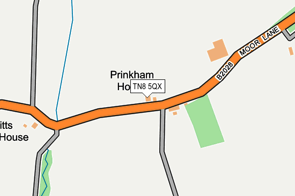
TN8 5QX lies on Moor Lane in Marsh Green, Edenbridge. TN8 5QX is located in the Dormansland and Felcourt electoral ward, within the local authority district of Tandridge and the English Parliamentary constituency of East Surrey. The Sub Integrated Care Board (ICB) Location is NHS Surrey Heartlands ICB - 92A and the police force is Surrey. This postcode has been in use since January 1980.


GetTheData
Source: OS OpenMap – Local (Ordnance Survey)
Source: OS VectorMap District (Ordnance Survey)
Licence: Open Government Licence (requires attribution)
| Easting | 542702 |
| Northing | 143466 |
| Latitude | 51.172636 |
| Longitude | 0.039909 |
GetTheData
Source: Open Postcode Geo
Licence: Open Government Licence
| Street | Moor Lane |
| Locality | Marsh Green |
| Town/City | Edenbridge |
| Country | England |
| Postcode District | TN8 |
| ➜ TN8 open data dashboard ➜ See where TN8 is on a map | |
GetTheData
Source: Land Registry Price Paid Data
Licence: Open Government Licence
Elevation or altitude of TN8 5QX as distance above sea level:
| Metres | Feet | |
|---|---|---|
| Elevation | 60m | 197ft |
Elevation is measured from the approximate centre of the postcode, to the nearest point on an OS contour line from OS Terrain 50, which has contour spacing of ten vertical metres.
➜ How high above sea level am I? Find the elevation of your current position using your device's GPS.
GetTheData
Source: Open Postcode Elevation
Licence: Open Government Licence
| Ward | Dormansland And Felcourt |
| Constituency | East Surrey |
GetTheData
Source: ONS Postcode Database
Licence: Open Government Licence
| New Barns Farm (Moor Lane) | Dormansland | 22m |
| New Barns Farm (Moor Lane) | Dormansland | 72m |
| Marsh Green Road (Moor Lane) | Dormansland | 351m |
| Marsh Green Road (Moor Lane) | Dormansland | 371m |
| Wheatsheaf (Marsh Green Road) | Marsh Green | 1,261m |
| Lingfield Station | 3.3km |
| Edenbridge Town Station | 3.6km |
| Dormans Station | 3.6km |
GetTheData
Source: NaPTAN
Licence: Open Government Licence
➜ Broadband speed and availability dashboard for TN8 5QX
| Percentage of properties with Next Generation Access | 100.0% |
| Percentage of properties with Superfast Broadband | 0.0% |
| Percentage of properties with Ultrafast Broadband | 0.0% |
| Percentage of properties with Full Fibre Broadband | 0.0% |
Superfast Broadband is between 30Mbps and 300Mbps
Ultrafast Broadband is > 300Mbps
| Median download speed | 3.7Mbps |
| Average download speed | 4.3Mbps |
| Maximum download speed | 6.74Mbps |
| Median upload speed | 0.6Mbps |
| Average upload speed | 0.7Mbps |
| Maximum upload speed | 1.18Mbps |
| Percentage of properties unable to receive 2Mbps | 0.0% |
| Percentage of properties unable to receive 5Mbps | 100.0% |
| Percentage of properties unable to receive 10Mbps | 100.0% |
| Percentage of properties unable to receive 30Mbps | 100.0% |
➜ Broadband speed and availability dashboard for TN8 5QX
GetTheData
Source: Ofcom
Licence: Ofcom Terms of Use (requires attribution)
GetTheData
Source: ONS Postcode Database
Licence: Open Government Licence


➜ Get more ratings from the Food Standards Agency
GetTheData
Source: Food Standards Agency
Licence: FSA terms & conditions
| Last Collection | |||
|---|---|---|---|
| Location | Mon-Fri | Sat | Distance |
| Marsh Green | 16:30 | 09:00 | 1,323m |
| Jeddere Cottages | 16:45 | 10:00 | 2,522m |
| Hollow Lane | 17:00 | 10:00 | 2,557m |
GetTheData
Source: Dracos
Licence: Creative Commons Attribution-ShareAlike
| Facility | Distance |
|---|---|
| St Piers School (Young Epilepsy) St. Piers Lane, Lingfield Grass Pitches, Health and Fitness Gym, Sports Hall | 2.4km |
| Blossoms Park Mill Hill, Edenbridge Grass Pitches | 2.6km |
| Lingfield Road Recreation Ground Coomb Field, Lingfield Road, Edenbridge Grass Pitches | 2.7km |
GetTheData
Source: Active Places
Licence: Open Government Licence
| School | Phase of Education | Distance |
|---|---|---|
| Lingfield College Racecourse Road, Lingfield, RH7 6PH | Not applicable | 1.9km |
| St Piers School St Pier's Lane, Lingfield, RH7 6PW | Not applicable | 2.4km |
| St Piers College (Young Epilepsy) St Piers Lane, Lingfield, RH7 6PW | Not applicable | 2.4km |
GetTheData
Source: Edubase
Licence: Open Government Licence
The below table lists the International Territorial Level (ITL) codes (formerly Nomenclature of Territorial Units for Statistics (NUTS) codes) and Local Administrative Units (LAU) codes for TN8 5QX:
| ITL 1 Code | Name |
|---|---|
| TLJ | South East (England) |
| ITL 2 Code | Name |
| TLJ2 | Surrey, East and West Sussex |
| ITL 3 Code | Name |
| TLJ26 | East Surrey |
| LAU 1 Code | Name |
| E07000215 | Tandridge |
GetTheData
Source: ONS Postcode Directory
Licence: Open Government Licence
The below table lists the Census Output Area (OA), Lower Layer Super Output Area (LSOA), and Middle Layer Super Output Area (MSOA) for TN8 5QX:
| Code | Name | |
|---|---|---|
| OA | E00157152 | |
| LSOA | E01030822 | Tandridge 010B |
| MSOA | E02006437 | Tandridge 010 |
GetTheData
Source: ONS Postcode Directory
Licence: Open Government Licence
| TN8 5QT | Moor Lane | 59m |
| TN8 5RA | Moor Lane | 372m |
| TN8 5QY | Moor Lane | 651m |
| TN8 5QU | Moor Lane | 678m |
| TN8 5RD | Starborough Road | 735m |
| TN8 5QS | Moor Lane | 763m |
| RH7 6NY | Moor Lane | 908m |
| TN8 5QP | Greybury Lane | 964m |
| TN8 5QR | Marsh Green Road | 1080m |
| TN8 5RB | Starborough Road | 1145m |
GetTheData
Source: Open Postcode Geo; Land Registry Price Paid Data
Licence: Open Government Licence