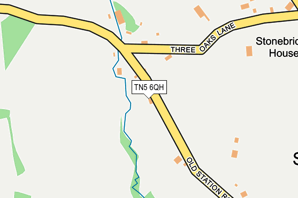
TN5 6QH lies on Old Station Road in Wadhurst. TN5 6QH is located in the Frant & Wadhurst electoral ward, within the local authority district of Wealden and the English Parliamentary constituency of Wealden. The Sub Integrated Care Board (ICB) Location is NHS Sussex ICB - 97R and the police force is Sussex. This postcode has been in use since January 1980.


GetTheData
Source: OS OpenMap – Local (Ordnance Survey)
Source: OS VectorMap District (Ordnance Survey)
Licence: Open Government Licence (requires attribution)
| Easting | 563271 |
| Northing | 132957 |
| Latitude | 51.072717 |
| Longitude | 0.329167 |
GetTheData
Source: Open Postcode Geo
Licence: Open Government Licence
| Street | Old Station Road |
| Town/City | Wadhurst |
| Country | England |
| Postcode District | TN5 |
| ➜ TN5 open data dashboard ➜ See where TN5 is on a map | |
GetTheData
Source: Land Registry Price Paid Data
Licence: Open Government Licence
Elevation or altitude of TN5 6QH as distance above sea level:
| Metres | Feet | |
|---|---|---|
| Elevation | 120m | 394ft |
Elevation is measured from the approximate centre of the postcode, to the nearest point on an OS contour line from OS Terrain 50, which has contour spacing of ten vertical metres.
➜ How high above sea level am I? Find the elevation of your current position using your device's GPS.
GetTheData
Source: Open Postcode Elevation
Licence: Open Government Licence
| Ward | Frant & Wadhurst |
| Constituency | Wealden |
GetTheData
Source: ONS Postcode Database
Licence: Open Government Licence
| May 2022 | Violence and sexual offences | On or near Queens Cottages | 396m |
| May 2022 | Vehicle crime | On or near Queens Cottages | 396m |
| May 2022 | Public order | On or near Sports/Recreation Area | 428m |
| ➜ Old Station Road crime map and outcomes | |||
GetTheData
Source: data.police.uk
Licence: Open Government Licence
| South View Corner (Cousley Wood Road) | Sparrows Green | 584m |
| South View Corner (Cousley Wood Road) | Sparrows Green | 606m |
| Mayfield Lane (Station Road) | Wadhurst | 705m |
| Mayfield Lane (Station Road) | Wadhurst | 709m |
| War Memorial (High Street) | Wadhurst | 931m |
| Wadhurst Station | 1.1km |
| Frant Station | 4.2km |
GetTheData
Source: NaPTAN
Licence: Open Government Licence
| Percentage of properties with Next Generation Access | 100.0% |
| Percentage of properties with Superfast Broadband | 50.0% |
| Percentage of properties with Ultrafast Broadband | 0.0% |
| Percentage of properties with Full Fibre Broadband | 0.0% |
Superfast Broadband is between 30Mbps and 300Mbps
Ultrafast Broadband is > 300Mbps
| Percentage of properties unable to receive 2Mbps | 0.0% |
| Percentage of properties unable to receive 5Mbps | 0.0% |
| Percentage of properties unable to receive 10Mbps | 0.0% |
| Percentage of properties unable to receive 30Mbps | 50.0% |
GetTheData
Source: Ofcom
Licence: Ofcom Terms of Use (requires attribution)
GetTheData
Source: ONS Postcode Database
Licence: Open Government Licence


➜ Get more ratings from the Food Standards Agency
GetTheData
Source: Food Standards Agency
Licence: FSA terms & conditions
| Last Collection | |||
|---|---|---|---|
| Location | Mon-Fri | Sat | Distance |
| Fairhaven | 16:15 | 10:30 | 447m |
| Sparrows Green | 16:15 | 11:00 | 590m |
| Woods Green | 16:15 | 10:00 | 886m |
GetTheData
Source: Dracos
Licence: Creative Commons Attribution-ShareAlike
| Facility | Distance |
|---|---|
| Sparrows Green Recreation Ground South View Road, Sparrows Green, Wadhurst Grass Pitches, Outdoor Tennis Courts | 427m |
| Wadhurst Cofe Primary School Sparrows Green, Wadhurst Grass Pitches | 824m |
| Sacred Heart School Mayfield Lane, Durgates, Wadhurst Grass Pitches | 936m |
GetTheData
Source: Active Places
Licence: Open Government Licence
| School | Phase of Education | Distance |
|---|---|---|
| Wadhurst CofE Primary School and Nursery Sparrows Green Road, Sparrow Green, Wadhurst, TN5 6SR | Primary | 823m |
| Sacred Heart School Mayfield Lane, Durgates, Wadhurst, TN5 6DQ | Not applicable | 936m |
| The Mount Camphill Community Ltd Faircrouch Lane, East Sussex, Wadhurst, TN5 6PT | Not applicable | 1.4km |
GetTheData
Source: Edubase
Licence: Open Government Licence
The below table lists the International Territorial Level (ITL) codes (formerly Nomenclature of Territorial Units for Statistics (NUTS) codes) and Local Administrative Units (LAU) codes for TN5 6QH:
| ITL 1 Code | Name |
|---|---|
| TLJ | South East (England) |
| ITL 2 Code | Name |
| TLJ2 | Surrey, East and West Sussex |
| ITL 3 Code | Name |
| TLJ22 | East Sussex CC |
| LAU 1 Code | Name |
| E07000065 | Wealden |
GetTheData
Source: ONS Postcode Directory
Licence: Open Government Licence
The below table lists the Census Output Area (OA), Lower Layer Super Output Area (LSOA), and Middle Layer Super Output Area (MSOA) for TN5 6QH:
| Code | Name | |
|---|---|---|
| OA | E00107834 | |
| LSOA | E01021229 | Wealden 005C |
| MSOA | E02004407 | Wealden 005 |
GetTheData
Source: ONS Postcode Directory
Licence: Open Government Licence
| TN5 6PY | Three Oaks Lane | 269m |
| TN5 6TZ | Old Station Road | 342m |
| TN5 6RN | Queens Cottages | 379m |
| TN5 6TX | Western Road | 430m |
| TN5 6TP | Southfields | 436m |
| TN5 6UA | Old Station Road | 447m |
| TN5 6RW | Queens Cottages | 459m |
| TN5 6UR | Jonas Lane | 478m |
| TN5 6TN | South View Road | 486m |
| TN5 6TA | Gloucester Road | 497m |
GetTheData
Source: Open Postcode Geo; Land Registry Price Paid Data
Licence: Open Government Licence