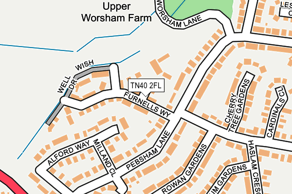
TN40 2FL is located in the Bexhill Old Town & Worsham electoral ward, within the local authority district of Rother and the English Parliamentary constituency of Bexhill and Battle. The Sub Integrated Care Board (ICB) Location is NHS Sussex ICB - 97R and the police force is Sussex. This postcode has been in use since July 2016.


GetTheData
Source: OS OpenMap – Local (Ordnance Survey)
Source: OS VectorMap District (Ordnance Survey)
Licence: Open Government Licence (requires attribution)
| Easting | 575605 |
| Northing | 108947 |
| Latitude | 50.853377 |
| Longitude | 0.493472 |
GetTheData
Source: Open Postcode Geo
Licence: Open Government Licence
| Country | England |
| Postcode District | TN40 |
| ➜ TN40 open data dashboard ➜ See where TN40 is on a map ➜ Where is Bexhill? | |
GetTheData
Source: Land Registry Price Paid Data
Licence: Open Government Licence
Elevation or altitude of TN40 2FL as distance above sea level:
| Metres | Feet | |
|---|---|---|
| Elevation | 30m | 98ft |
Elevation is measured from the approximate centre of the postcode, to the nearest point on an OS contour line from OS Terrain 50, which has contour spacing of ten vertical metres.
➜ How high above sea level am I? Find the elevation of your current position using your device's GPS.
GetTheData
Source: Open Postcode Elevation
Licence: Open Government Licence
| Ward | Bexhill Old Town & Worsham |
| Constituency | Bexhill And Battle |
GetTheData
Source: ONS Postcode Database
Licence: Open Government Licence
| June 2022 | Violence and sexual offences | On or near Amanda Close | 212m |
| June 2022 | Criminal damage and arson | On or near Amanda Close | 212m |
| June 2022 | Bicycle theft | On or near Alford Way | 272m |
| ➜ Get more crime data in our Crime section | |||
GetTheData
Source: data.police.uk
Licence: Open Government Licence
| Seabourne Road (Pebsham Lane) | Pebsham | 86m |
| Rowan Gardens (Seabourne Road) | Pebsham | 164m |
| Milland Close (Pebsham Lane) | Pebsham | 232m |
| Allen Way (Pebsham Lane) | Pebsham | 244m |
| Haslam Crescent (Seabourne Road) | Pebsham | 399m |
| Bexhill Station | 1.8km |
| Collington Station | 3km |
| West St Leonards Station | 3.3km |
GetTheData
Source: NaPTAN
Licence: Open Government Licence
| Percentage of properties with Next Generation Access | 100.0% |
| Percentage of properties with Superfast Broadband | 100.0% |
| Percentage of properties with Ultrafast Broadband | 100.0% |
| Percentage of properties with Full Fibre Broadband | 100.0% |
Superfast Broadband is between 30Mbps and 300Mbps
Ultrafast Broadband is > 300Mbps
| Percentage of properties unable to receive 2Mbps | 0.0% |
| Percentage of properties unable to receive 5Mbps | 0.0% |
| Percentage of properties unable to receive 10Mbps | 0.0% |
| Percentage of properties unable to receive 30Mbps | 0.0% |
GetTheData
Source: Ofcom
Licence: Ofcom Terms of Use (requires attribution)
GetTheData
Source: ONS Postcode Database
Licence: Open Government Licence


➜ Get more ratings from the Food Standards Agency
GetTheData
Source: Food Standards Agency
Licence: FSA terms & conditions
| Last Collection | |||
|---|---|---|---|
| Location | Mon-Fri | Sat | Distance |
| Pebsham Lane | 17:15 | 12:30 | 155m |
| Haslam Crescent Post Office | 17:15 | 12:15 | 410m |
| The Glades | 17:45 | 12:30 | 598m |
GetTheData
Source: Dracos
Licence: Creative Commons Attribution-ShareAlike
| Facility | Distance |
|---|---|
| Bexhill College Sports Centre Penland Road, Bexhill-on-sea Sports Hall, Artificial Grass Pitch, Health and Fitness Gym, Studio, Outdoor Tennis Courts | 539m |
| St Marys School Wrestwood Road, Bexhill-on-sea Sports Hall, Swimming Pool | 647m |
| Battle Abbey Prep School Hastings Road, Bexhill-on-sea Swimming Pool, Artificial Grass Pitch, Grass Pitches | 715m |
GetTheData
Source: Active Places
Licence: Open Government Licence
| School | Phase of Education | Distance |
|---|---|---|
| St Mary Magdalene Catholic Primary School Hastings Road, Bexhill-on-Sea, TN40 2ND | Primary | 421m |
| Bexhill College Penland Road, Bexhill-on-Sea, TN40 2JG | 16 plus | 567m |
| St Mary's School and 6th Form College Wrestwood Road, Bexhill on Sea, TN40 2LU | Not applicable | 646m |
GetTheData
Source: Edubase
Licence: Open Government Licence
The below table lists the International Territorial Level (ITL) codes (formerly Nomenclature of Territorial Units for Statistics (NUTS) codes) and Local Administrative Units (LAU) codes for TN40 2FL:
| ITL 1 Code | Name |
|---|---|
| TLJ | South East (England) |
| ITL 2 Code | Name |
| TLJ2 | Surrey, East and West Sussex |
| ITL 3 Code | Name |
| TLJ22 | East Sussex CC |
| LAU 1 Code | Name |
| E07000064 | Rother |
GetTheData
Source: ONS Postcode Directory
Licence: Open Government Licence
The below table lists the Census Output Area (OA), Lower Layer Super Output Area (LSOA), and Middle Layer Super Output Area (MSOA) for TN40 2FL:
| Code | Name | |
|---|---|---|
| OA | E00107252 | |
| LSOA | E01021113 | Rother 007B |
| MSOA | E02004398 | Rother 007 |
GetTheData
Source: ONS Postcode Directory
Licence: Open Government Licence
| TN40 2QN | Pebsham Lane | 91m |
| TN40 2QL | Cherry Tree Gardens | 179m |
| TN40 2RA | Pebsham Lane | 200m |
| TN40 2RB | Pebsham Lane | 220m |
| TN40 2SZ | Gwyneth Grove | 226m |
| TN40 2QA | Pebsham Lane | 237m |
| TN40 2RF | Lesley Close | 239m |
| TN40 2QD | Alford Way | 240m |
| TN40 2QQ | Rowan Gardens | 246m |
| TN40 2QG | Seabourne Road | 246m |
GetTheData
Source: Open Postcode Geo; Land Registry Price Paid Data
Licence: Open Government Licence