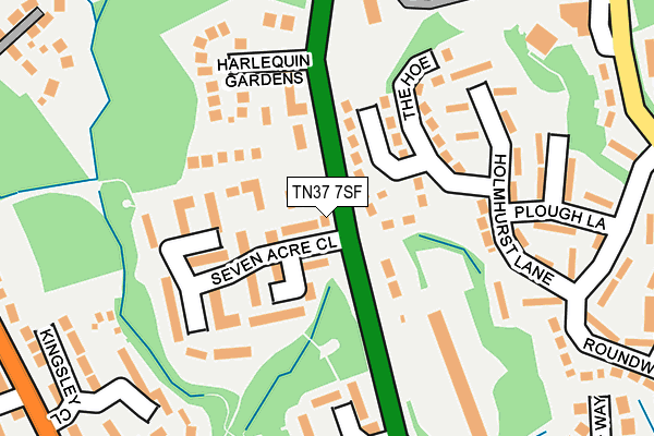
TN37 7SF is located in the Ashdown electoral ward, within the local authority district of Hastings and the English Parliamentary constituency of Hastings and Rye. The Sub Integrated Care Board (ICB) Location is NHS Sussex ICB - 97R and the police force is Sussex. This postcode has been in use since November 2006.


GetTheData
Source: OS OpenMap – Local (Ordnance Survey)
Source: OS VectorMap District (Ordnance Survey)
Licence: Open Government Licence (requires attribution)
| Easting | 579499 |
| Northing | 112487 |
| Latitude | 50.883985 |
| Longitude | 0.550471 |
GetTheData
Source: Open Postcode Geo
Licence: Open Government Licence
| Country | England |
| Postcode District | TN37 |
| ➜ TN37 open data dashboard ➜ See where TN37 is on a map ➜ Where is Hastings? | |
GetTheData
Source: Land Registry Price Paid Data
Licence: Open Government Licence
Elevation or altitude of TN37 7SF as distance above sea level:
| Metres | Feet | |
|---|---|---|
| Elevation | 80m | 262ft |
Elevation is measured from the approximate centre of the postcode, to the nearest point on an OS contour line from OS Terrain 50, which has contour spacing of ten vertical metres.
➜ How high above sea level am I? Find the elevation of your current position using your device's GPS.
GetTheData
Source: Open Postcode Elevation
Licence: Open Government Licence
| Ward | Ashdown |
| Constituency | Hastings And Rye |
GetTheData
Source: ONS Postcode Database
Licence: Open Government Licence
| January 2024 | Other crime | On or near Roundwood Road | 266m |
| October 2023 | Other theft | On or near Carinus Gardens | 481m |
| October 2023 | Violence and sexual offences | On or near Welton Rise | 489m |
| ➜ Get more crime data in our Crime section | |||
GetTheData
Source: data.police.uk
Licence: Open Government Licence
| Seven Acre Close (Sedlescombe Road North) | Silverhill Park | 30m |
| Seven Acre Close (Sedlescombe Road North) | Silverhill Park | 31m |
| Harlequin Gardens (Sedlescombe Road North) | Baldslow | 111m |
| Premier Inn (Sedlescombe Road North) | Baldslow | 243m |
| Ledsham Avenue (Sedlescombe Road North) | Silverhill Park | 292m |
| St Leonards Warrior Square Station | 3.2km |
| Hastings Station | 3.4km |
| Ore Station | 3.5km |
GetTheData
Source: NaPTAN
Licence: Open Government Licence
| Percentage of properties with Next Generation Access | 100.0% |
| Percentage of properties with Superfast Broadband | 100.0% |
| Percentage of properties with Ultrafast Broadband | 0.0% |
| Percentage of properties with Full Fibre Broadband | 0.0% |
Superfast Broadband is between 30Mbps and 300Mbps
Ultrafast Broadband is > 300Mbps
| Percentage of properties unable to receive 2Mbps | 0.0% |
| Percentage of properties unable to receive 5Mbps | 0.0% |
| Percentage of properties unable to receive 10Mbps | 0.0% |
| Percentage of properties unable to receive 30Mbps | 0.0% |
GetTheData
Source: Ofcom
Licence: Ofcom Terms of Use (requires attribution)
GetTheData
Source: ONS Postcode Database
Licence: Open Government Licence


➜ Get more ratings from the Food Standards Agency
GetTheData
Source: Food Standards Agency
Licence: FSA terms & conditions
| Last Collection | |||
|---|---|---|---|
| Location | Mon-Fri | Sat | Distance |
| Sedlescombe Road North | 17:30 | 12:00 | 52m |
| Battle Road | 17:15 | 12:00 | 403m |
| Harrow Lane | 17:30 | 12:15 | 501m |
GetTheData
Source: Dracos
Licence: Creative Commons Attribution-ShareAlike
| Facility | Distance |
|---|---|
| Civil Service Club (Closed) Harrow Lane, St Leonards-on-sea Sports Hall | 294m |
| Harrow Lane Recreation Ground (Closed) Harrow Lane, St. Leonards-on-sea Grass Pitches | 636m |
| Hollington Youth Centre Wishing Tree Road North, St. Leonards-on-sea Sports Hall | 685m |
GetTheData
Source: Active Places
Licence: Open Government Licence
| School | Phase of Education | Distance |
|---|---|---|
| Ark Little Ridge Primary Academy Little Ridge Avenue, St Leonards-on-Sea, TN37 7LR | Primary | 402m |
| Hollington Primary School Hollington Old Lane, St. Leonards-on-Sea, TN38 9DS | Primary | 829m |
| New Horizons School (Part of the Sabden Multi Academy Trust) Beauchamp Road, St Leonards-on-Sea, TN38 9JU | Not applicable | 911m |
GetTheData
Source: Edubase
Licence: Open Government Licence
The below table lists the International Territorial Level (ITL) codes (formerly Nomenclature of Territorial Units for Statistics (NUTS) codes) and Local Administrative Units (LAU) codes for TN37 7SF:
| ITL 1 Code | Name |
|---|---|
| TLJ | South East (England) |
| ITL 2 Code | Name |
| TLJ2 | Surrey, East and West Sussex |
| ITL 3 Code | Name |
| TLJ22 | East Sussex CC |
| LAU 1 Code | Name |
| E07000062 | Hastings |
GetTheData
Source: ONS Postcode Directory
Licence: Open Government Licence
The below table lists the Census Output Area (OA), Lower Layer Super Output Area (LSOA), and Middle Layer Super Output Area (MSOA) for TN37 7SF:
| Code | Name | |
|---|---|---|
| OA | E00106466 | |
| LSOA | E01020971 | Hastings 001C |
| MSOA | E02004368 | Hastings 001 |
GetTheData
Source: ONS Postcode Directory
Licence: Open Government Licence
| TN37 7PD | Sedlescombe Road North | 41m |
| TN37 7QD | Seven Acre Close | 62m |
| TN37 7QB | Seven Acre Close | 102m |
| TN37 7PA | The Willows | 104m |
| TN37 7PG | Sedlescombe Road North | 106m |
| TN37 7LL | The Hoe | 127m |
| TN37 7QF | Seven Acre Close | 129m |
| TN37 7LN | Holmhurst Lane | 146m |
| TN37 7PF | Harlequin Gardens | 164m |
| TN37 7LW | Holmhurst Lane | 185m |
GetTheData
Source: Open Postcode Geo; Land Registry Price Paid Data
Licence: Open Government Licence