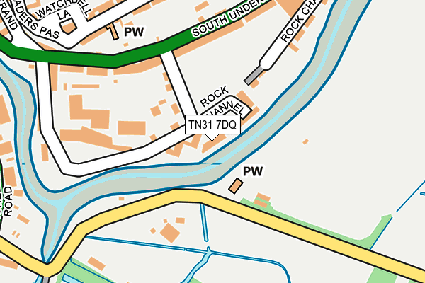
TN31 7DQ lies on Rock Channel Quay in Rye. TN31 7DQ is located in the Rye & Winchelsea electoral ward, within the local authority district of Rother and the English Parliamentary constituency of Hastings and Rye. The Sub Integrated Care Board (ICB) Location is NHS Sussex ICB - 97R and the police force is Sussex. This postcode has been in use since January 1993.


GetTheData
Source: OS OpenMap – Local (Ordnance Survey)
Source: OS VectorMap District (Ordnance Survey)
Licence: Open Government Licence (requires attribution)
| Easting | 592207 |
| Northing | 120031 |
| Latitude | 50.947666 |
| Longitude | 0.734862 |
GetTheData
Source: Open Postcode Geo
Licence: Open Government Licence
| Street | Rock Channel Quay |
| Town/City | Rye |
| Country | England |
| Postcode District | TN31 |
➜ See where TN31 is on a map ➜ Where is Rye? | |
GetTheData
Source: Land Registry Price Paid Data
Licence: Open Government Licence
Elevation or altitude of TN31 7DQ as distance above sea level:
| Metres | Feet | |
|---|---|---|
| Elevation | 10m | 33ft |
Elevation is measured from the approximate centre of the postcode, to the nearest point on an OS contour line from OS Terrain 50, which has contour spacing of ten vertical metres.
➜ How high above sea level am I? Find the elevation of your current position using your device's GPS.
GetTheData
Source: Open Postcode Elevation
Licence: Open Government Licence
| Ward | Rye & Winchelsea |
| Constituency | Hastings And Rye |
GetTheData
Source: ONS Postcode Database
Licence: Open Government Licence
| Shipyard Lane (South Undercliff) | Rye | 155m |
| Harbour Road (New Winchelsea Road) | Rye | 377m |
| Lion Street (High Street) | Rye | 384m |
| Harbour Road (New Winchelsea Road) | Rye | 396m |
| Bowling Green (Fishmarket Road) | Rye | 467m |
| Rye Station | 0.6km |
| Winchelsea Station | 2.8km |
GetTheData
Source: NaPTAN
Licence: Open Government Licence
| Percentage of properties with Next Generation Access | 100.0% |
| Percentage of properties with Superfast Broadband | 100.0% |
| Percentage of properties with Ultrafast Broadband | 0.0% |
| Percentage of properties with Full Fibre Broadband | 0.0% |
Superfast Broadband is between 30Mbps and 300Mbps
Ultrafast Broadband is > 300Mbps
| Median download speed | 30.0Mbps |
| Average download speed | 23.7Mbps |
| Maximum download speed | 34.44Mbps |
| Median upload speed | 5.2Mbps |
| Average upload speed | 3.9Mbps |
| Maximum upload speed | 6.49Mbps |
| Percentage of properties unable to receive 2Mbps | 0.0% |
| Percentage of properties unable to receive 5Mbps | 0.0% |
| Percentage of properties unable to receive 10Mbps | 0.0% |
| Percentage of properties unable to receive 30Mbps | 0.0% |
GetTheData
Source: Ofcom
Licence: Ofcom Terms of Use (requires attribution)
Estimated total energy consumption in TN31 7DQ by fuel type, 2015.
| Consumption (kWh) | 39,187 |
|---|---|
| Meter count | 9 |
| Mean (kWh/meter) | 4,354 |
| Median (kWh/meter) | 3,327 |
| Consumption (kWh) | 41,515 |
|---|---|
| Meter count | 18 |
| Mean (kWh/meter) | 2,306 |
| Median (kWh/meter) | 1,053 |
GetTheData
Source: Postcode level gas estimates: 2015 (experimental)
Source: Postcode level electricity estimates: 2015 (experimental)
Licence: Open Government Licence
GetTheData
Source: ONS Postcode Database
Licence: Open Government Licence


➜ Get more ratings from the Food Standards Agency
GetTheData
Source: Food Standards Agency
Licence: FSA terms & conditions
| Last Collection | |||
|---|---|---|---|
| Location | Mon-Fri | Sat | Distance |
| Ballards Hill | 16:45 | 09:00 | 287m |
| High Street | 17:45 | 11:30 | 386m |
| Rye Sorting Office | 18:00 | 12:00 | 505m |
GetTheData
Source: Dracos
Licence: Creative Commons Attribution-ShareAlike
| Risk of TN31 7DQ flooding from rivers and sea | Low |
| ➜ TN31 7DQ flood map | |
GetTheData
Source: Open Flood Risk by Postcode
Licence: Open Government Licence
The below table lists the International Territorial Level (ITL) codes (formerly Nomenclature of Territorial Units for Statistics (NUTS) codes) and Local Administrative Units (LAU) codes for TN31 7DQ:
| ITL 1 Code | Name |
|---|---|
| TLJ | South East (England) |
| ITL 2 Code | Name |
| TLJ2 | Surrey, East and West Sussex |
| ITL 3 Code | Name |
| TLJ22 | East Sussex CC |
| LAU 1 Code | Name |
| E07000064 | Rother |
GetTheData
Source: ONS Postcode Directory
Licence: Open Government Licence
The below table lists the Census Output Area (OA), Lower Layer Super Output Area (LSOA), and Middle Layer Super Output Area (MSOA) for TN31 7DQ:
| Code | Name | |
|---|---|---|
| OA | E00107271 | |
| LSOA | E01021117 | Rother 004C |
| MSOA | E02004395 | Rother 004 |
GetTheData
Source: ONS Postcode Directory
Licence: Open Government Licence
| TN31 7DL | Rock Channel Quay | 50m |
| TN31 7HL | Shipyard Lane | 72m |
| TN31 7HJ | Rock Channel | 118m |
| TN31 7HW | South Undercliff | 161m |
| TN31 7HN | South Undercliff | 181m |
| TN31 7HG | Hucksteps Row | 214m |
| TN31 7HB | Watchbell Street | 220m |
| TN31 7HE | Church Square | 233m |
| TN31 7DE | St Margarets Terrace | 243m |
| TN31 7HA | Watchbell Street | 246m |
GetTheData
Source: Open Postcode Geo; Land Registry Price Paid Data
Licence: Open Government Licence