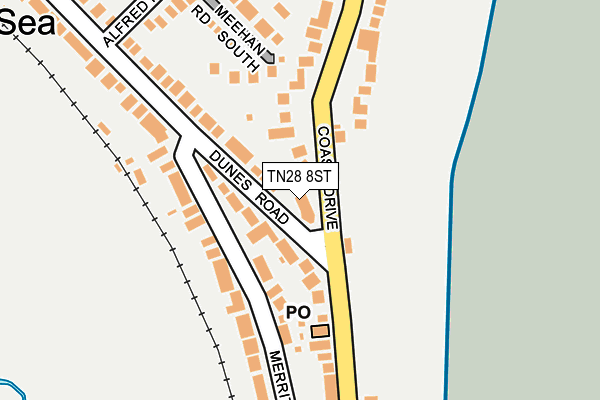
TN28 8ST is located in the New Romney electoral ward, within the local authority district of Folkestone and Hythe and the English Parliamentary constituency of Folkestone and Hythe. The Sub Integrated Care Board (ICB) Location is NHS Kent and Medway ICB - 91Q and the police force is Kent. This postcode has been in use since January 1980.


GetTheData
Source: OS OpenMap – Local (Ordnance Survey)
Source: OS VectorMap District (Ordnance Survey)
Licence: Open Government Licence (requires attribution)
| Easting | 608083 |
| Northing | 122977 |
| Latitude | 50.968614 |
| Longitude | 0.962279 |
GetTheData
Source: Open Postcode Geo
Licence: Open Government Licence
| Country | England |
| Postcode District | TN28 |
| ➜ TN28 open data dashboard ➜ See where TN28 is on a map | |
GetTheData
Source: Land Registry Price Paid Data
Licence: Open Government Licence
Elevation or altitude of TN28 8ST as distance above sea level:
| Metres | Feet | |
|---|---|---|
| Elevation | 10m | 33ft |
Elevation is measured from the approximate centre of the postcode, to the nearest point on an OS contour line from OS Terrain 50, which has contour spacing of ten vertical metres.
➜ How high above sea level am I? Find the elevation of your current position using your device's GPS.
GetTheData
Source: Open Postcode Elevation
Licence: Open Government Licence
| Ward | New Romney |
| Constituency | Folkestone And Hythe |
GetTheData
Source: ONS Postcode Database
Licence: Open Government Licence
| January 2024 | Other theft | On or near Parking Area | 136m |
| January 2024 | Violence and sexual offences | On or near Parking Area | 136m |
| December 2023 | Violence and sexual offences | On or near Parking Area | 136m |
| ➜ Get more crime data in our Crime section | |||
GetTheData
Source: data.police.uk
Licence: Open Government Licence
| Jolly Fisherman (Coast Drive) | Greatstone-on-sea | 59m |
| Jolly Fisherman (The Parade) | Greatstone-on-sea | 111m |
| Hardy Road (Coast Drive) | Greatstone-on-sea | 438m |
| Baldwin Road (The Parade) | Greatstone-on-sea | 472m |
| Baldwin Road (The Parade) | Greatstone-on-sea | 478m |
| Romney Sands Station (Rhdr) | Greatstone-on-sea | 1,036m |
GetTheData
Source: NaPTAN
Licence: Open Government Licence
GetTheData
Source: ONS Postcode Database
Licence: Open Government Licence


➜ Get more ratings from the Food Standards Agency
GetTheData
Source: Food Standards Agency
Licence: FSA terms & conditions
| Last Collection | |||
|---|---|---|---|
| Location | Mon-Fri | Sat | Distance |
| Greatstone Post Office | 17:00 | 09:00 | 127m |
| Dunes Road | 16:45 | 09:00 | 447m |
| Littlestone Golf Club | 16:15 | 09:00 | 1,909m |
GetTheData
Source: Dracos
Licence: Creative Commons Attribution-ShareAlike
| Facility | Distance |
|---|---|
| Greatstone Primary School Baldwin Road, Greatstone, New Romney Grass Pitches, Sports Hall | 571m |
| Littlestone Golf Club St. Andrews Road, Littlestone, New Romney Golf, Outdoor Tennis Courts | 1.9km |
| New Romney Sports Club Station Road, New Romney Grass Pitches | 2.1km |
GetTheData
Source: Active Places
Licence: Open Government Licence
| School | Phase of Education | Distance |
|---|---|---|
| Greatstone Primary School Baldwin Road, Greatstone, New Romney, TN28 8SY | Primary | 588m |
| Lighthouse On the Marsh Unit 4, Mountfield Road, New Romney, TN28 8LH | Not applicable | 1.9km |
| The Marsh Academy Station Road, New Romney, TN28 8BB | Secondary | 2.2km |
GetTheData
Source: Edubase
Licence: Open Government Licence
The below table lists the International Territorial Level (ITL) codes (formerly Nomenclature of Territorial Units for Statistics (NUTS) codes) and Local Administrative Units (LAU) codes for TN28 8ST:
| ITL 1 Code | Name |
|---|---|
| TLJ | South East (England) |
| ITL 2 Code | Name |
| TLJ4 | Kent |
| ITL 3 Code | Name |
| TLJ44 | East Kent |
| LAU 1 Code | Name |
| E07000112 | Folkestone and Hythe |
GetTheData
Source: ONS Postcode Directory
Licence: Open Government Licence
The below table lists the Census Output Area (OA), Lower Layer Super Output Area (LSOA), and Middle Layer Super Output Area (MSOA) for TN28 8ST:
| Code | Name | |
|---|---|---|
| OA | E00124547 | |
| LSOA | E01024537 | Shepway 012A |
| MSOA | E02005113 | Shepway 012 |
GetTheData
Source: ONS Postcode Directory
Licence: Open Government Licence
| TN28 8SS | Dunes Road | 79m |
| TN28 8SL | Meehan Road South | 174m |
| TN28 8SZ | Merritt Road | 198m |
| TN28 8NP | The Parade | 244m |
| TN28 8NX | Coast Drive | 251m |
| TN28 8SJ | Alfred Road | 272m |
| TN28 8SH | Alfred Road | 310m |
| TN28 8SQ | Meehan Road | 341m |
| TN28 8SN | Dunes Road | 361m |
| TN28 8SF | Hardy Road | 370m |
GetTheData
Source: Open Postcode Geo; Land Registry Price Paid Data
Licence: Open Government Licence