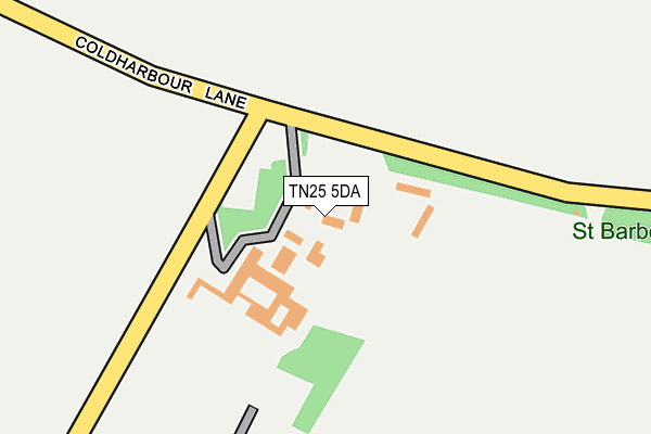
TN25 5DA is located in the Wye with Hinxhill electoral ward, within the local authority district of Ashford and the English Parliamentary constituency of Ashford. The Sub Integrated Care Board (ICB) Location is NHS Kent and Medway ICB - 91Q and the police force is Kent. This postcode has been in use since January 1980.


GetTheData
Source: OS OpenMap – Local (Ordnance Survey)
Source: OS VectorMap District (Ordnance Survey)
Licence: Open Government Licence (requires attribution)
| Easting | 606188 |
| Northing | 146496 |
| Latitude | 51.180502 |
| Longitude | 0.948695 |
GetTheData
Source: Open Postcode Geo
Licence: Open Government Licence
| Country | England |
| Postcode District | TN25 |
| ➜ TN25 open data dashboard ➜ See where TN25 is on a map ➜ Where is Wye? | |
GetTheData
Source: Land Registry Price Paid Data
Licence: Open Government Licence
Elevation or altitude of TN25 5DA as distance above sea level:
| Metres | Feet | |
|---|---|---|
| Elevation | 60m | 197ft |
Elevation is measured from the approximate centre of the postcode, to the nearest point on an OS contour line from OS Terrain 50, which has contour spacing of ten vertical metres.
➜ How high above sea level am I? Find the elevation of your current position using your device's GPS.
GetTheData
Source: Open Postcode Elevation
Licence: Open Government Licence
| Ward | Wye With Hinxhill |
| Constituency | Ashford |
GetTheData
Source: ONS Postcode Database
Licence: Open Government Licence
| June 2022 | Criminal damage and arson | On or near Sports/Recreation Area | 451m |
| June 2022 | Public order | On or near Sports/Recreation Area | 451m |
| April 2022 | Public order | On or near Jarman'S Field | 459m |
| ➜ Get more crime data in our Crime section | |||
GetTheData
Source: data.police.uk
Licence: Open Government Licence
| New Flying Horse (Bridge Street) | Wye | 690m |
| Library (Bridge Street) | Wye | 807m |
| Church (High Street) | Wye | 841m |
| Wye Free School (Olantigh Road) | Wye | 928m |
| Little Chequers (Bridge Street) | Wye | 1,011m |
| Wye Station | 1.4km |
| Ashford International Station | 6.5km |
GetTheData
Source: NaPTAN
Licence: Open Government Licence
| Percentage of properties with Next Generation Access | 100.0% |
| Percentage of properties with Superfast Broadband | 100.0% |
| Percentage of properties with Ultrafast Broadband | 0.0% |
| Percentage of properties with Full Fibre Broadband | 0.0% |
Superfast Broadband is between 30Mbps and 300Mbps
Ultrafast Broadband is > 300Mbps
| Percentage of properties unable to receive 2Mbps | 0.0% |
| Percentage of properties unable to receive 5Mbps | 0.0% |
| Percentage of properties unable to receive 10Mbps | 0.0% |
| Percentage of properties unable to receive 30Mbps | 0.0% |
GetTheData
Source: Ofcom
Licence: Ofcom Terms of Use (requires attribution)
GetTheData
Source: ONS Postcode Database
Licence: Open Government Licence


➜ Get more ratings from the Food Standards Agency
GetTheData
Source: Food Standards Agency
Licence: FSA terms & conditions
| Last Collection | |||
|---|---|---|---|
| Location | Mon-Fri | Sat | Distance |
| Coldharbour | 16:15 | 11:00 | 420m |
| Jarmans Field | 16:30 | 09:00 | 492m |
| Wye Post Office | 17:00 | 11:00 | 815m |
GetTheData
Source: Dracos
Licence: Creative Commons Attribution-ShareAlike
| Facility | Distance |
|---|---|
| Dark Lane Off Scotton Street, Wye, Ashford Grass Pitches | 428m |
| Wye School Olantigh Road, Olantigh Road, Wye, Ashford Grass Pitches, Sports Hall | 742m |
| Imperial College (Wye Campus) (Closed) High Street, Wye, Ashford Sports Hall, Health and Fitness Gym, Swimming Pool, Grass Pitches, Squash Courts | 844m |
GetTheData
Source: Active Places
Licence: Open Government Licence
| School | Phase of Education | Distance |
|---|---|---|
| Wye School Olantigh Road, Wye, TN25 5EJ | Secondary | 710m |
| Lady Joanna Thornhill Endowed Primary School Bridge Street, Wye, Ashford, TN25 5EA | Primary | 1.1km |
| Spring Grove School 2003 Ltd Harville Road, Wye, Ashford, TN25 5EZ | Not applicable | 2km |
GetTheData
Source: Edubase
Licence: Open Government Licence
The below table lists the International Territorial Level (ITL) codes (formerly Nomenclature of Territorial Units for Statistics (NUTS) codes) and Local Administrative Units (LAU) codes for TN25 5DA:
| ITL 1 Code | Name |
|---|---|
| TLJ | South East (England) |
| ITL 2 Code | Name |
| TLJ4 | Kent |
| ITL 3 Code | Name |
| TLJ45 | Mid Kent |
| LAU 1 Code | Name |
| E07000105 | Ashford |
GetTheData
Source: ONS Postcode Directory
Licence: Open Government Licence
The below table lists the Census Output Area (OA), Lower Layer Super Output Area (LSOA), and Middle Layer Super Output Area (MSOA) for TN25 5DA:
| Code | Name | |
|---|---|---|
| OA | E00122063 | |
| LSOA | E01024041 | Ashford 001E |
| MSOA | E02004996 | Ashford 001 |
GetTheData
Source: ONS Postcode Directory
Licence: Open Government Licence
| TN25 5BW | Scotton Street | 370m |
| TN25 5DB | Amage Road | 482m |
| TN25 5AQ | Jarmans Field | 490m |
| TN25 5DQ | Little Olantigh Road | 493m |
| TN25 5AS | Cherry Garden Crescent | 539m |
| TN25 5BU | Scotton Street | 561m |
| TN25 5AT | Orchard Drive | 584m |
| TN25 5BZ | Scotton Street | 596m |
| TN25 5AR | Cherry Garden Lane | 605m |
| TN25 5AU | Orchard Drive | 608m |
GetTheData
Source: Open Postcode Geo; Land Registry Price Paid Data
Licence: Open Government Licence