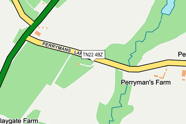
TN22 4BZ is located in the Buxted electoral ward, within the local authority district of Wealden and the English Parliamentary constituency of Wealden. The Sub Integrated Care Board (ICB) Location is NHS Sussex ICB - 97R and the police force is Sussex. This postcode has been in use since August 2003.


GetTheData
Source: OS OpenMap – Local (Ordnance Survey)
Source: OS VectorMap District (Ordnance Survey)
Licence: Open Government Licence (requires attribution)
| Easting | 548167 |
| Northing | 126503 |
| Latitude | 51.018818 |
| Longitude | 0.111073 |
GetTheData
Source: Open Postcode Geo
Licence: Open Government Licence
| Country | England |
| Postcode District | TN22 |
| ➜ TN22 open data dashboard ➜ See where TN22 is on a map | |
GetTheData
Source: Land Registry Price Paid Data
Licence: Open Government Licence
Elevation or altitude of TN22 4BZ as distance above sea level:
| Metres | Feet | |
|---|---|---|
| Elevation | 90m | 295ft |
Elevation is measured from the approximate centre of the postcode, to the nearest point on an OS contour line from OS Terrain 50, which has contour spacing of ten vertical metres.
➜ How high above sea level am I? Find the elevation of your current position using your device's GPS.
GetTheData
Source: Open Postcode Elevation
Licence: Open Government Licence
| Ward | Buxted |
| Constituency | Wealden |
GetTheData
Source: ONS Postcode Database
Licence: Open Government Licence
| July 2021 | Violence and sexual offences | On or near Sports/Recreation Area | 479m |
| June 2021 | Other theft | On or near Sports/Recreation Area | 479m |
| June 2021 | Violence and sexual offences | On or near Sports/Recreation Area | 479m |
| ➜ Get more crime data in our Crime section | |||
GetTheData
Source: data.police.uk
Licence: Open Government Licence
| Perrymans Lane (A26) | Herons Ghyll | 220m |
| Perrymans Lane (A26) | Herons Ghyll | 242m |
| Church (A26) | Herons Ghyll | 473m |
| Church (A26) | Herons Ghyll | 506m |
| Temple Grove (A26) | Herons Ghyll | 646m |
| Buxted Station | 3.5km |
GetTheData
Source: NaPTAN
Licence: Open Government Licence
GetTheData
Source: ONS Postcode Database
Licence: Open Government Licence


➜ Get more ratings from the Food Standards Agency
GetTheData
Source: Food Standards Agency
Licence: FSA terms & conditions
| Last Collection | |||
|---|---|---|---|
| Location | Mon-Fri | Sat | Distance |
| Herons Ghyll | 16:00 | 09:45 | 554m |
| Paynes Hill | 16:15 | 09:45 | 743m |
| Lilac Cottage | 16:00 | 10:15 | 1,277m |
GetTheData
Source: Dracos
Licence: Creative Commons Attribution-ShareAlike
| Facility | Distance |
|---|---|
| Temple Grove Cricket Ground (Newick Cc) Uckfield Road, Herons Ghyll, Uckfield Grass Pitches | 539m |
| Fairwarp Sports Field Hop Gardens, Fairwarp, Uckfield Grass Pitches | 885m |
| High Hurstwood Recreation Ground Chillies Lane, High Hurstwood, Uckfield Grass Pitches | 1.5km |
GetTheData
Source: Active Places
Licence: Open Government Licence
| School | Phase of Education | Distance |
|---|---|---|
| High Hurstwood Church of England Primary School Chillies Lane, High Hurstwood, Uckfield, TN22 4AD | Primary | 1.3km |
| Bonners CofE School School Hill, Maresfield, Uckfield, TN22 2EG | Primary | 3km |
| Buxted CofE Primary School Hurstwood Road, Buxted, Uckfield, TN22 4BB | Primary | 3.1km |
GetTheData
Source: Edubase
Licence: Open Government Licence
The below table lists the International Territorial Level (ITL) codes (formerly Nomenclature of Territorial Units for Statistics (NUTS) codes) and Local Administrative Units (LAU) codes for TN22 4BZ:
| ITL 1 Code | Name |
|---|---|
| TLJ | South East (England) |
| ITL 2 Code | Name |
| TLJ2 | Surrey, East and West Sussex |
| ITL 3 Code | Name |
| TLJ22 | East Sussex CC |
| LAU 1 Code | Name |
| E07000065 | Wealden |
GetTheData
Source: ONS Postcode Directory
Licence: Open Government Licence
The below table lists the Census Output Area (OA), Lower Layer Super Output Area (LSOA), and Middle Layer Super Output Area (MSOA) for TN22 4BZ:
| Code | Name | |
|---|---|---|
| OA | E00107414 | |
| LSOA | E01021145 | Wealden 008B |
| MSOA | E02004410 | Wealden 008 |
GetTheData
Source: ONS Postcode Directory
Licence: Open Government Licence
| TN22 4BX | Perrymans Lane | 476m |
| TN22 4BY | 639m | |
| TN22 4BU | 1034m | |
| TN22 3BU | 1037m | |
| TN22 3BT | Hop Garden | 1150m |
| TN22 4AG | Perrymans Lane | 1158m |
| TN22 3BS | Normansland | 1176m |
| TN22 3BY | 1182m | |
| TN22 4AB | Chillies Lane | 1238m |
| TN22 3DA | Oldlands | 1259m |
GetTheData
Source: Open Postcode Geo; Land Registry Price Paid Data
Licence: Open Government Licence